

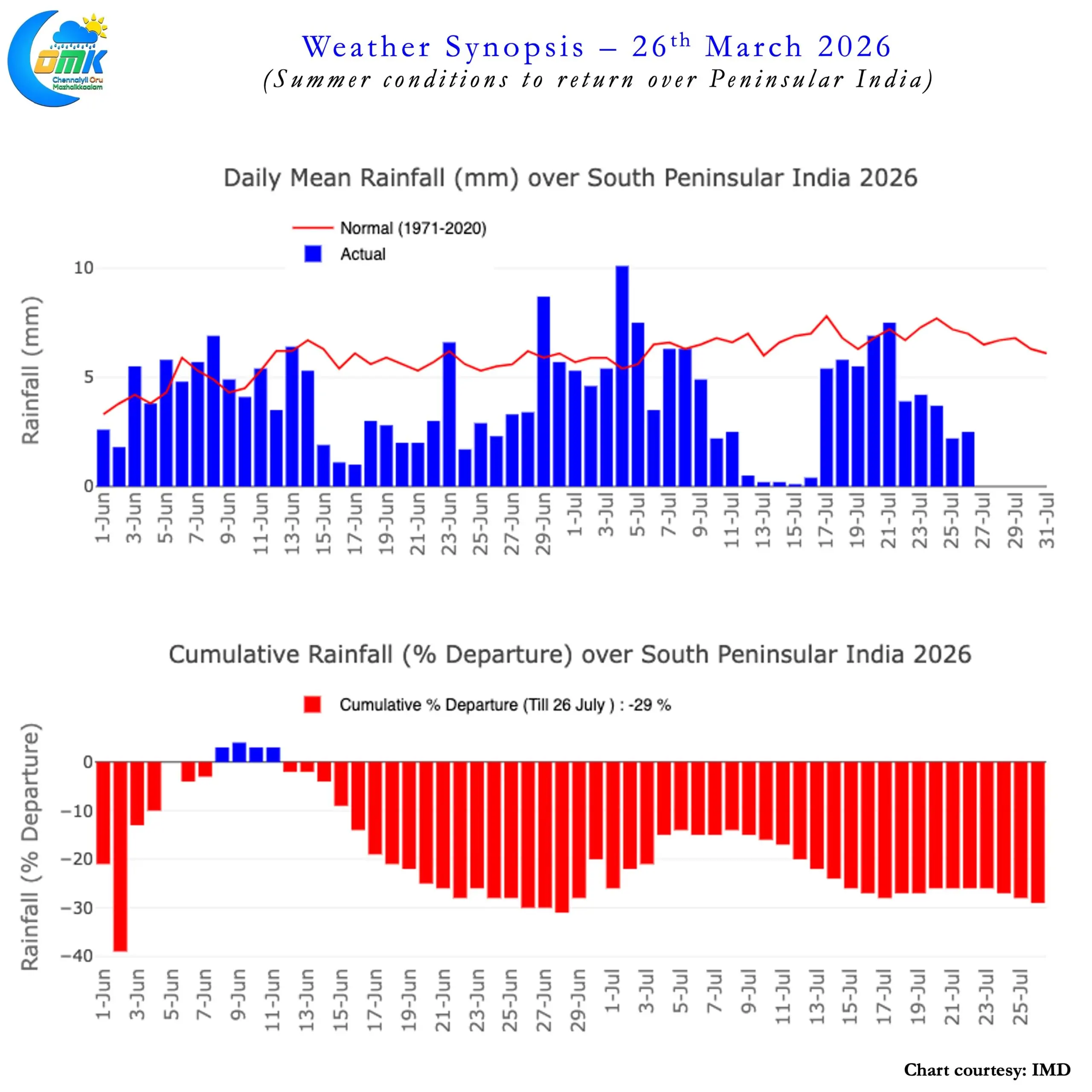
Southwest Monsoon this year has mostly flattered to deceive for Peninsular India. It made onset over Kerala on 4th June it has performed sporadically with long dry / sub par spells. The as on date cumulative departure for the country stands at -15%. Southern Peninsular India and East & North East India deficit stands at -28.6% and -29% respectively. The deficit for July over Southern Peninsular India stands at -36%. One look at the weekly departures for Southern Peninsular India sums up the story so far. Only Andaman & Nicobar Islands have more positive weeks than negative weeks so far. Kerala had just one week, ending 10th June, when it saw 46% excess. Cauvery Basin desperately needs a monsoon revival.
The Monsoon Gods seem to have finally decided to answer the prayers. The human tendency is to always ask for more and Pluviophiles are no exception. But one needs to look at the larger picture always while keeping an eye on positive news. The Monsoon revival over the next week or two also falls under this category. It is essential to look at the larger picture and look forward to a spell of active monsoon conditions for Peninsular India.
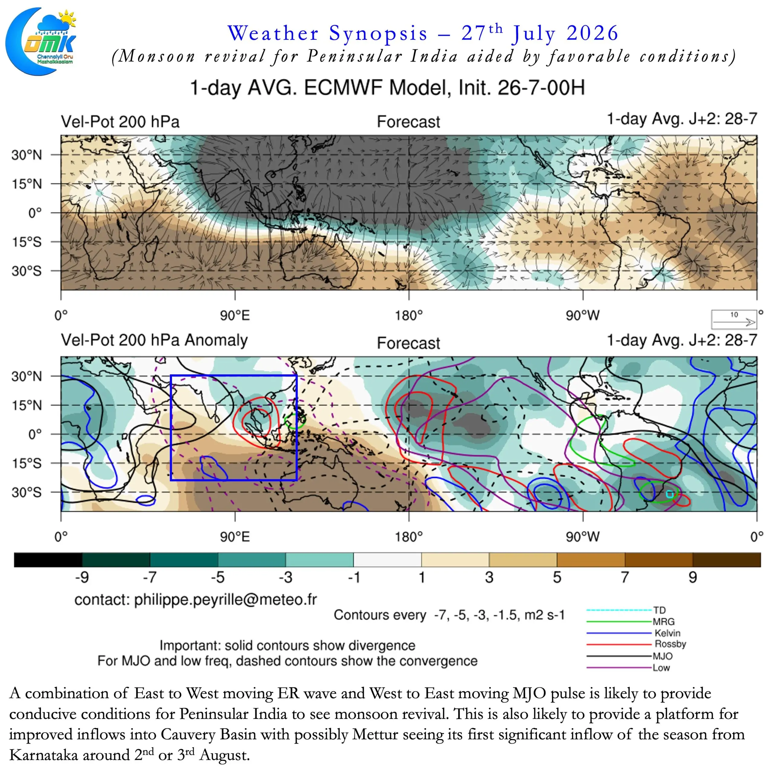
This year the most active phases have always coincided with exceptional rains over North Konkan and surrounding areas. Peninsular India has pretty much lacked a sustained spell of rains all the while. The longest streak of daily positive rainfall anomaly this year stands at just 3 days. Between 7th and 9th June, more than 6 weeks back, Southwest Monsoon had this positive streak. A combination of favourable transit of ER and MJO may help monsoon dynamics flare up positively for Peninsular India.
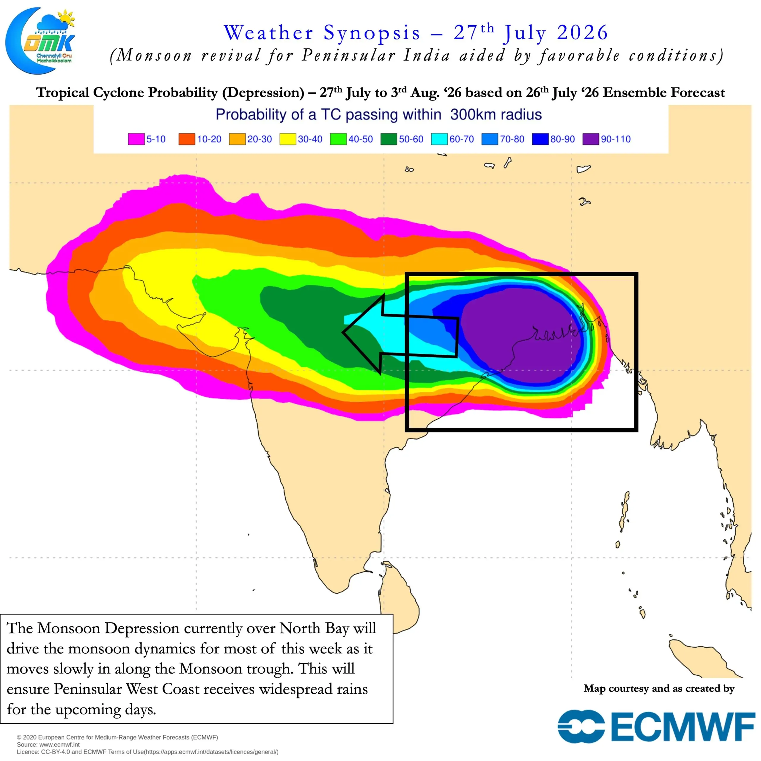
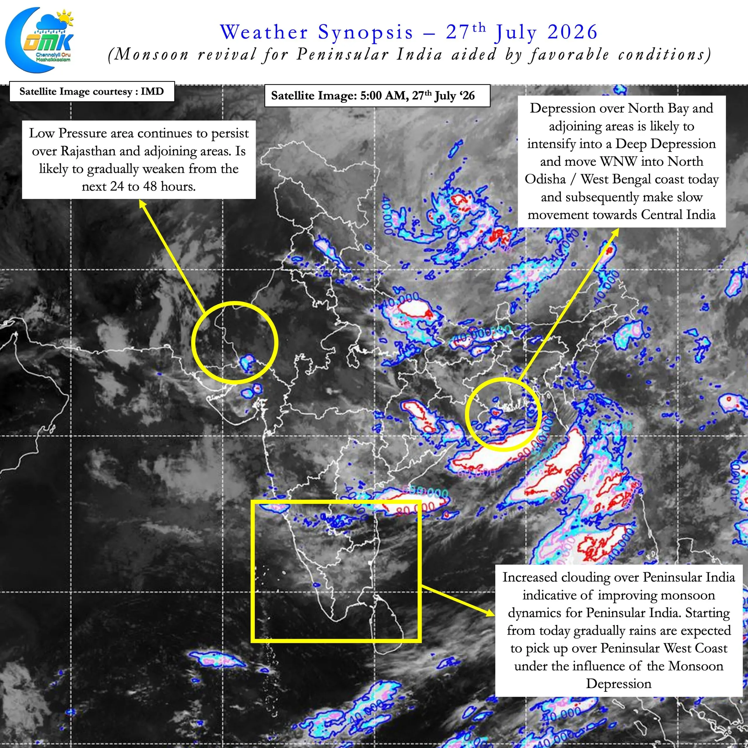
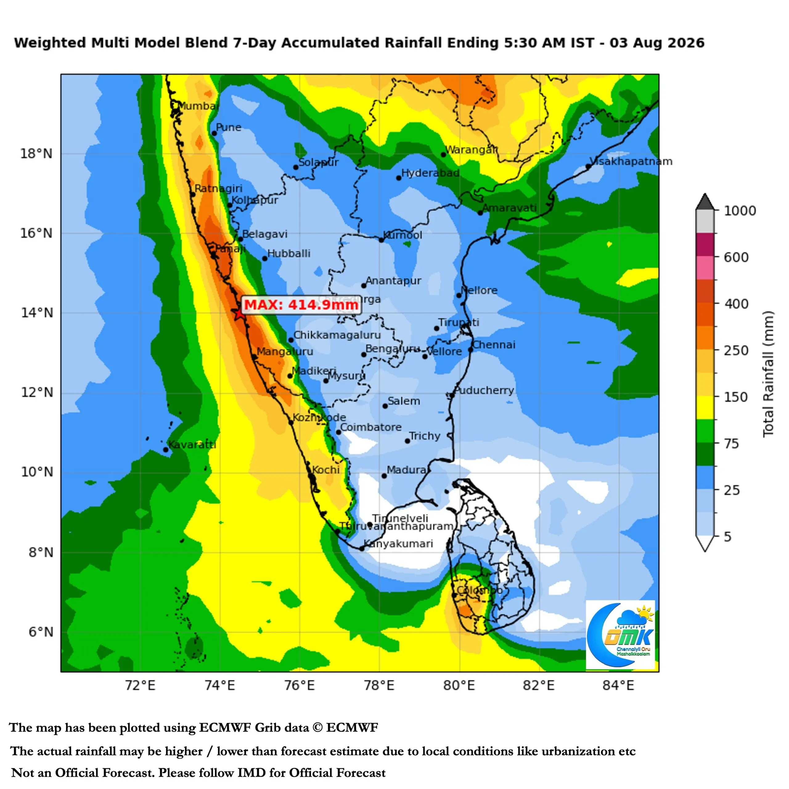
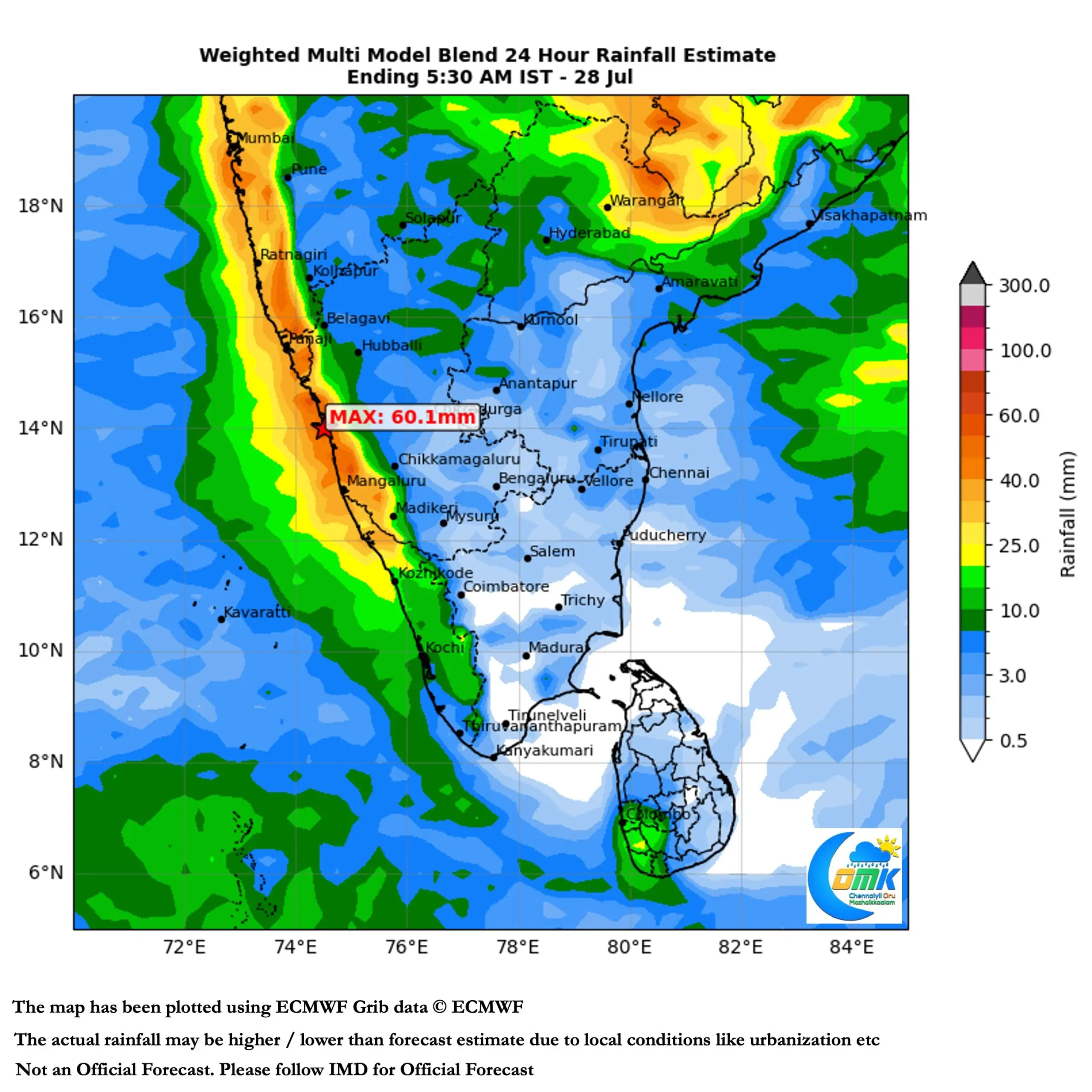
Hopefully this could finally result in the daily positive rainfall anomaly streak extend beyond this 3 days. This spell of active monsoon conditions will also owe its strength to the monsoon depression over North Bay. It is likely to become a deep depression today before crossing the North Odisha / West Bengal coast today. After crossing a slow movement along the monsoon trough towards Central India will provide much needed impetus to monsoon dynamics.
Not only we are likely to see Monsoon revival of Monsoon over Peninsular Coast there may be good news on the Cauvery front as well. Looking at the current storage and expected inflow the first significant inflow into Mettur from Karnataka may reach around 2nd or 3rd August. Kabini as always will set the ball rolling. With Harangi reaching near FRL most of it’s inflows will now reach KRS. Fingers crossed by mid August the cumulative storage may be near FRL across Karnataka dams which would finally open the flood gates for Mettur.
Though it remains to be seen how would the inflows sustain during the remaining monsoon season. We will cross the bridge when it comes. Until then its time to look forward to the revival of Monsoon over Peninsular India. Closer home we may have isolated scattered thunderstorms for the next day or two before increased moisture may provide for better thunderstorms over the plains of TN. If the surge becomes too strong bulk of these rains may be from remnant moisture pushed from West.