
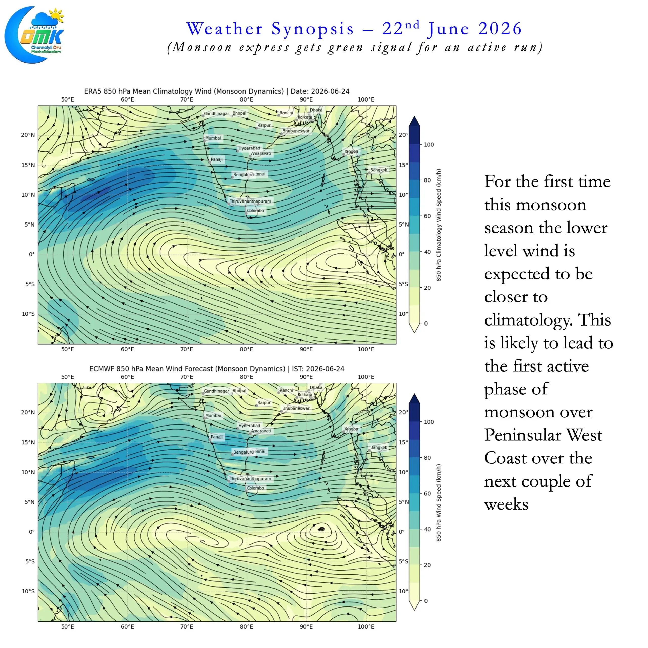
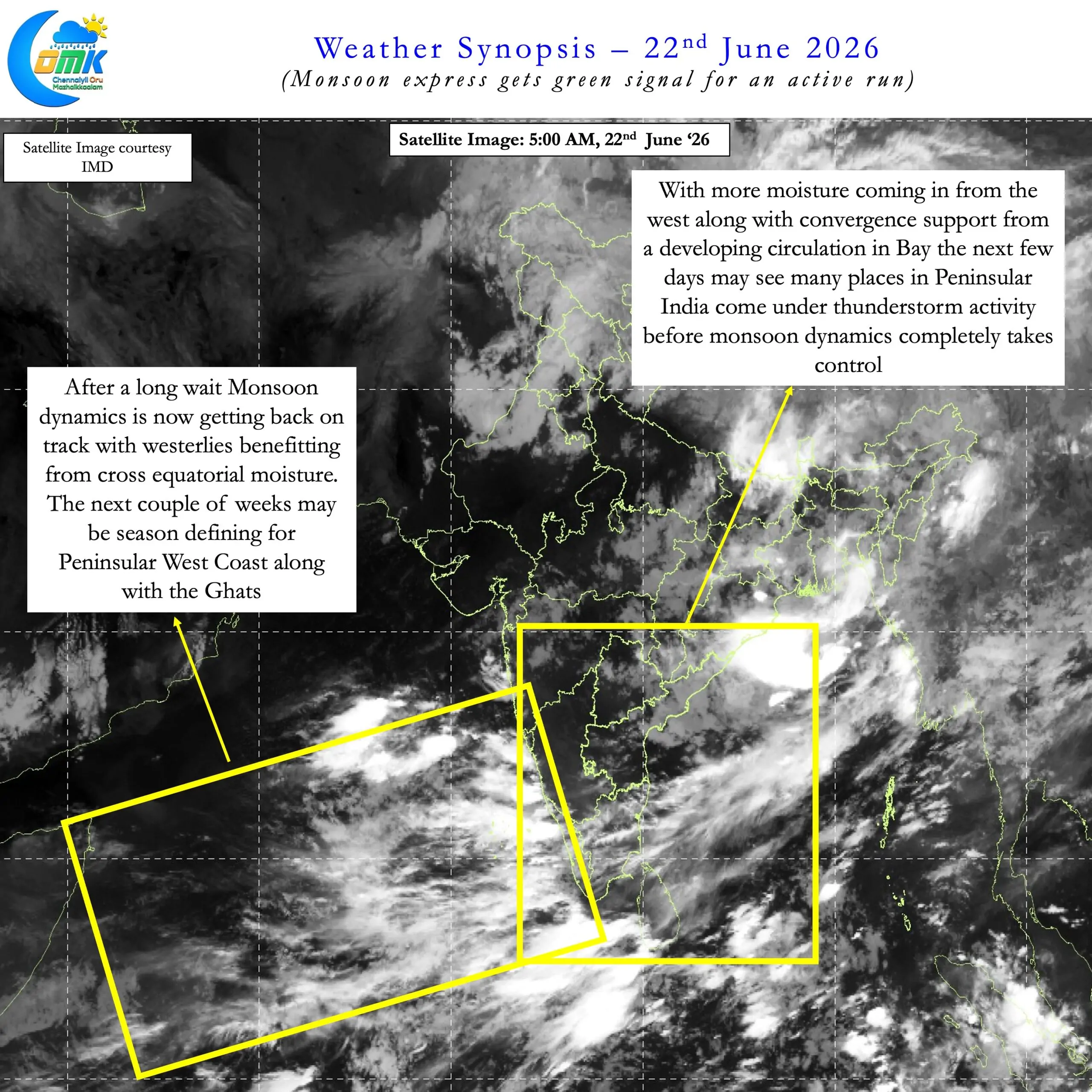
On 8th June the Arabian Sea branch of monsoon passed over Harnai in Konkan Maharashtra. Since then it has been stationery while the Bay branch has covered all of West Bengal. It has reached right at the border of East UP / North Bihar. It is almost like the Monsoon Express was given a red signal at Harnai preventing any further movement along Peninsular West Coast. This also coincided with a fairly subdued rainfall activity along west coast and the Ghats. Simultaneously an active phase of thunderstorms has been happening over the leeward plains of TN. Though the Ghats have been scoring less daily thunderstorms have meant the seasonal rainfall for TN & PDC now stands at 56% excess.
But all that is going to change. After waiting at red signal for 2 weeks Monsoon express has received green signal. The green signal has arrived in the form of a weak MJO that is trying regenerate itself over the Indian Ocean. As MJO tries to regenerate and start a global circuit it will spend the next couple of weeks over the Indian Ocean. This will provide the necessary fuel for Monsoon express to notch up gears for the net couple of weeks.
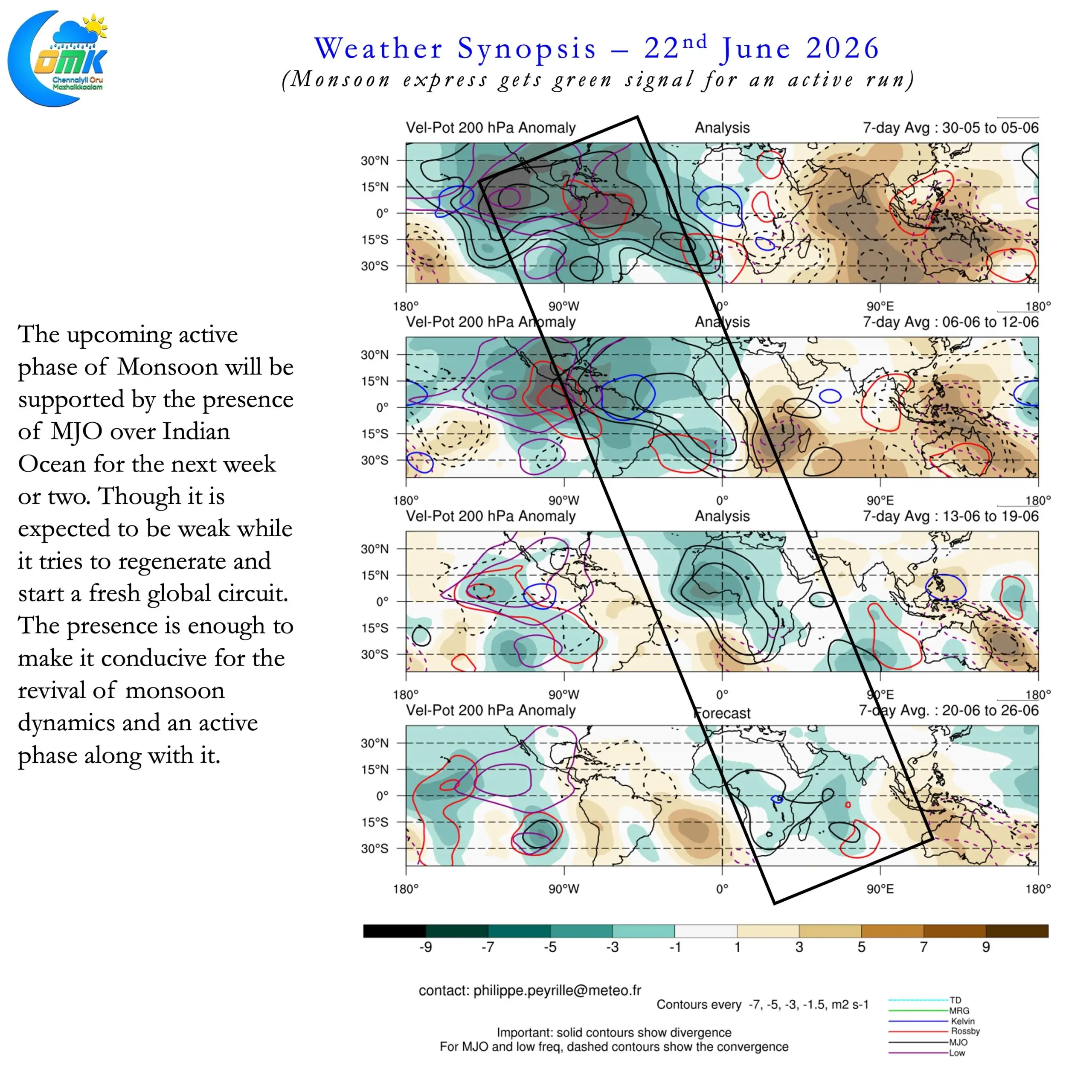
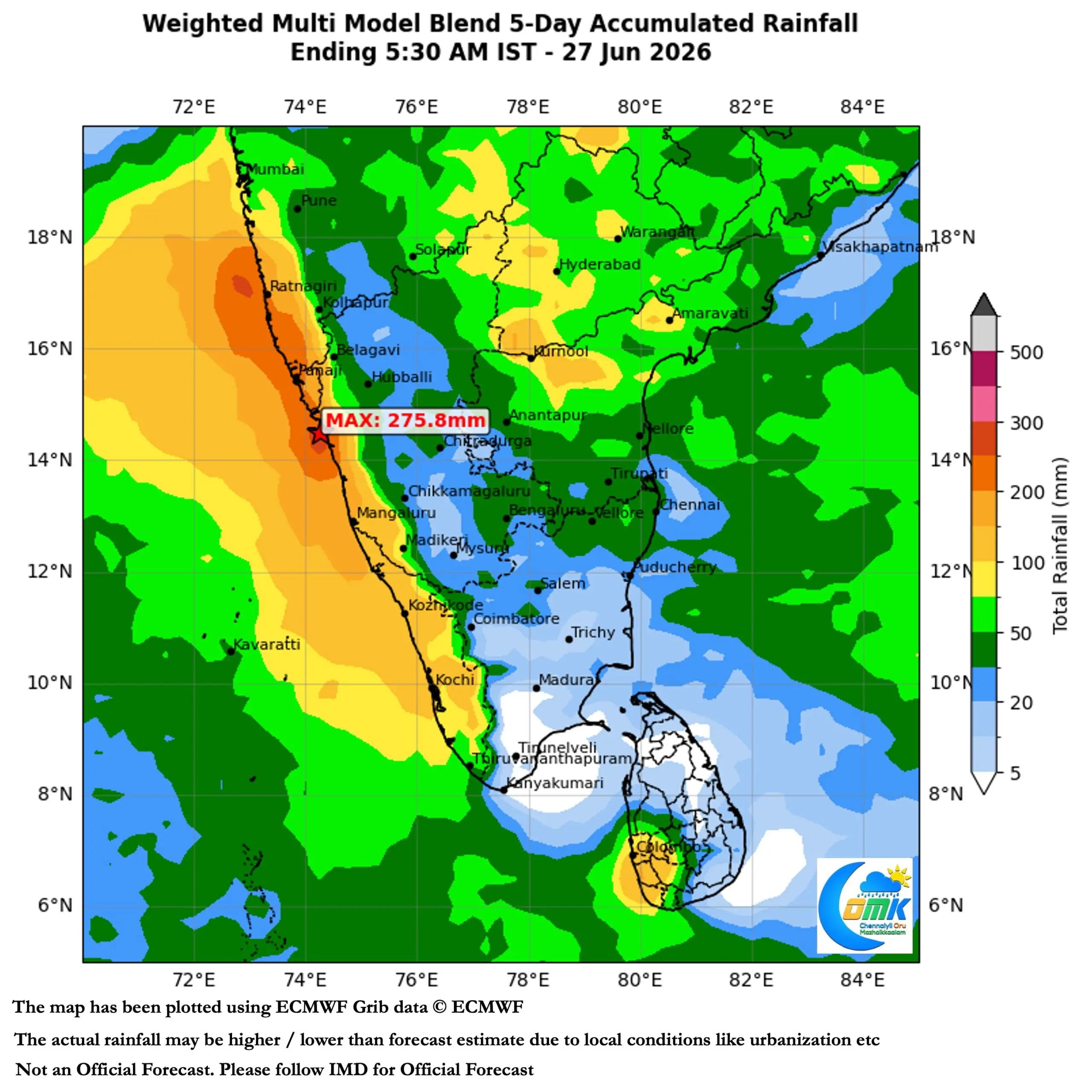
This phase is likely to be very critical as we are not sure how MJO would behave during the month of July when it reaches Maritime Continent. If it behaves similar to the last time around then we can expect another long suppressed phase. The last time around an interaction between the base state created by developing El Nino and MJO meant a slow transit across Pacific and Western Hemisphere. Nevertheless the next couple of weeks is going to be an extremely active phase and much needed one too.
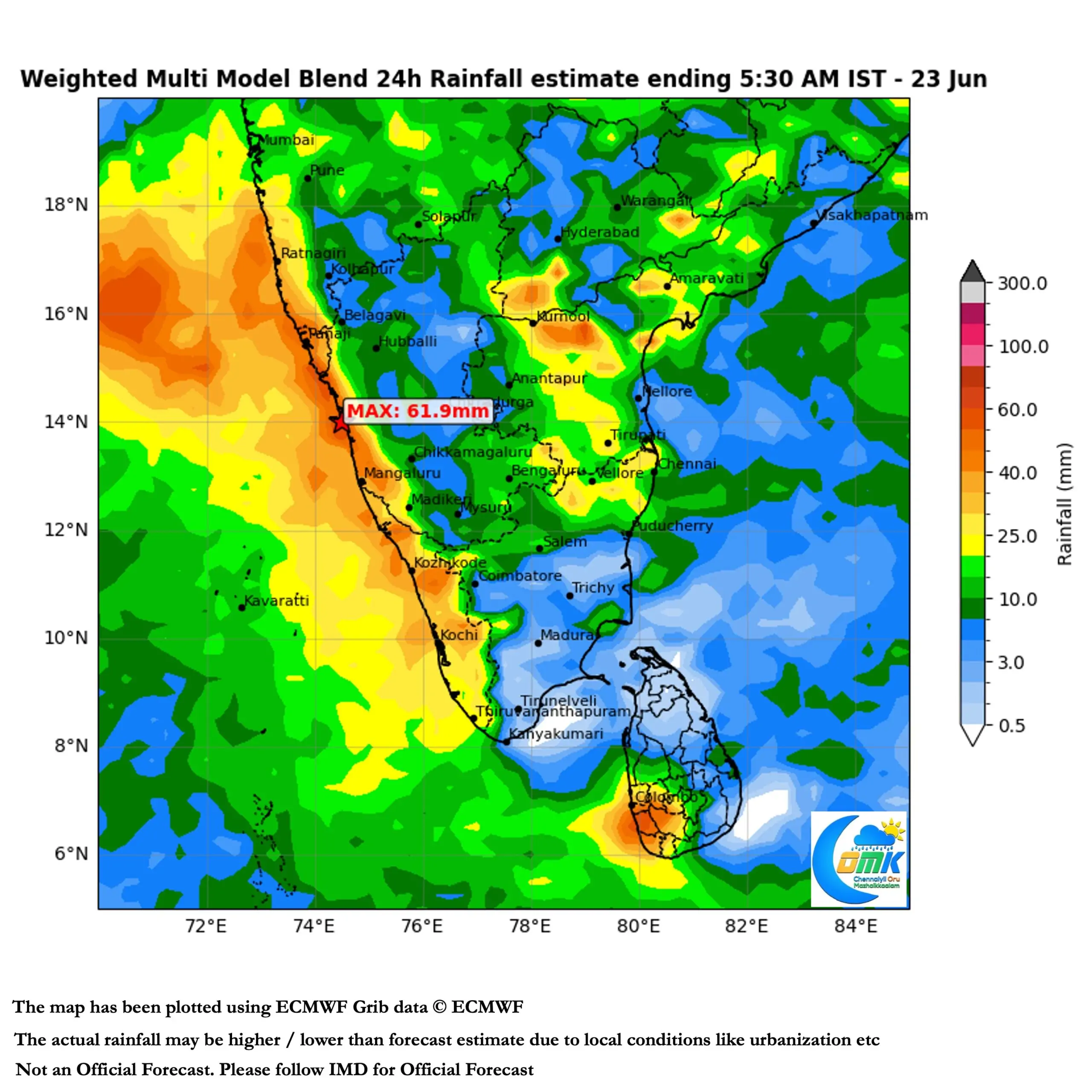
Under the influence of a developing cyclonic circulation and associated East West Shear Zone leeward plains of Peninsular India may see thunderstorms at many places for the next couple of days. As the shear zone climbs up monsoon onset will also gradually push across northern parts of Peninsular India. Sub seasonal weather models indicate possibly a Monsoon low may form towards end of June which could keep the monsoon dynamics going.
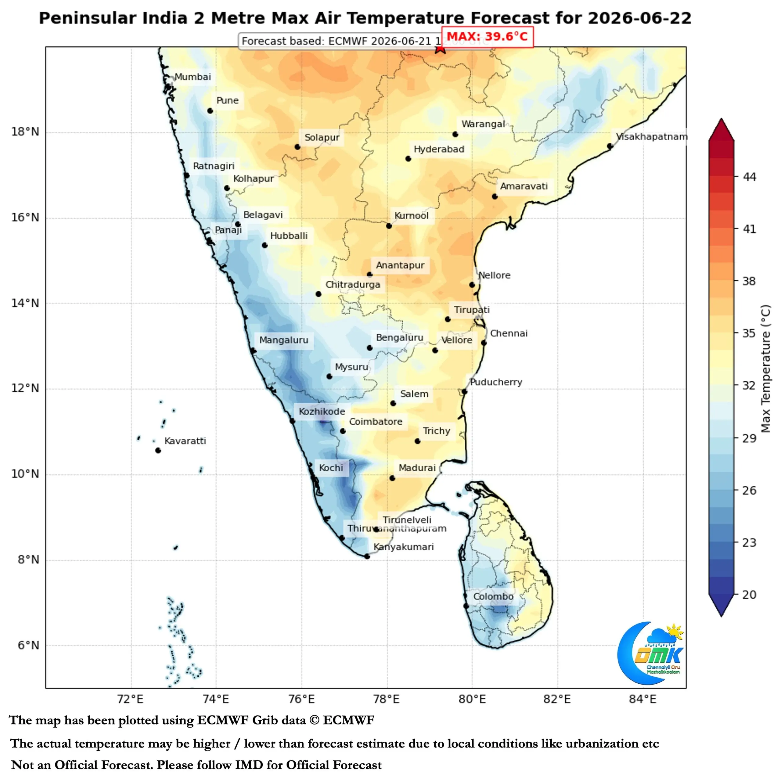
Parts of Chennai and suburbs saw intense thunderstorms yesterday while widespread thunderstorms happened over the plains of TN. Today we may see intense thunderstorms over North TN with Chennai possibly best placed for another widespread thunderstorm event between today and Wednesday. Wind convergence created by the Shear Zone may help Chennai and suburbs with westerlies pushing moisture and the interior storms during this phase. An incidental benefit of monsoon picking up is reduction in afternoon temperatures for the plains of North TN including Chennai.