

The North Indian Ocean cyclone season is typically split as two sub seasons by Southwest Monsoon. Pre Monsoon season coincides with the summer months. Post Monsoon season coincides with Northeast Monsoon season. Often these cyclones also play a role in reversing the seasonal winds between Westerlies and Easterlies. Over the past 24 to 48 hours satellite image has been resembling a NEM day with LPA in South Bay.
During the pre monsoon season there is always a very high chance of Northward movement due to the ridge positions. The probability of NE recurve is the highest at this time of the year compared to post monsoon season. The probability of Northward movement with Recurve makes genesis location important. During 2016 we had cyclone Roanu which had its genesis near Sri Lanka moved along near Peninsular East Coast giving widespread rains to TN. Eventually it took the NE recurve reaching North Bay near Bangladesh.
The cyclonic circulation over Gulf of Mannar and adjoining areas brought about widespread summer rains over most of TN. Both the IMD observatories of Chennai recorded 4 cm for the 48 hours ending today. The long term mean average rainfall during May is about 4 cms for Nungambakkam and 5 cms for Meenambakkam. IMD in their daily bulletin yesterday has indicated an LPA is likely to form tomorrow over Southwest Bay.
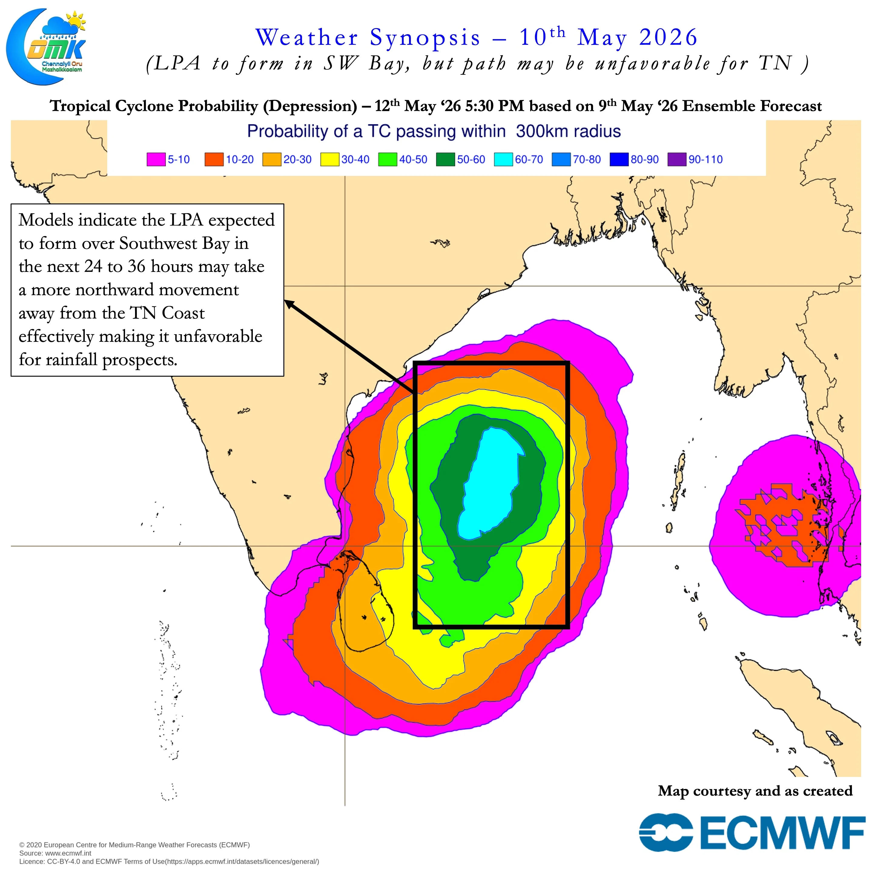
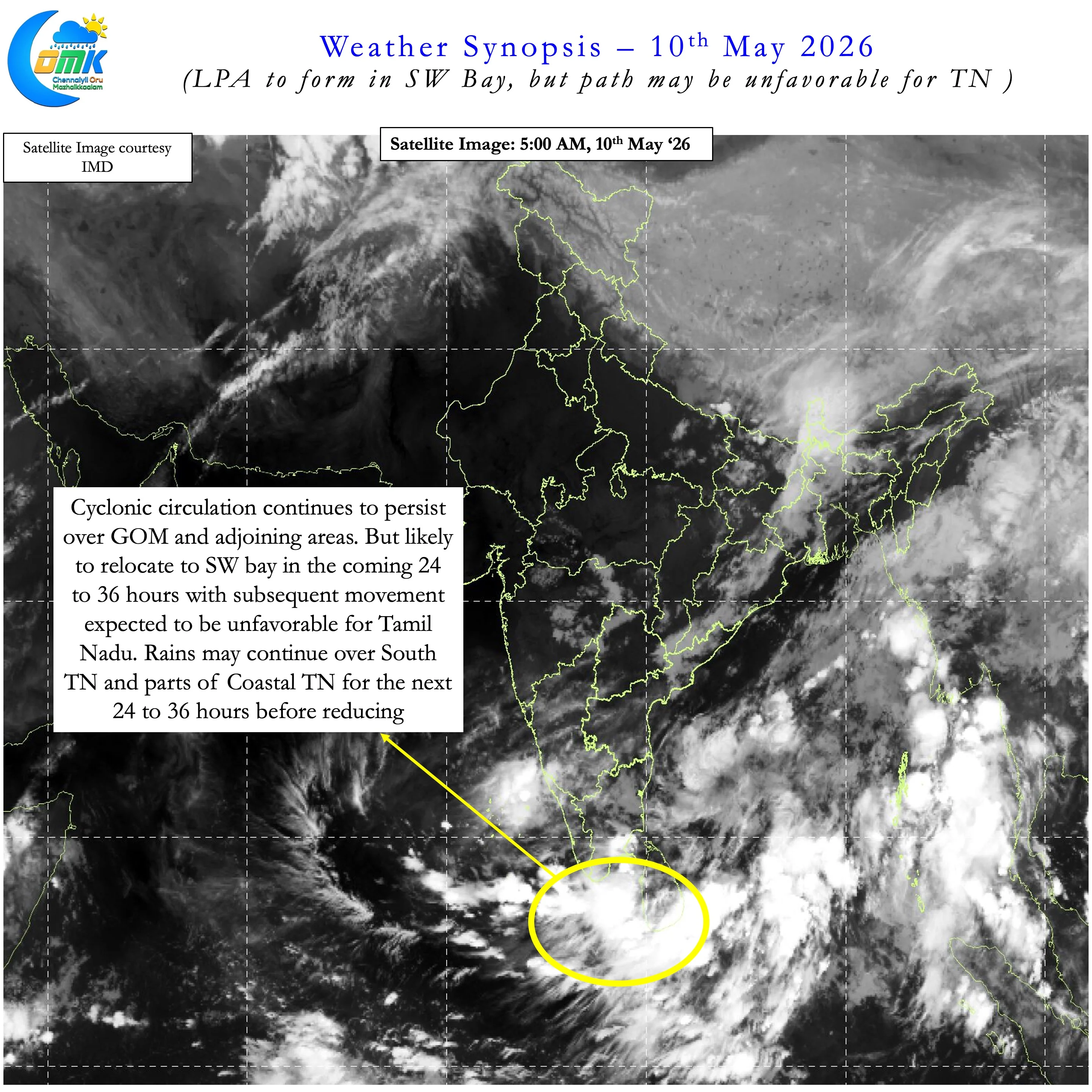
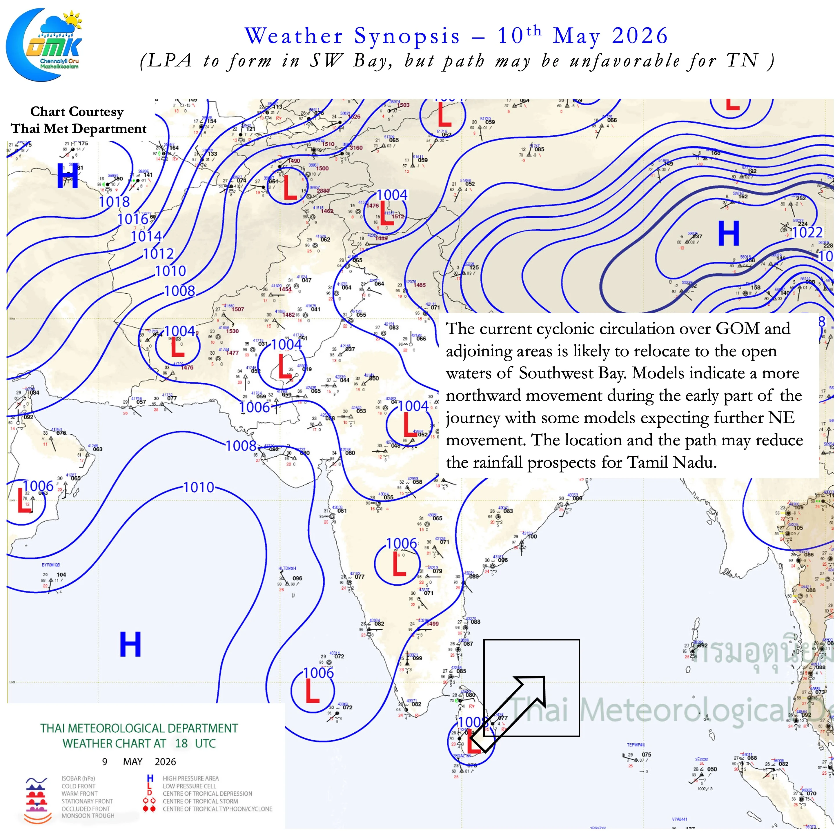
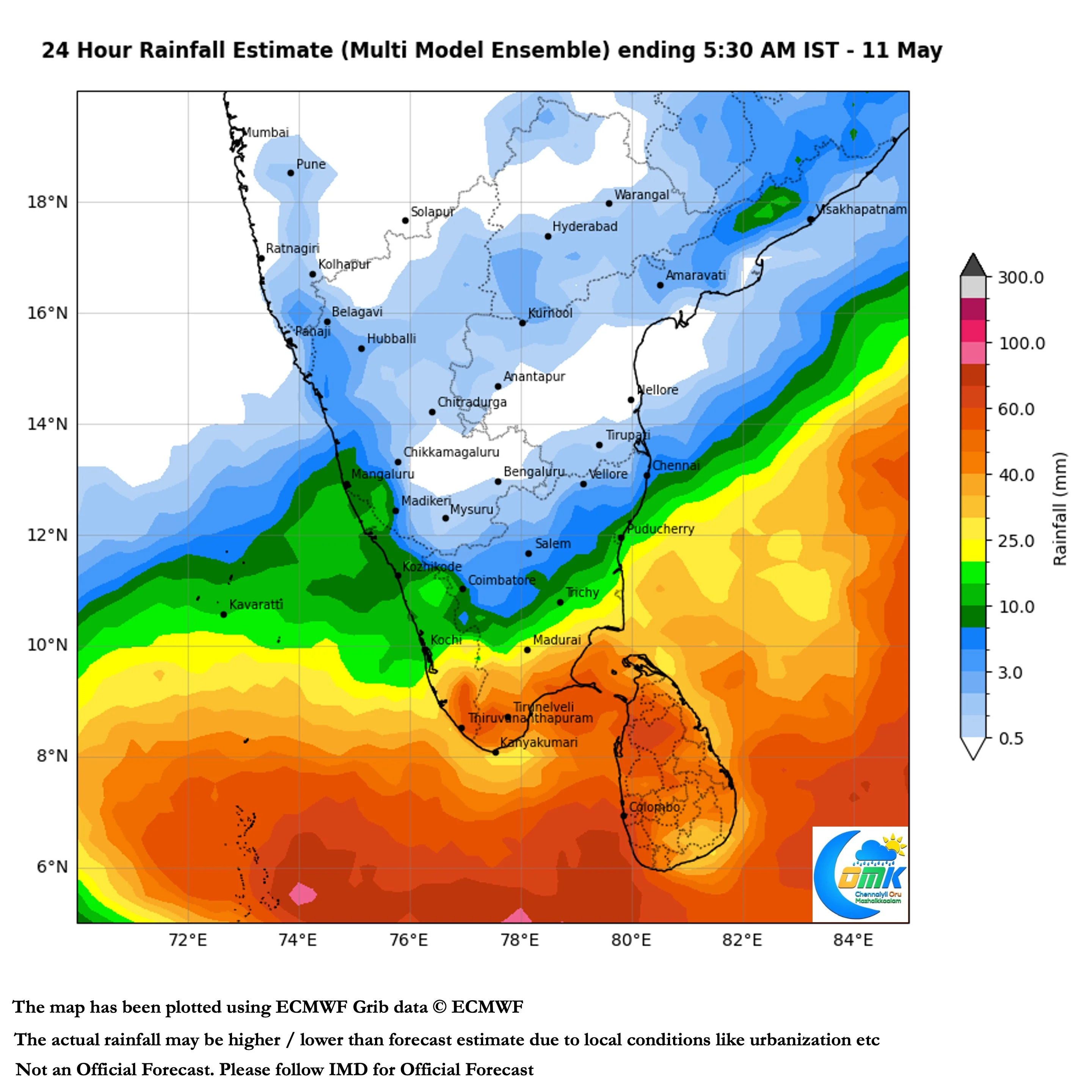
The current cyclonic circulation over GOM could possibly relocate to the open waters of SW bay in the next 24 hours or so. This relocation puts the location of LPA in an area which could potentially be unfavourable for Tamil Nadu. This relocation is effectively the difference in a Roanu like situation repeating once again. It is essential to point here though most models expect a weak disturbance rather than a cyclone. There is a fair bit of consensus among deterministic and ensembles for the disturbance to take a more Northward track. For the next 3 / 4 days the circulation may move in the open waters of Bay. Additionally the nature of circulation could mean moisture is likely to stay over the seas.
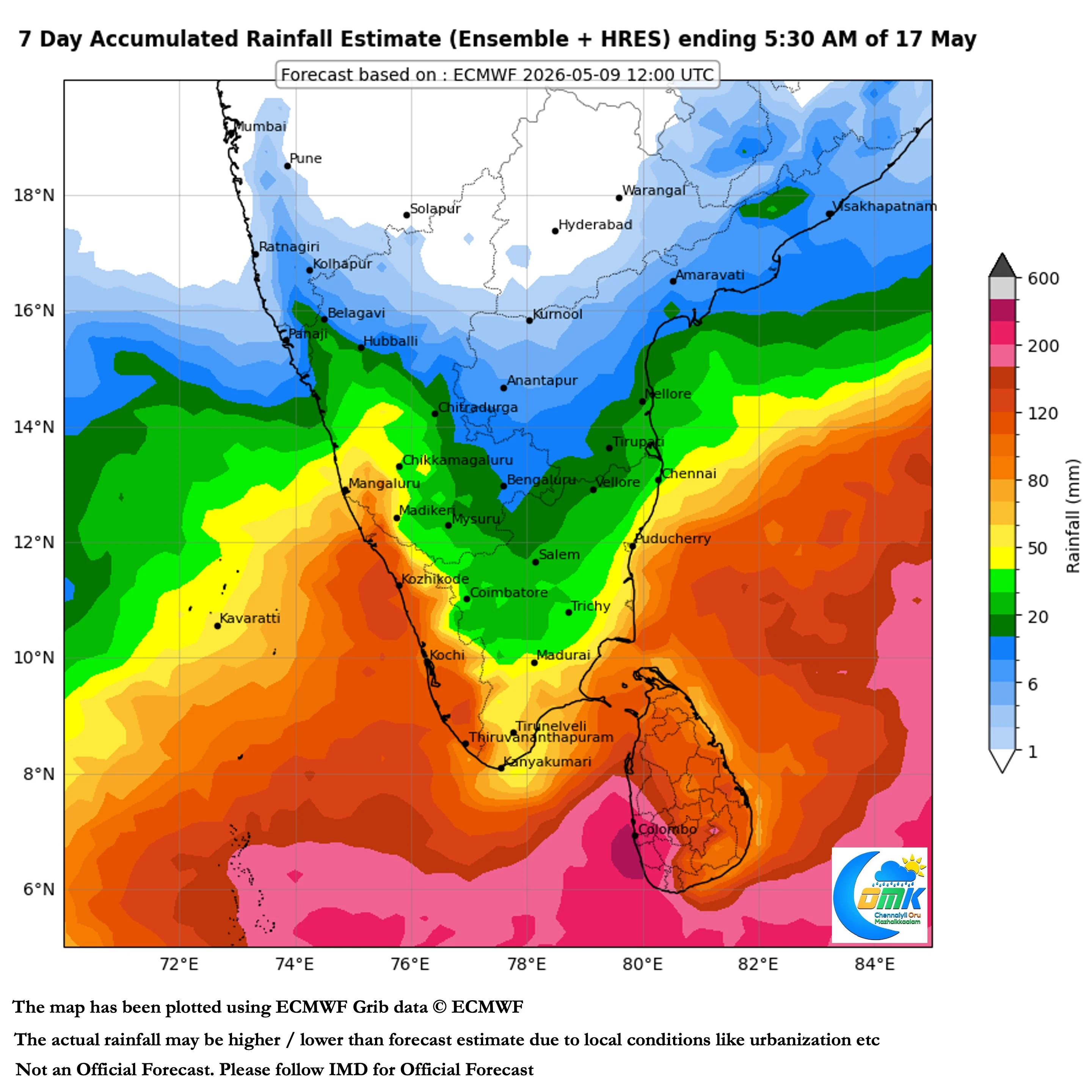
Effectively this could mean rains for Tamil Nadu may start to fade away from today. South TN could possibly get rains today with few places seeing moderate to heavy rains. Coastal stretch between Chennai and Delta may not see much rainfall activity from now. Some ensembles indicate the remnant circulation to drift West across Peninsular India after weakening. If this happens we may see a fresh spell of rains for a day or two later next week. But there is a lot of ifs and buts in this.