
Summer thunderstorms in India are called by different names. Mango Showers / Coffee Showers / Blossom Showers because they help in the flowering of Mango and Coffee crops. Kal Baishaki / Norwesters in East India while neighbouring Assam calls it Bardoli Chheerha. Often intense thunderstorms accompany these spells of rains. Pre Monsoon Season (March to May) is the peak period for lightning flashes in India. Lightning deaths though peak during the monsoon season due to increased agricultural activity coinciding with monsoon.
Bulk of the summer thunderstorms are convective in nature with seasonal wind change providing the platform. Line of Wind discontinuity develops over Peninsular India as winds change gradually change from East to West. Thunderstorms develop along the areas that have LWD taking advantage of convective development due to day time heating. At times, particularly during early season, Tropical and Sub Tropical interaction also brings these thunderstorms. Mid Level Westerlies and lower level Easterlies create unstable atmospheric conditions for thunderstorms to develop over large areas.
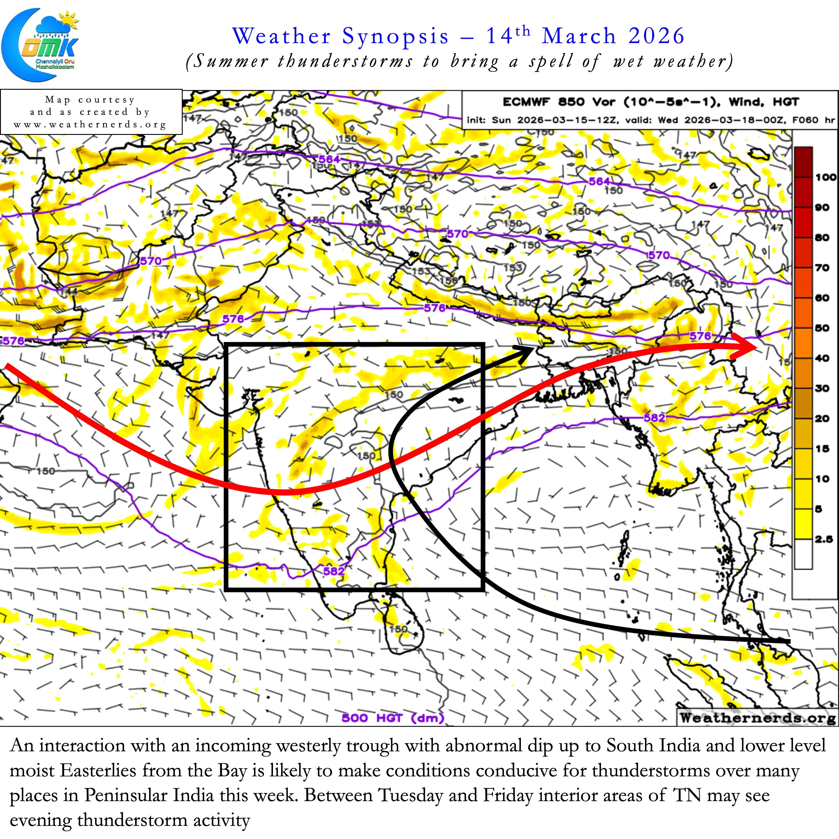
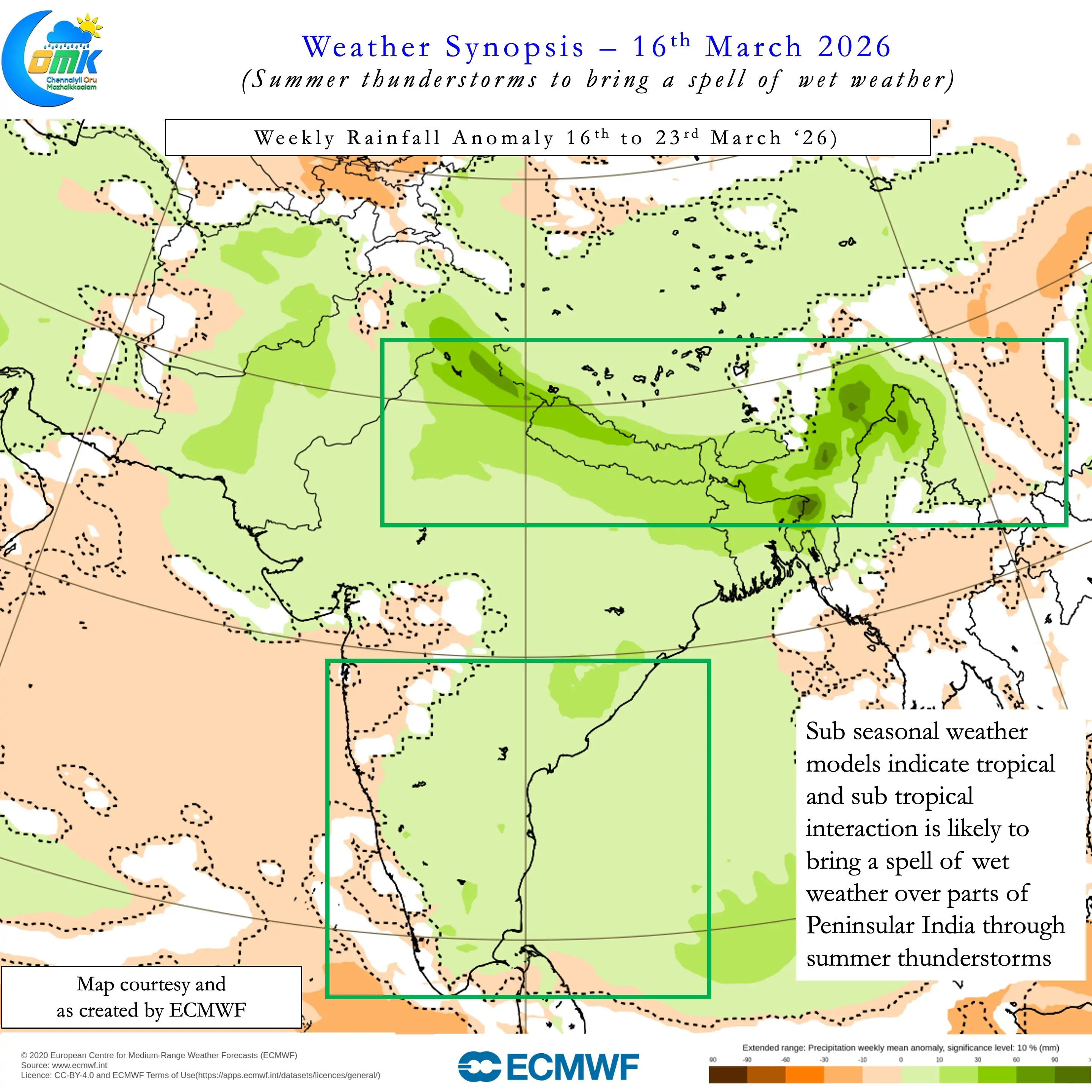
This week one such interaction may bring a spell of wet weather across the Indian sub continent. Sub seasonal weather models indicate above average rainfall activity for most places in the country. Interior areas of Peninsular India, parts of Chhattisgarh, AP, Telangana, Odisha may be the hotspots for these thunderstorms. With the westerly trough dipping into South India there is a very high possibility parts of Tamil Nadu may also see thunderstorm activity during this period.
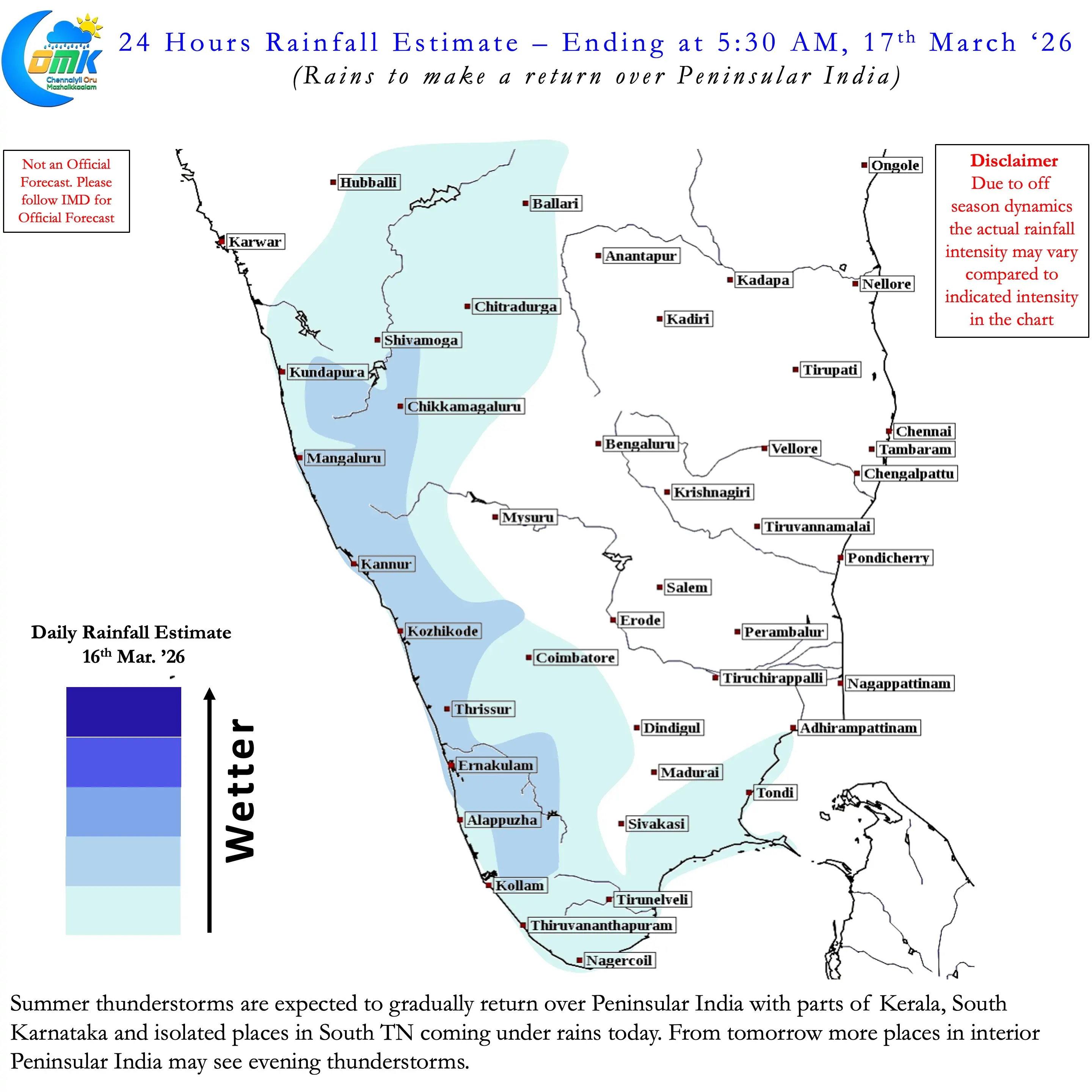
Lower level Easterlies with moisture from bay is likely to interact with the incoming Westerly Trough. This provides perfect platform for thunderstorms to develop during afternoon evening hours bringing sudden burst of rains. It may be noted unlike Easterlies influenced rains that peak during night / early morning hours this spell may see peak activity during evening hours. Depending on real time wind patterns Delta, parts of South TN and NW interior TN may see stormy weather from Tuesday. The wet spell is likely to continue until Thursday / Friday before gradually fading.
Since these storms may move from West to East under the influence of the trough there is a possibility some. ofthe interior storms may reach the coast closer to Chennai. We need to see if they bring rains to the city areas also or fade after giving rains to the suburbs.