
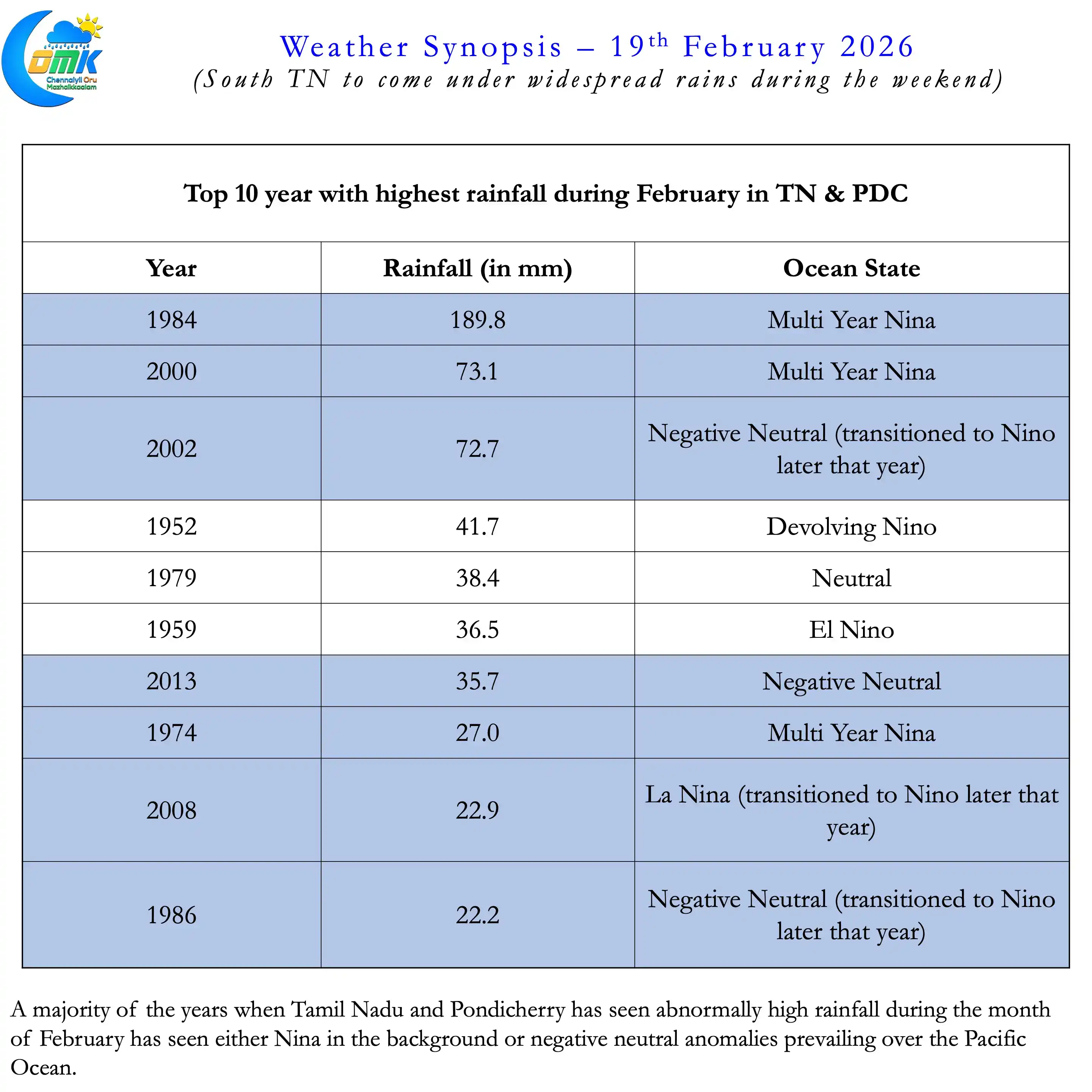
It is not often we see a Low Pressure Area during the month of February over the North Indian Ocean. Only about 7 Depressions / Cyclones have formed in Bay of Bengal since 1891 during the month of February. But at times the script is flipped.More than 40 years back the IMD observatory at Nungambakkam recorded 294 mm during Feb. 1984. In the 12 hours between 5 PM, 16th Feb. 1984 to 5 AM 17th Feb. 1984 25 cms fell. Synoptically the presence of a Trough of Low along Coastal TN provided for widespread rains across TN. While not at the same scale South TN may see widespread rains this weekend due to the LPA.
If one were to look at the years that have seen the highest rains during the month of February in TN & PDC there could be a pattern. A majority of the years have seen the influence of Nina prevail during the winter. In a couple of cases Pacific ocean has been seing negative anomaly. Interestingly a couple of years have also seen a flip to Nino during the later half of the year.
With a Low Pressure persisting over the Equatorial waters of SW Bay it appears parts of TN could come under rains. The LPA is expected to become well marked in the next 24 hours or so and gradually move WNW to the NE of Sri Lanka. A combination of weak steering and possible interaction with Westerly trough may make its movement near stationery at this point. For a period of 24 to 36 hours the circulation may remain in the same region.
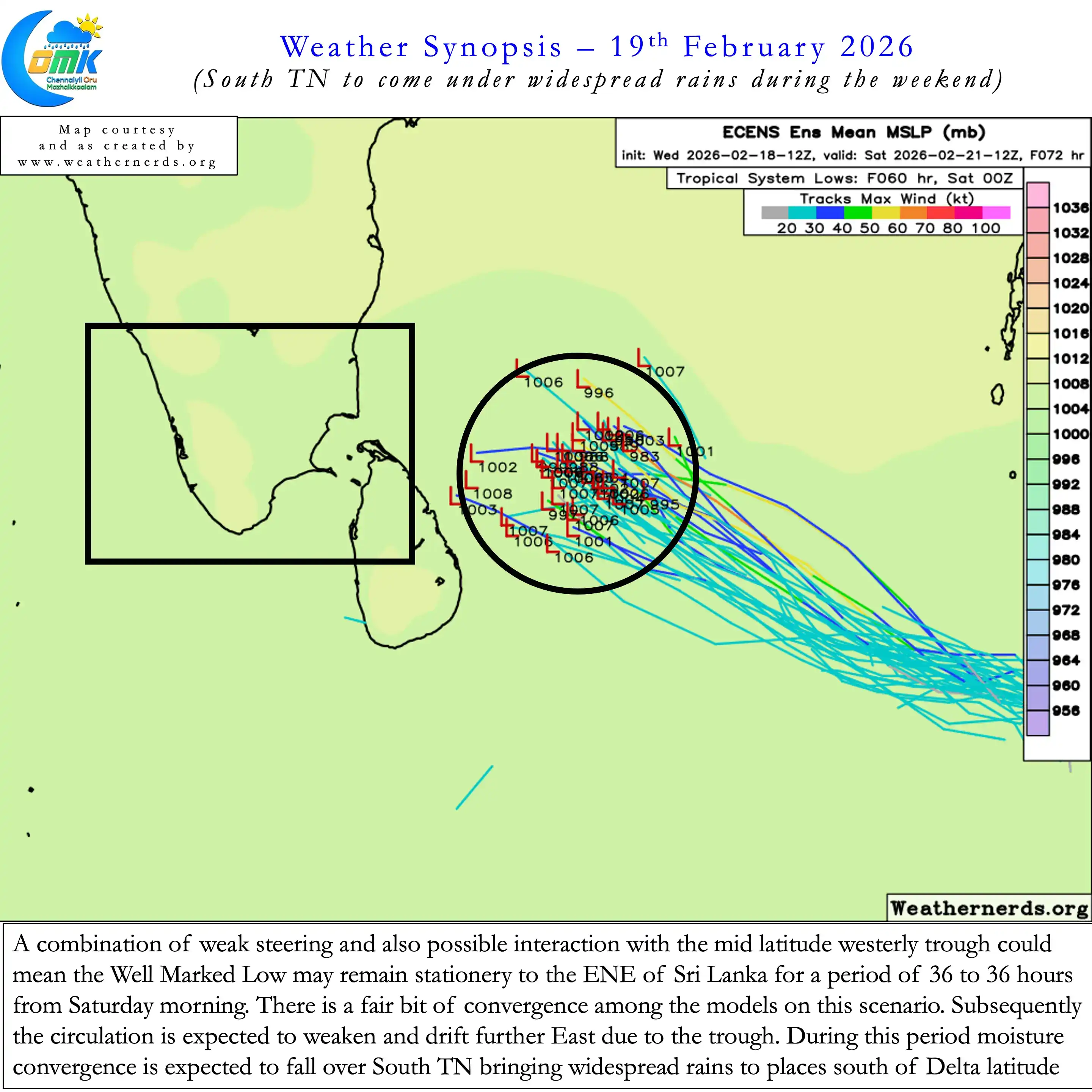
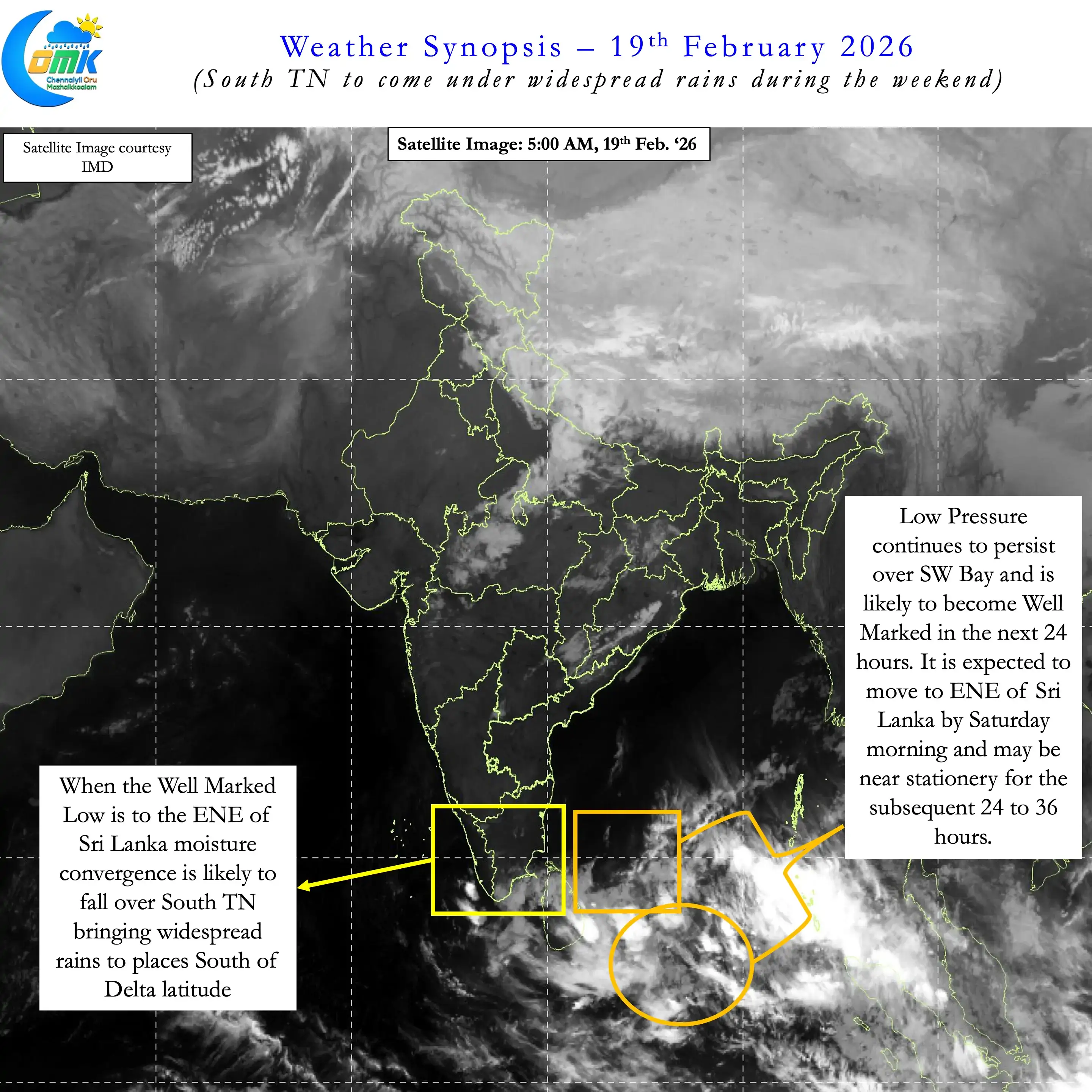

Wind charts indicate during this near stationery period moisture convergence may fall over places to the south of Delta latitude. This could mean South TN may see widespread rains from Saturday morning up to Sunday evening. A few places in South TN Ghats between Kanyakumari and Dindigul may also see heavy spell of rains. at times. Places like Manjolai may come under heavy to very heavy spell of rains depending on the location of the circulation.
Parts of Kerala and west interior TN may also see moderate spell of rains during the weekend. Places to the North of Delta latitude may see light / moderate spell of rains during the weekend. As we move up the intensity of the rain is likely to reduce with drizzles / light rains for Chennai . There is fair bit of convergence among models post this stationery period the system may weaken and drift East. Under the influence of the Westerly trough it may drift towards the open waters. andeventually dissipate.