

Roughly ten days back discussions around the weather blogging community centred around will NEM 2025 revive. It was almost 3 weeks since the last meaningful spell of rains and there was a lot of scepticism on possible rains. This despite weather models indicating the return of rains back over coastal TN. Even when the Low Pressure formed over Comorin Sea consensus was eluding on whether monsoon can revive. Ironically yesterday saw the 2nd highest daily rainfall for TN & PDC this NEM season.
Amidst this there was a phase when most models started showing a strong disturbance emerging out of SE Bay. Not only was the disturbance shown in SE bay but the track was also highly unfavourable for Tamil Nadu. Once again the nay sayers started the usual “NEM 2025 is heading towards a shutdown.” Machine Learning models continued to indicate a scenario where the circulation to emerge may not be from SE Bay but from SW Bay. But it is very easy for doubts to creep into human minds. More so during bad times. With numerical weather models leaning towards SE Bay it was a case of waiting for things to evolve.
Now certainly things have not only evolved but their seems to be some consensus building as well. Ensembles were the first to break ranks among numerical weather models. Day before yesterday the shift started appearing towards SW Bay circulation. Gradually we started seeing operational models also testing waters with the SW Bay circulation. Models like GFS could not give up on SE Bay circulation easily so has been showing a cat on the wall type multiple circulation scenario.
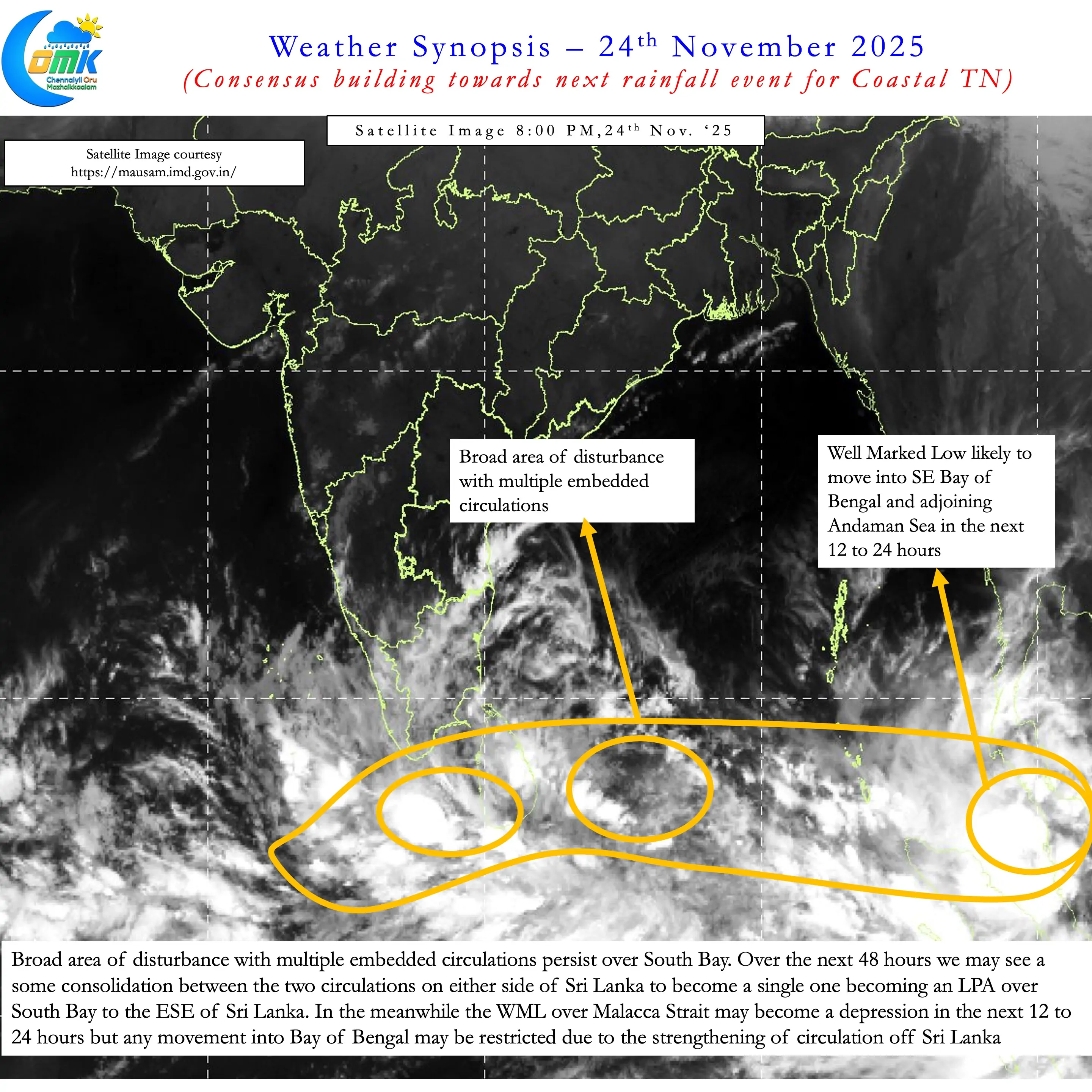
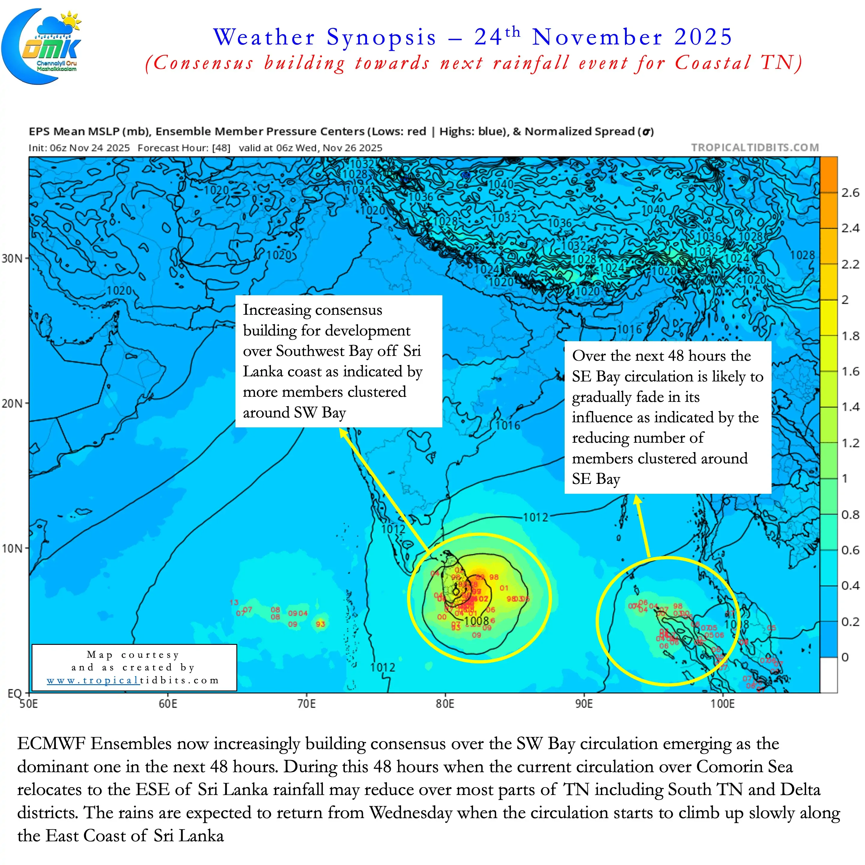
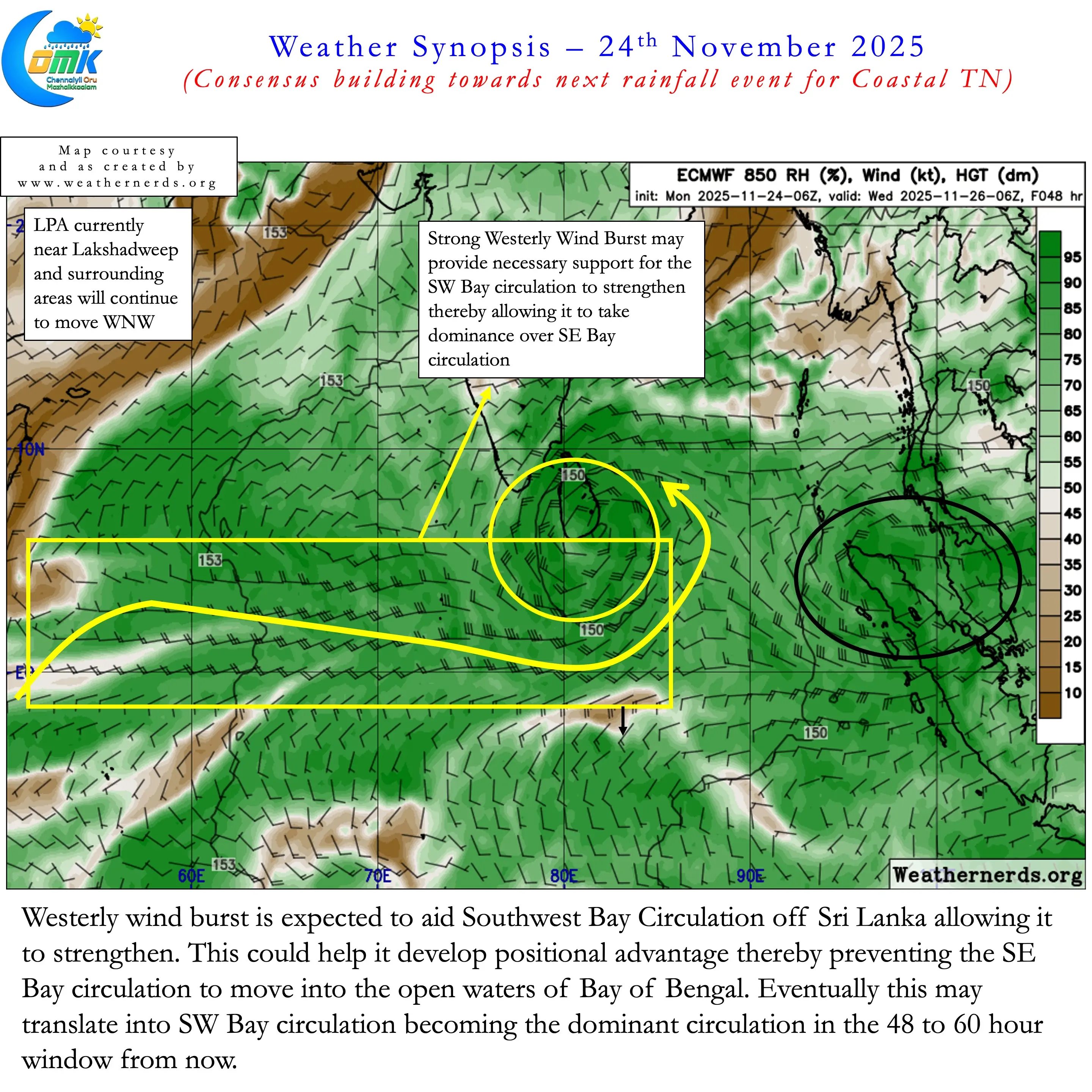
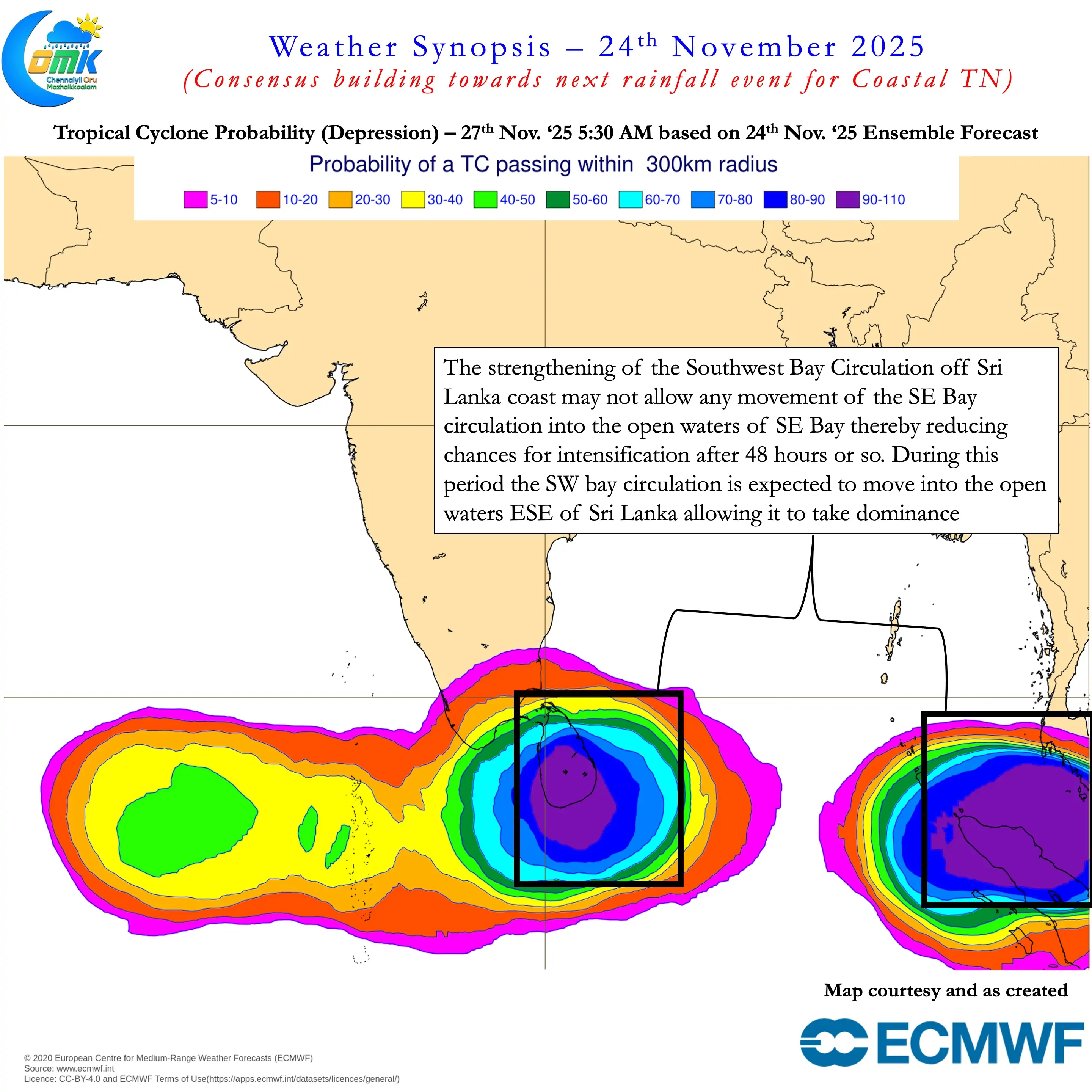
While it is not written on the stone moment yet for the Southwest Bay circulation things are certainly shaping up. Shaping up well enough to build consensus on the next rainfall event for Coastal TN. Over the next 48 hours a combination of factors may favour the circulation off Sri Lanka coast to strengthen. At the same time limited manoeuvrability may go against the SE Bay circulation during the same period. During this 48 hours we may see a reduction in rains over most parts of TN including South TN & Delta.
Post 48 hours we may see a gradual movement from SW Bay circulation. This may kickstart the next rainfall event for Coastal TN. There is increasing convergence among the ensembles the SW Bay circulation may relocation to the East of Sri Lanka. When it reaches ENE of Sri Lanka it may be at a location that may bring widespread rains to Coastal TN. It is not time yet to discuss about quantum of rainfall. But there is a high chance delta may end up in excess by end November. There is a very good chance for districts with negative anomaly in North Coastal TN to recover their deficits.