
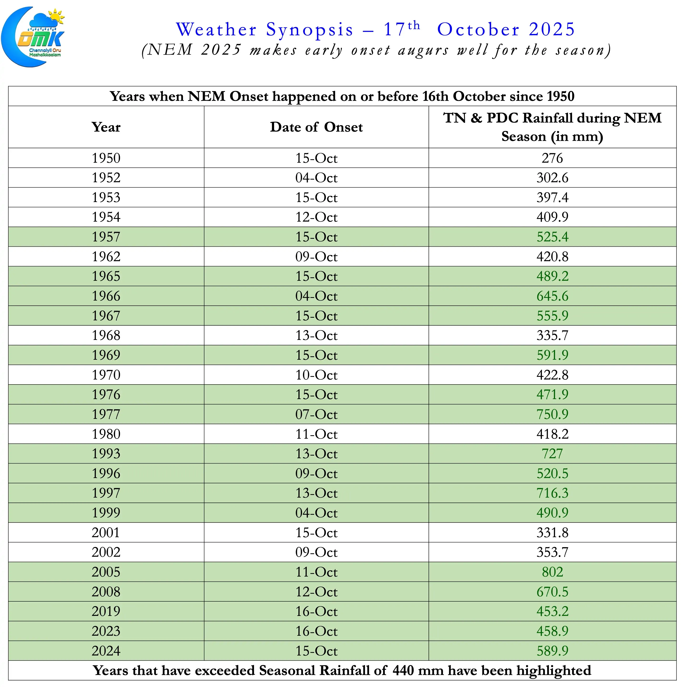
Yesterday the much awaited event for the weather bloggers of Tamil Nadu happened. IMD announced the withdrawal of SWM from the entire country. It also announced a simultaneous onset of NEM 2025 as well. In the last 75 years 2025 is the 27th instance when Northeast Monsoon has made onset on or before 16th October. The climatological onset date for Northeast Monsoon is 20th October with a variance of +/- 8 days as per the study conducted by YEA Raj and Geetha.
Taking this into account while one can say NEM 2025 has made an early onset it is within the variance window. Interestingly 16 of the 26 years since 1950 when NEM onset happened before 16th October have seen above average seasonal rainfall. To compare of the 49 years that saw onset after 16th October 26 saw seasonal rainfall exceed 440 mm. Another interesting statistic that is worth mentioning here is the mean average seasonal rainfall. Years that saw onset before 16th October has a mean seasonal rainfall of 505 mm. The mean seasonal rainfall for the years with onset after 16th October in comparison is 444 mm. On the face of it the numbers may stack similarly though one can say early onset increases the probability of a better NEM 2025 overall.
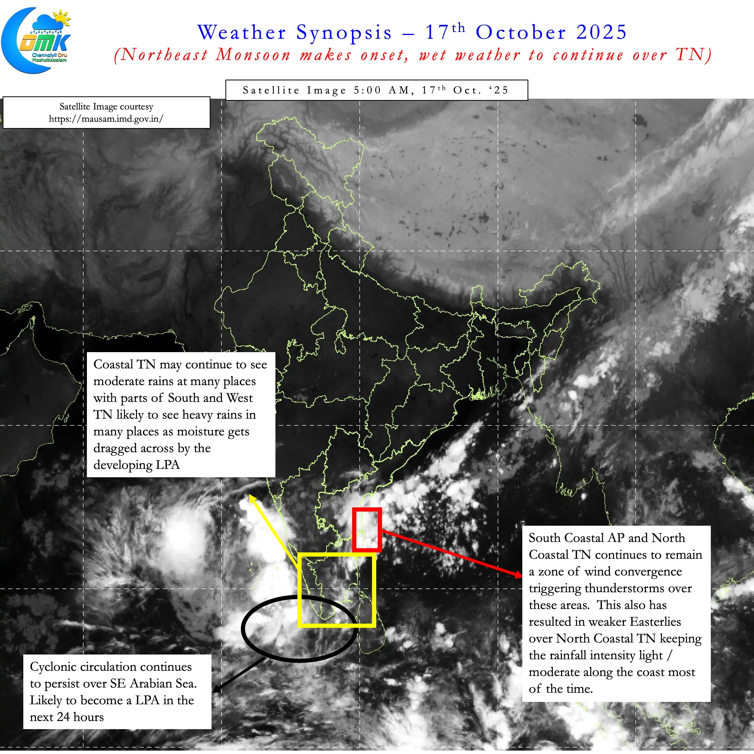
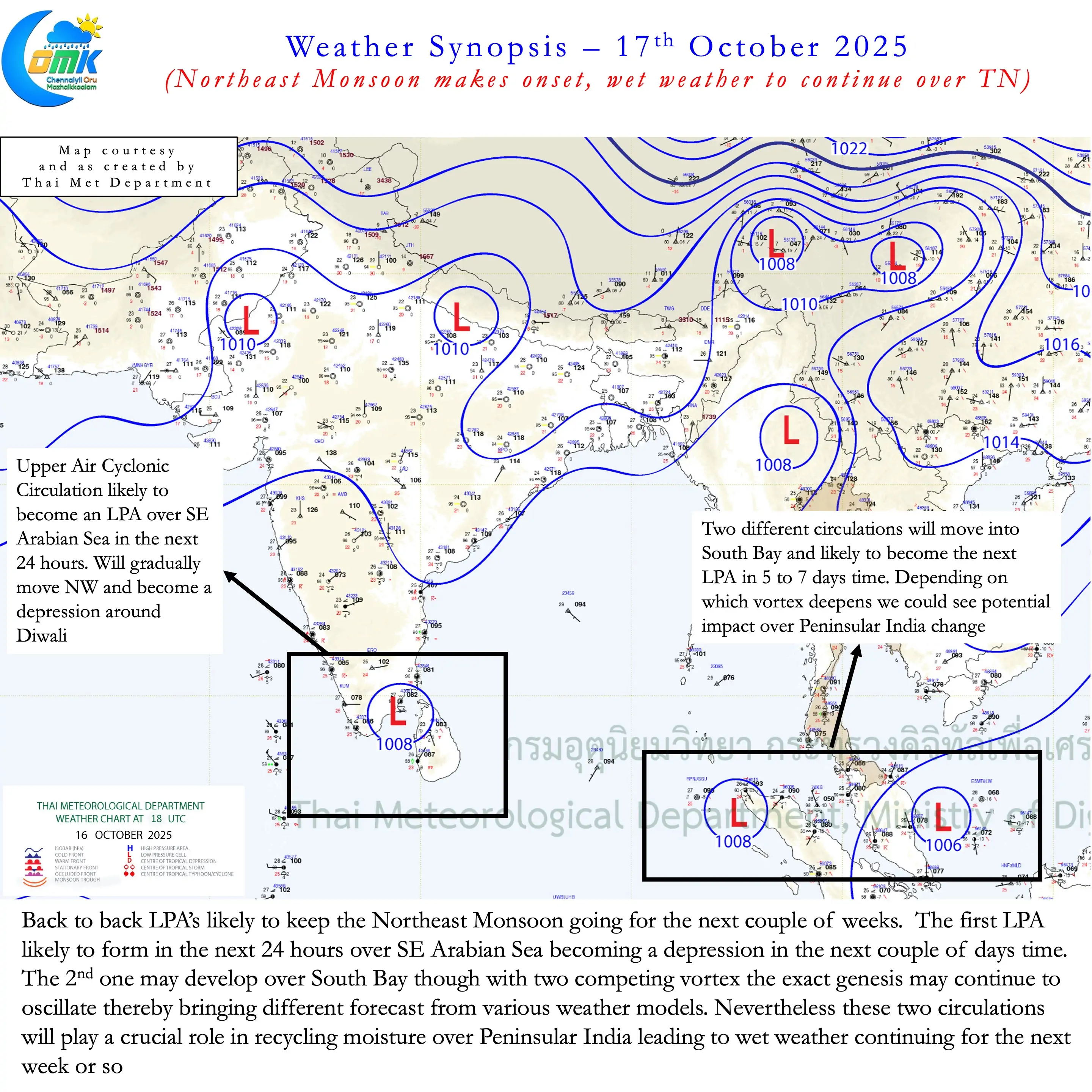
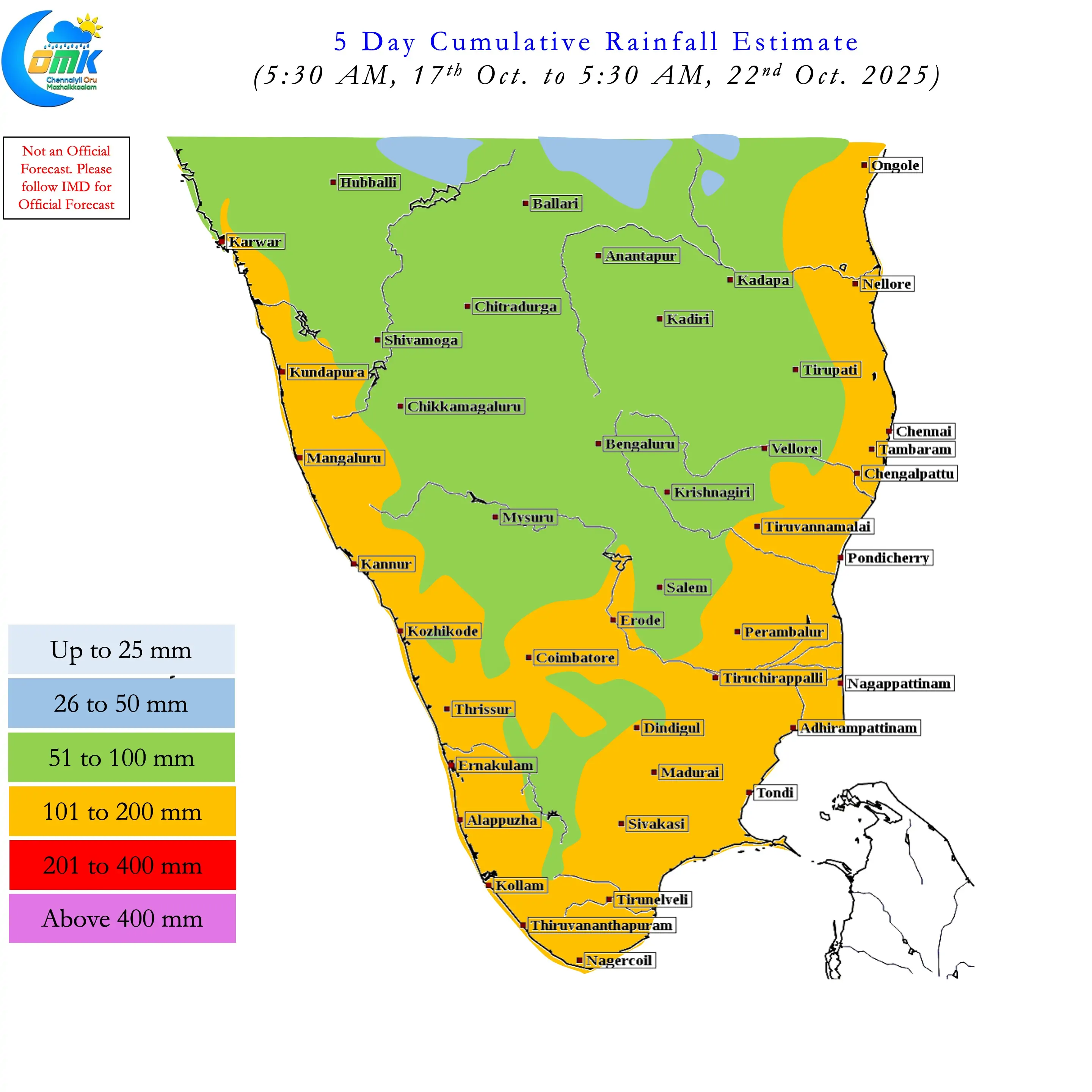
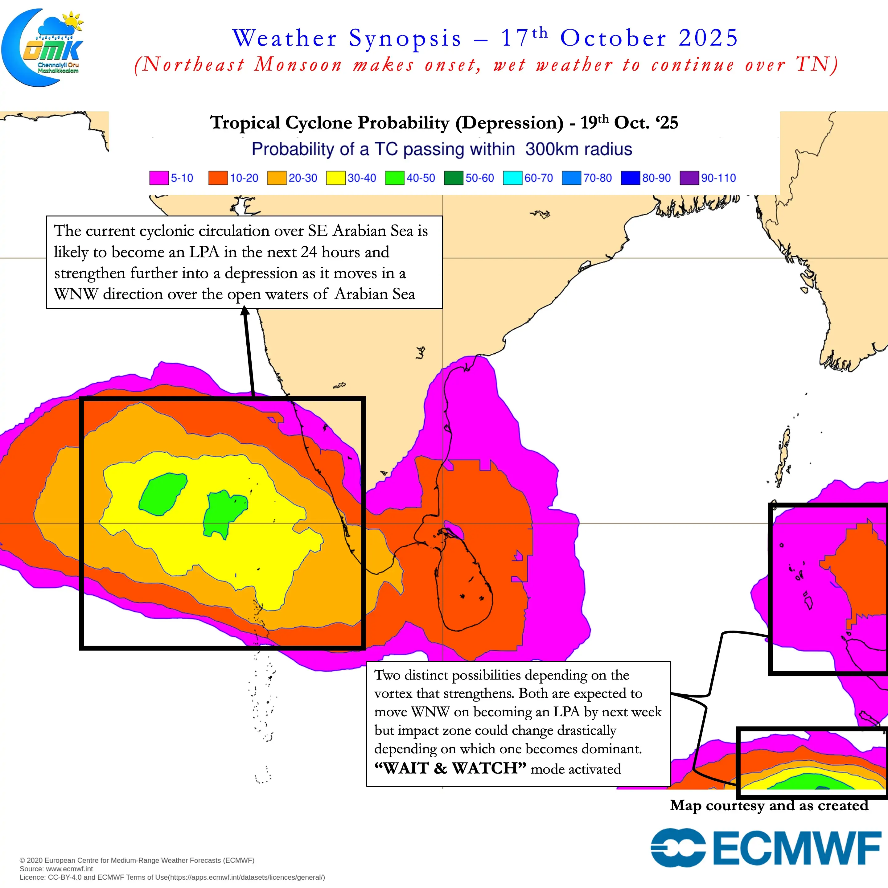
On the weather front a developing Low over Southeast Arabian Sea is likely to be the driver for the next couple of days. Currently as a cyclonic circulation it is expected to become an LPA in the next 24 hours. This will ensure Easterlies are strong over places south of Pondicherry all the way up to South TN. This will ensure widespread rains over most of South TN and parts of West TN for the next couple of days. Coastal areas north of Pondicherry will continue to see moderate rains though not as much as South TN and Delta.
A potential LPA in South Bay that may develop later next week is the one to watch out for North Coastal TN including Chennai. A pair of vortex that is likely to compete for dominance though makes the situation complex. This is also reflected in multiple scenarios being put out by the weather models. It may be prudent to wait for a couple of days to get clarity on which vortex evolves stronger. Subsequently there will be consistency on genesis, track, time line and impact areas. Nevertheless it is likely to be a wet couple of weeks until October end. The only question is where would the South Bay LPA and how would it move after that. From our side as we always say Wait & Watch Mode Activated.
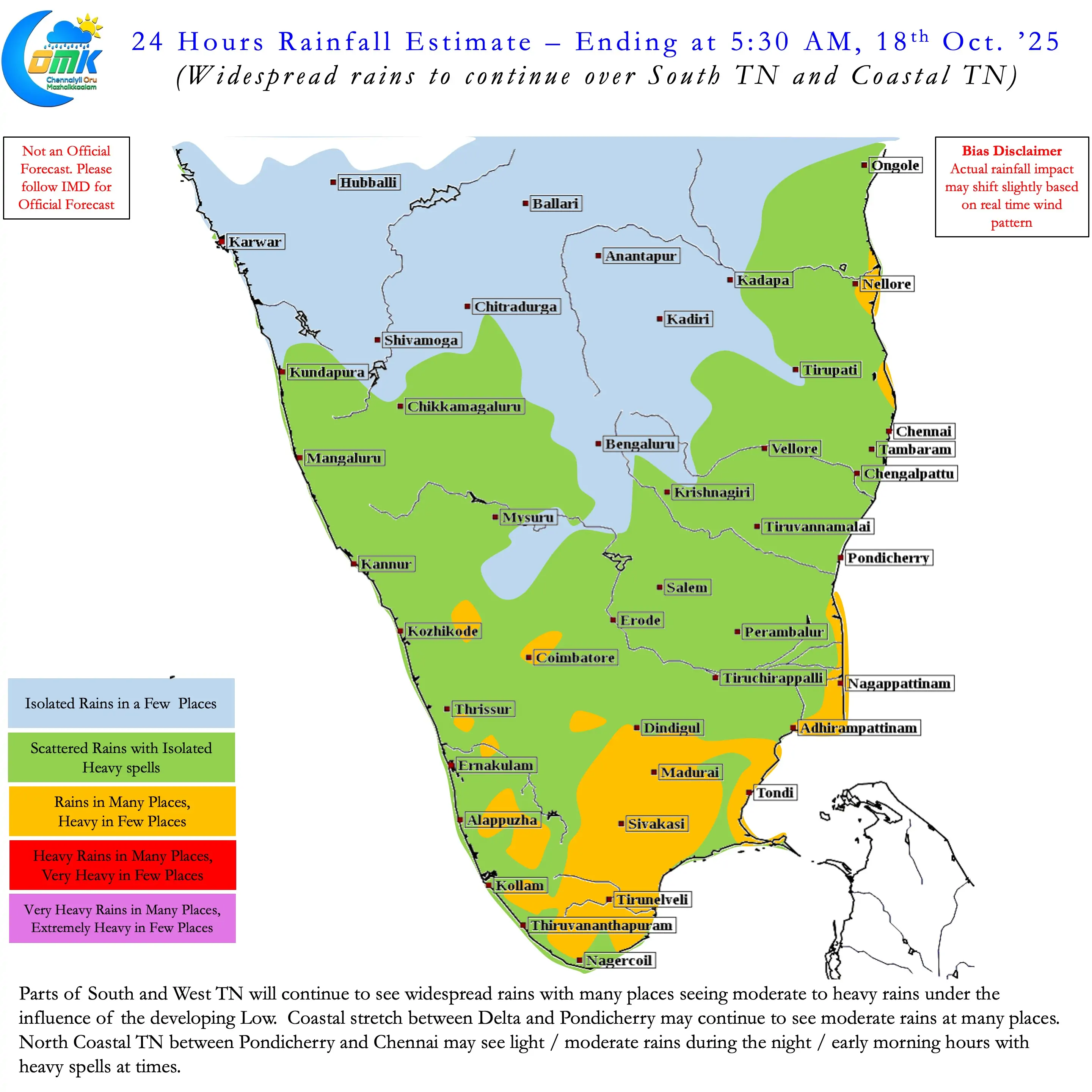
Today we may see widespread rains over South TN with many places coming under heavy rains. Delta and West TN may also see rains at many places with few places seeing heavy rains. North Costal TN may see widespread light / moderate rains with intensity of spell increasing during night and early morning hours.