
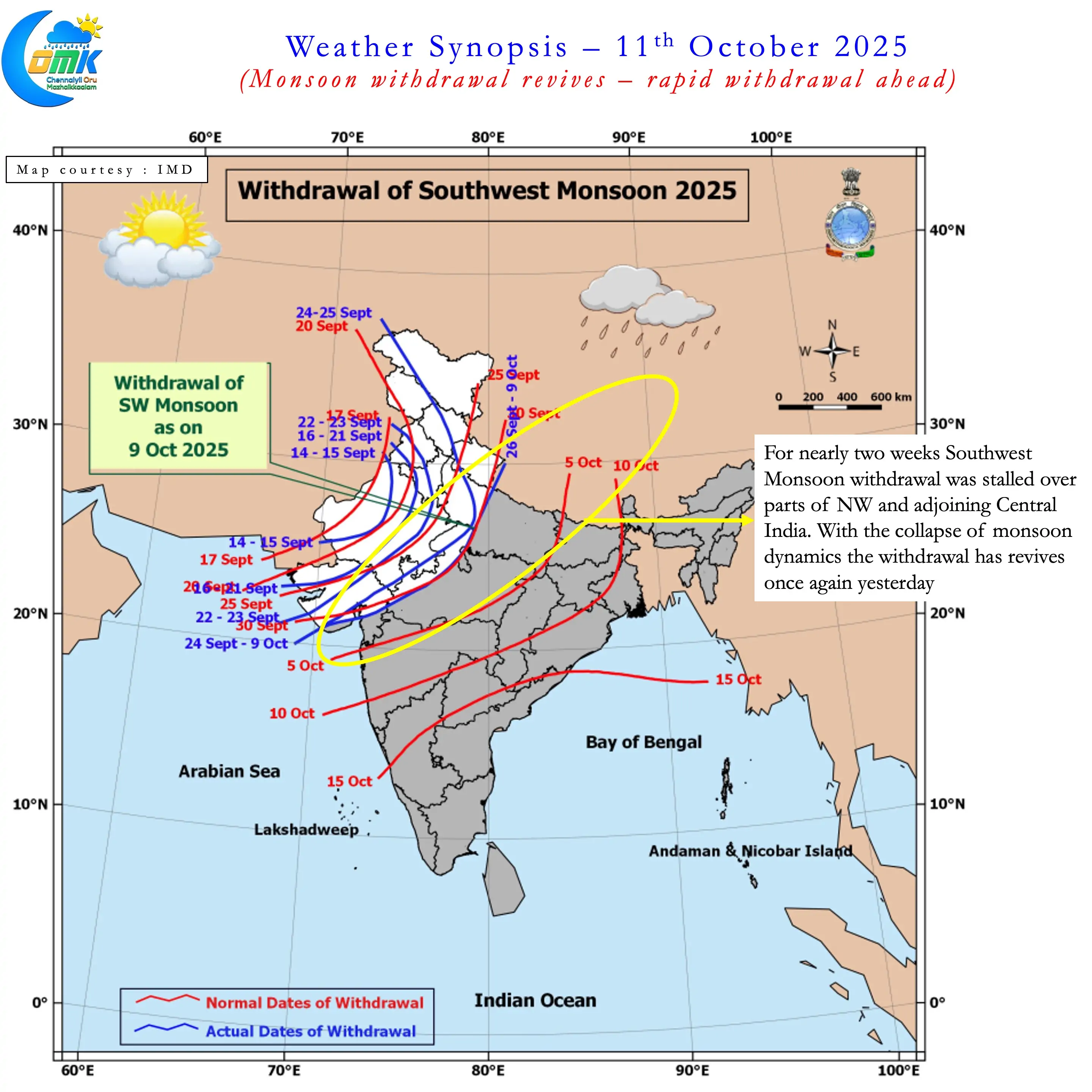
After a lull of nearly weeks IMD announced the revival of monsoon withdrawal yesterday. Since 26th of September SWM withdrawal was stalled over NW India and parts of Central India. The two circulations, Depression and Cyclonic Storm Shakthi kept the monsoon dynamics going during this period. Consequent to the weakening of these disturbances monsoon withdrawal has restarted. On 9th IMD Chennai issued a press release that sort of confirmed the end game of SWM 2025. Based on Extended Range Prediction NEM Onset is likely to happen between 16th & 18th October.
Looking at the rainfall performance over Southern Peninsular India it is easy to see why monsoon dynamics is collapsing fast. -19% deficit since 1st October driven majorly by the poor performance over the first few days. As transition thunderstorms started picking up the deficit is slowly getting bridged. If one were to look at the district wise seasonal rainfall performance for TN & PDC the bulk of the poor performance states are along the coast line. Interior districts like Dharmapuri, Krishnagiri, Vellore, Tirupathur, Tiruvannamalai have some of the highest positive anomalies.
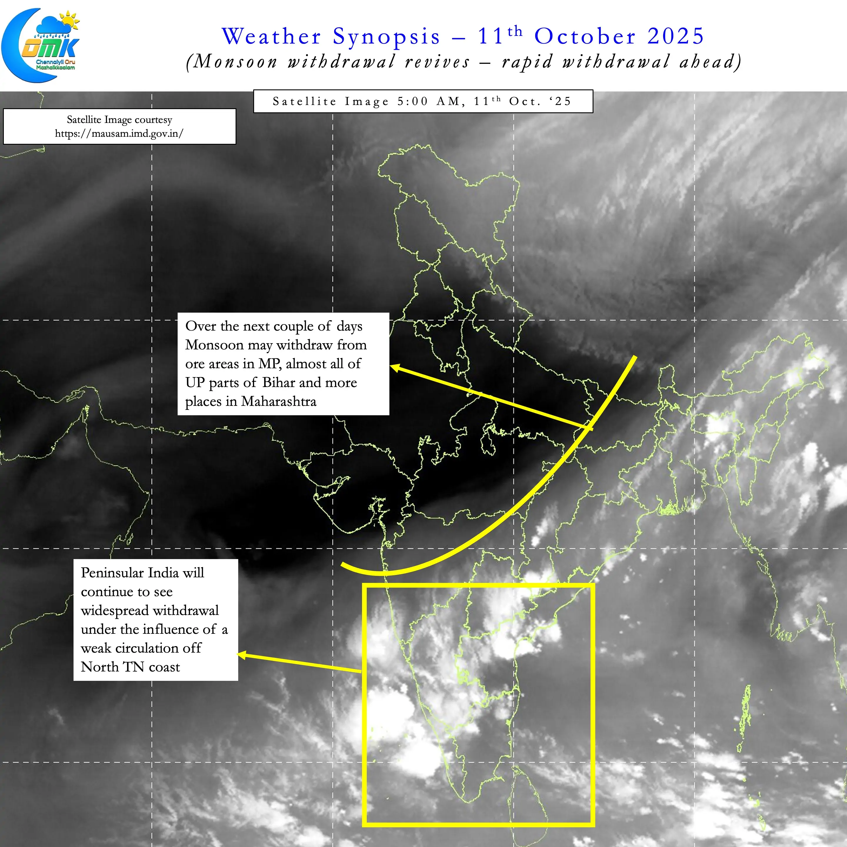
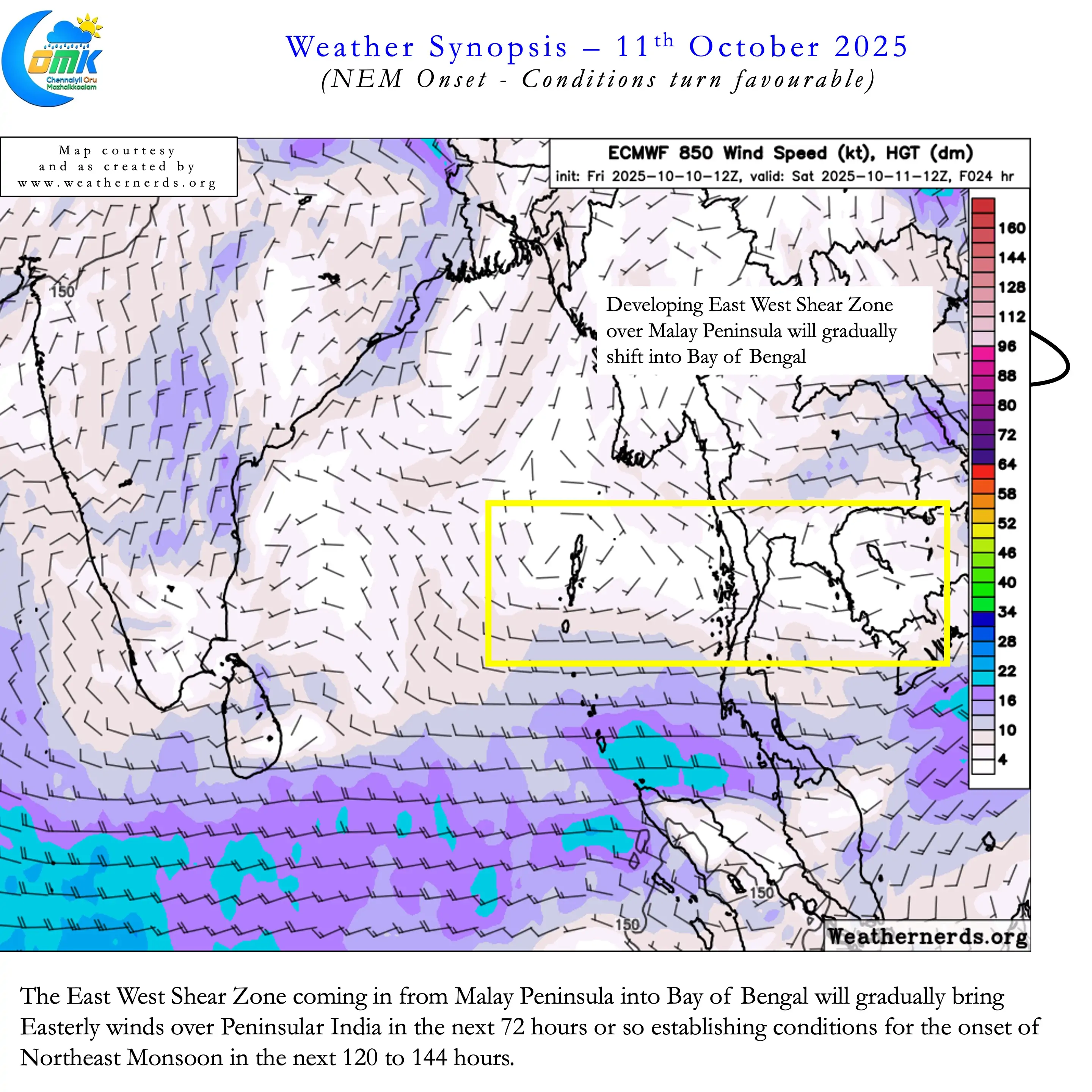
Satellite image confirms ripe conditions for SWM withdrawal over the next few days. Moisture has been reducing drastically over parts of Central India under the influence of drier Northerly winds. With a East West Shear Zone developing over Malay Peninsular conditions are getting better for NEM onset. Over the next 72 hours this West to East moving shear zone at lower levels will bring the Easterlies along with it. Peninsular India may see its first batch of Easterlies in the next 72 to 84 hours.
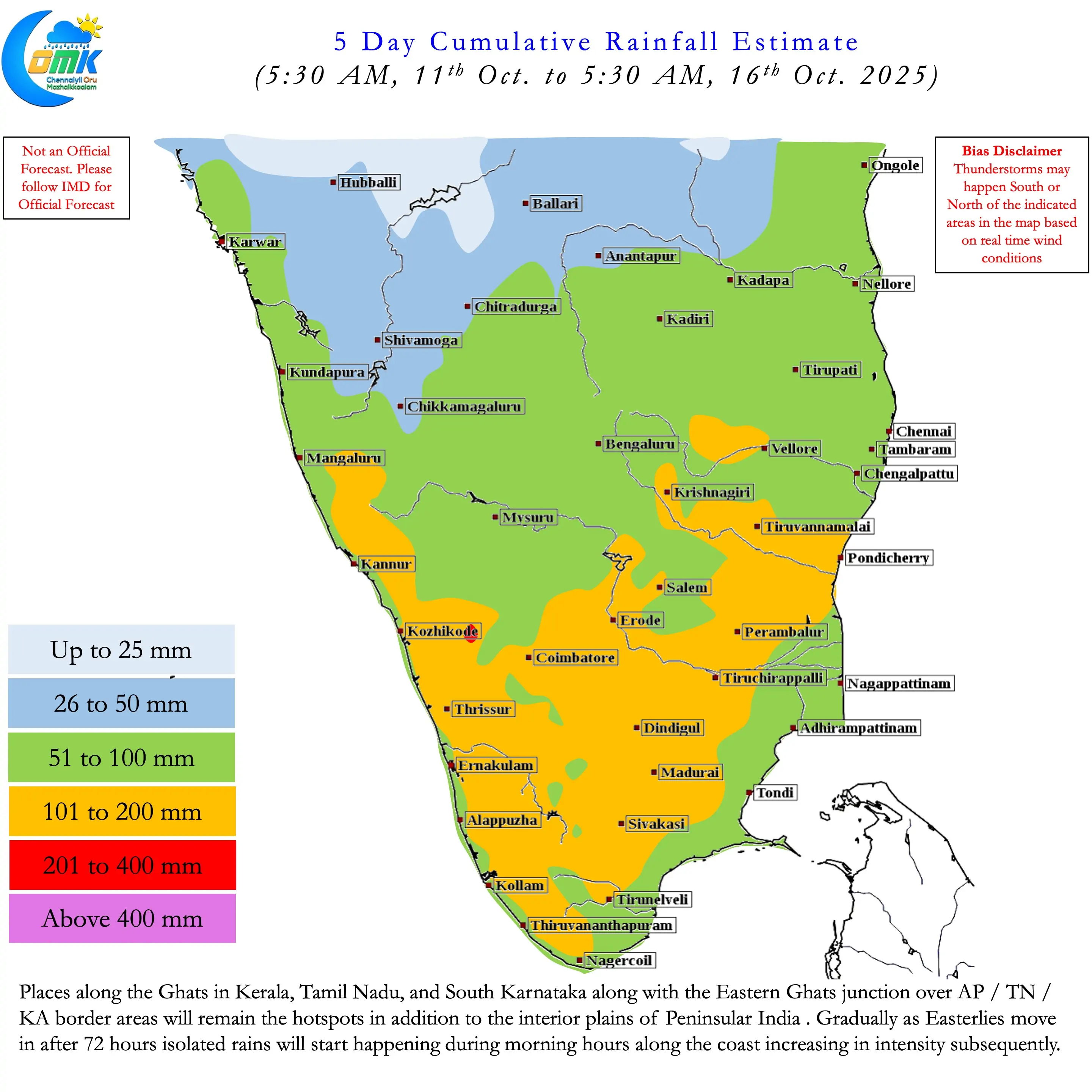
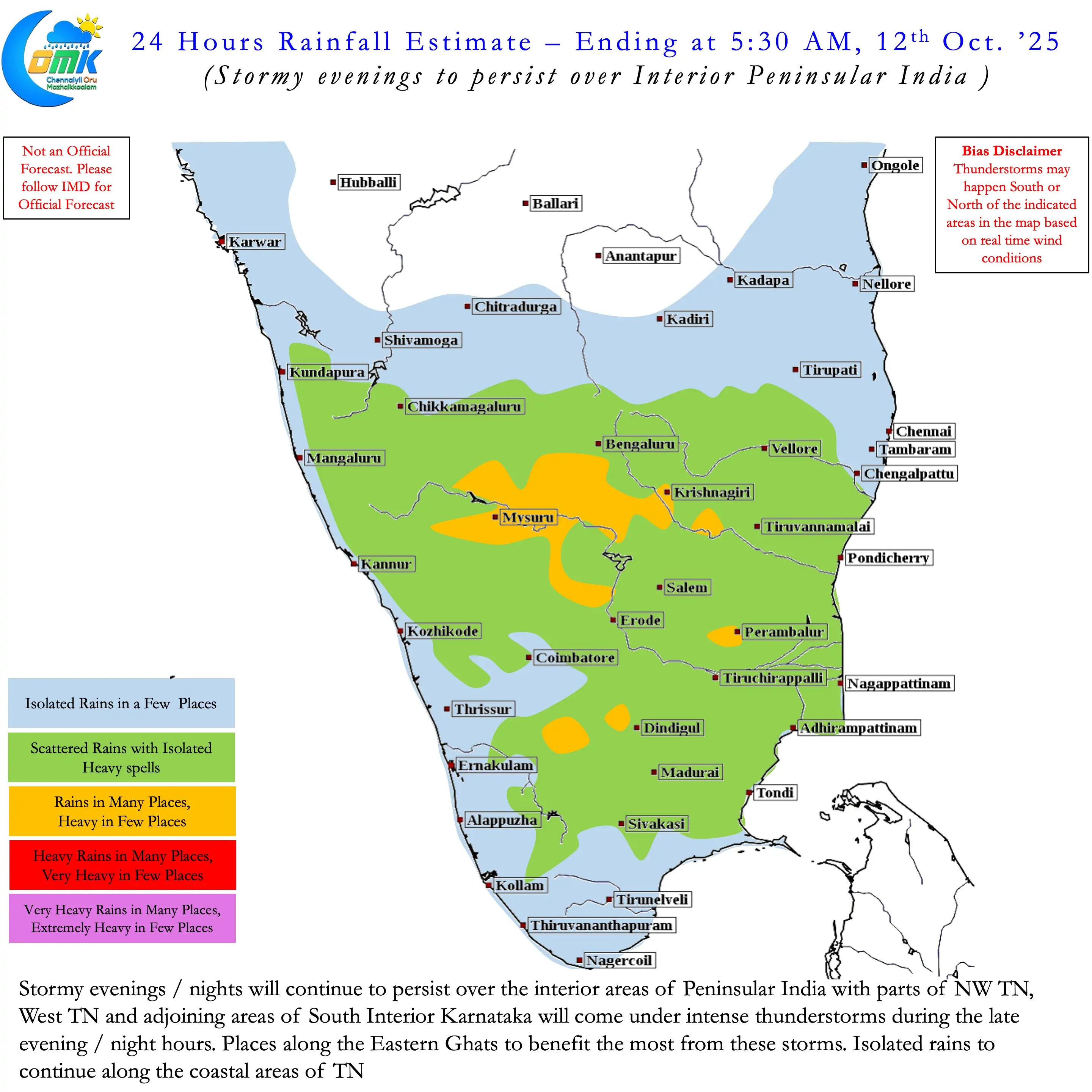
Once the Easterlies move in gradually the rains will also start coming in. Initially as isolated spells along the coast with remnant moisture intensifying about 50 to 100 kms away from the coastline. As Easterlies strengthen more places will come under rains bringing in NEM onset along with it. Roughly 120 to 144 hours from now we may look at the onset window if things stay as model estimates. During this period interior areas of Peninsular India will continue to see widespread thunderstorm activity. Places along the Eastern Ghats and some parts of Western Ghats will see the most rains. When the Easterlies establish the rains would start shifting towards the coast reducing in the interior areas.
To Sum Up. Easterlies likely to reach Peninsular India in the next 72 hours. NEM Onset window likely in the next 120 to 144 hours. It may be prudent to wait and watch for the next couple of days before judging on the individual rainfall events that may start once NEM arrives.