
India’s official weather agency IMD has classified a calendar year into four seasons for the purpose of rainfall classification. Rains during the months of January and February get counted against winter rains. Rains between March and May fall under Summer or Pre Monsoon season. Rainfall between 1st June and 30th September gets classified as SWM Season. Post Monsoon or NEM season is between 1st October to 31st December.
Effectively with 8:30 AM yesterday SWM season came to a statistical end. Cumulatively the overall rainfall during the period 1st June to 30th September was 937.2 mm for the country. The normal rainfall during this period is 868.6 mm. This means for this year Southwest Monsoon has seen 7.9% more rains than normal. NW India saw a 27.3% excess rains during this period while East and Northeast India saw a deficit of -20.2%.
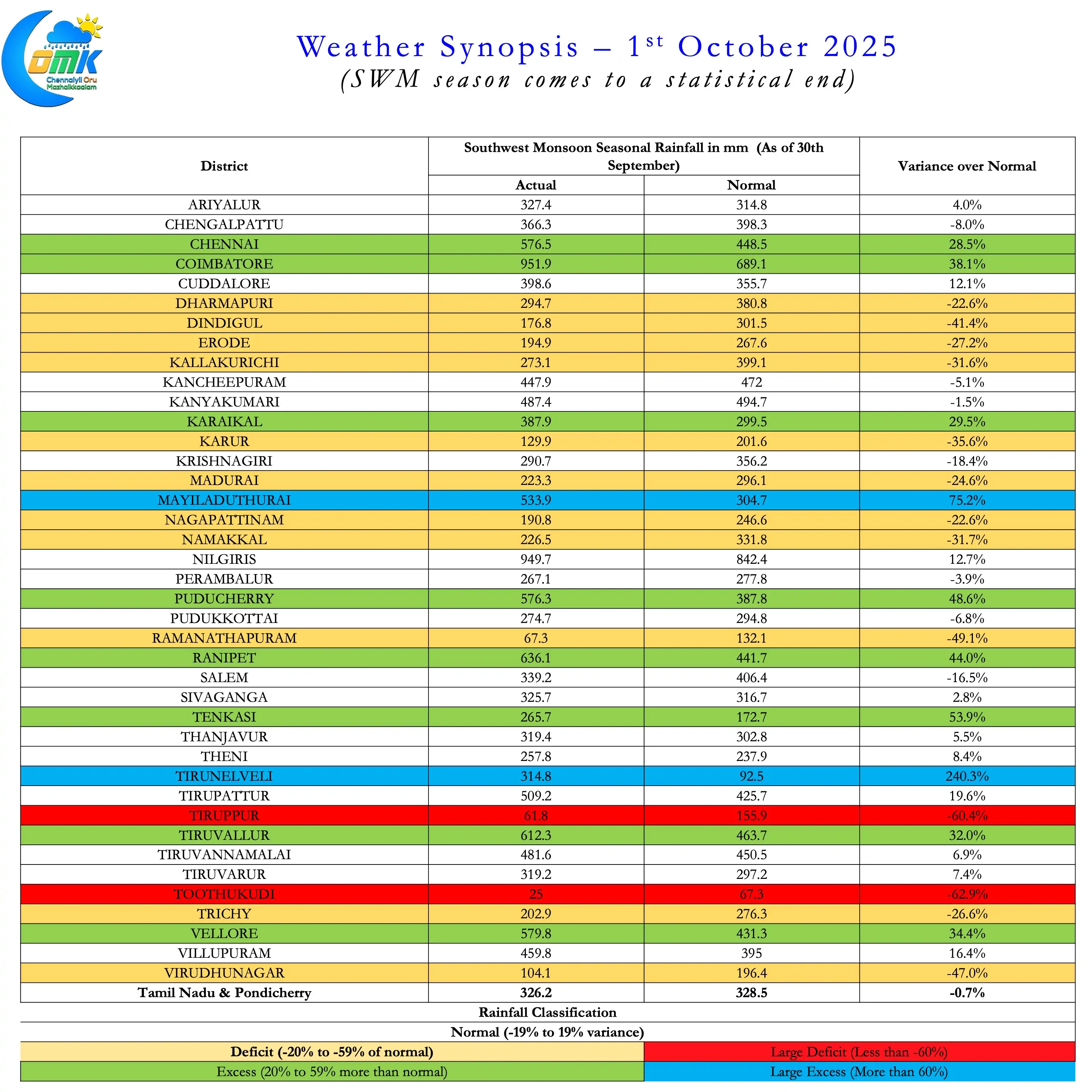
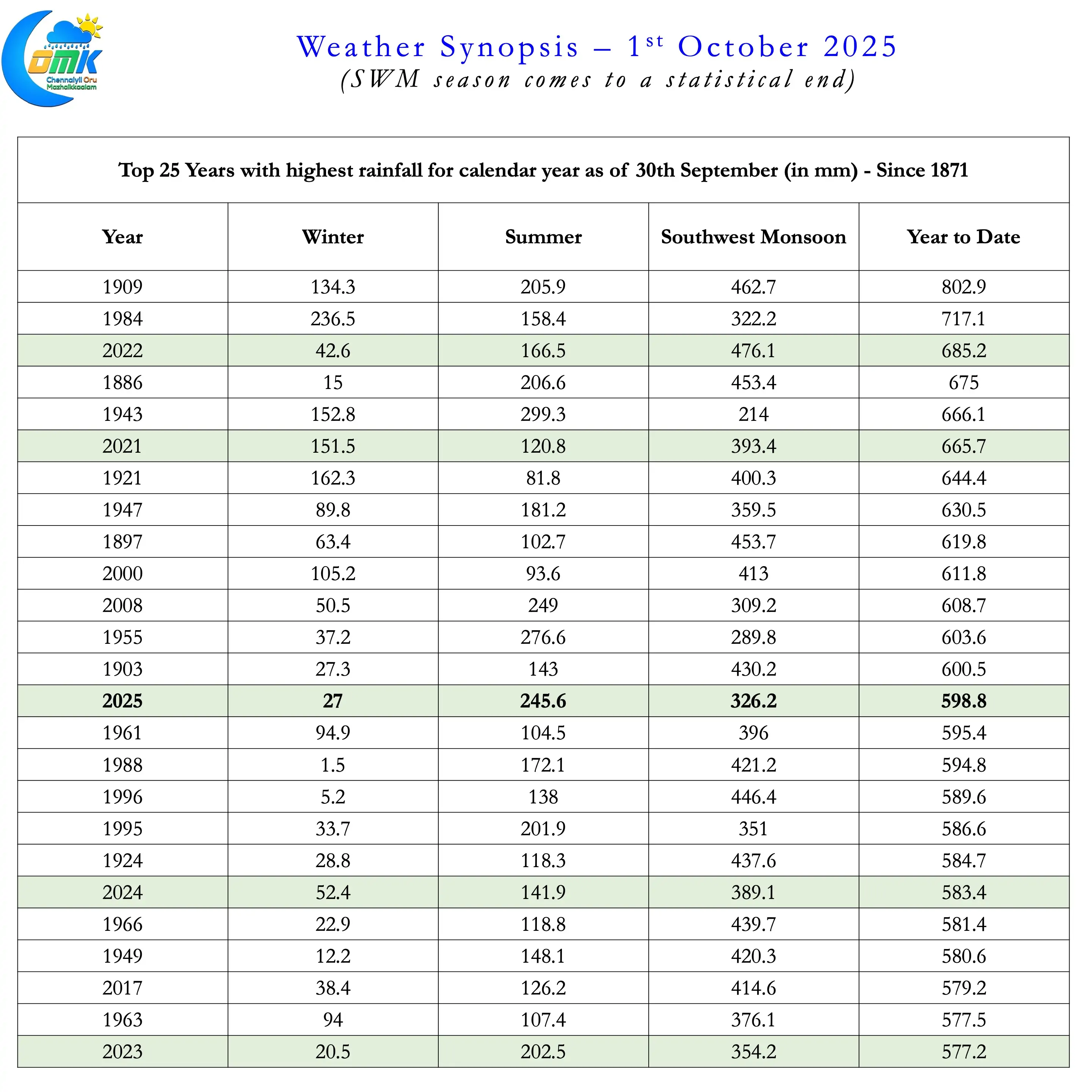
Though SWM season has ended normal for TN & PDC it was inconsistent spatially. 11 districts in TN & PDC saw deficit rains while a further two, Thoothukudi & Tiruppur saw Large Deficit. These two districts received less than 40% of the normal rainfall during SWM season. 8 districts saw excess rains while Mayiladuthurai and Tirunelveli saw large excess for the season. Tirunelveli saw nearly 3 and a half times of normal rainfall during this period. Overall 2025 has seen the 14th highest rainfall for the period 1st January to 30th September since 1871. Interestingly the last 5 years are all part of the Top 25 years in terms of cumulative rainfall between 1st Jan. to 30th Sept.
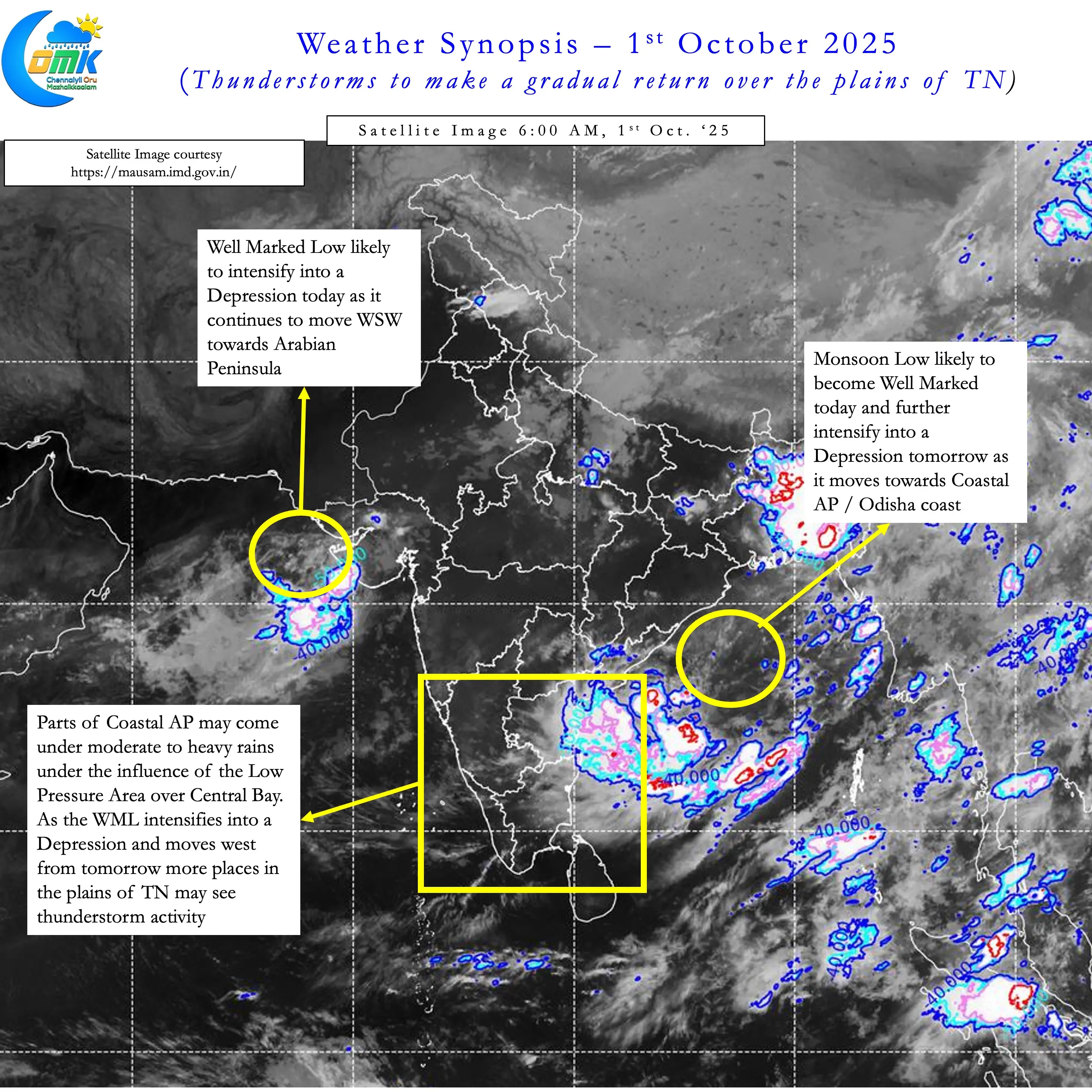
Though Southwest Monsoon has come to an end statistically the presence of two Monsoon Low would mean the dynamics will continue for the next couple of weeks. The LPA over Central Bay is likely to become a Depression in the next 24 to 48 hours before making landfall over AP / Odisha coast. During this period parts of Odisha, North AP and adjoining areas of Central India may see widespread rains. Weather models do not show any discernible increase in rainfall activity along the Peninsular West coast.
A possible interaction between this monsoon disturbance and westerly trough may explain why active monsoon may not happen along West Coast. As the depression moves inland this interaction may drag the circulation further up leading to widespread heavy rains along the foot hills of Himalayas and in the Himalaya region. There is potential for one or two flash flooding incidents in Uttarakhand and Himachal Pradesh hills during early part of next week.
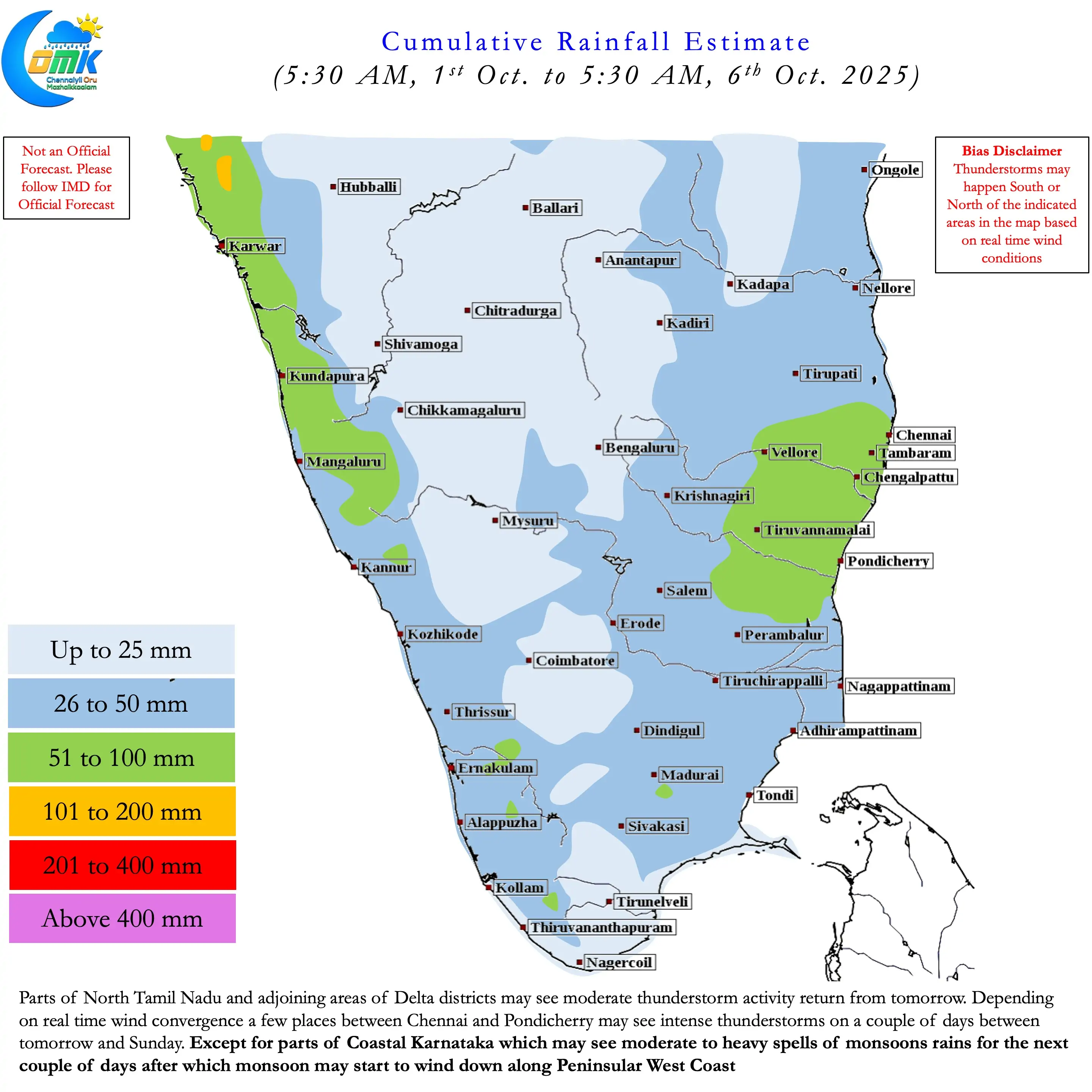
The plains of Tamil Nadu may see a gradual return of thunderstorms from tomorrow. Chennai and suburbs may also see moderate rains from tomorrow till weekend. One or two places between Chennai and Pondicherry may see intense thunderstorm activity between Friday and Sunday. These are not the typical transition thunderstorms but driven by wind convergence under the influence of the circulation. But as the effect of the circulation fades we can start seeing transition thunderstorms by later next week. There is a fair degree of consistency among weather models about a rapid withdrawal of SWM once the circulation fades. This could mean transition thunderstorm period over interior areas of TN may be shorter in duration.
All in All a quick transition from Southwest Monsoon to Northeast Monsoon is on the cards. How would NEM 2025 be is a question for which the answer will have to wait for another day.