
With IMD’s announcement of monsoon withdrawal of SWM from parts of Rajasthan the first milestone towards transition of Southwest Monsoon to Northeast Monsoon has been achieved. IMD also expected further withdrawal of Monsoon over parts of Rajasthan and Gujarat in the next few days. This year Monsoon withdrawal has started a couple of days before schedule. But looking at the larger picture the progress could be slow. A train of pulses from South China Sea to Bay of Bengal may keep monsoon dynamics alive. This also potentially creates a scenario of thunderstorms over Peninsular India through wind instability.
Over the past couple of weeks interior areas of South India has benefitted from the wind instability during the transition of UAC to Monsoon Low. The current monsoon low seen over North Telangana and adjoining Vidarbha is expected to move further west. This opens up space for the next circulation to start influencing weather over Peninsular India. A developing East West Shear Zone over South Bay is likely to take up that role this week.
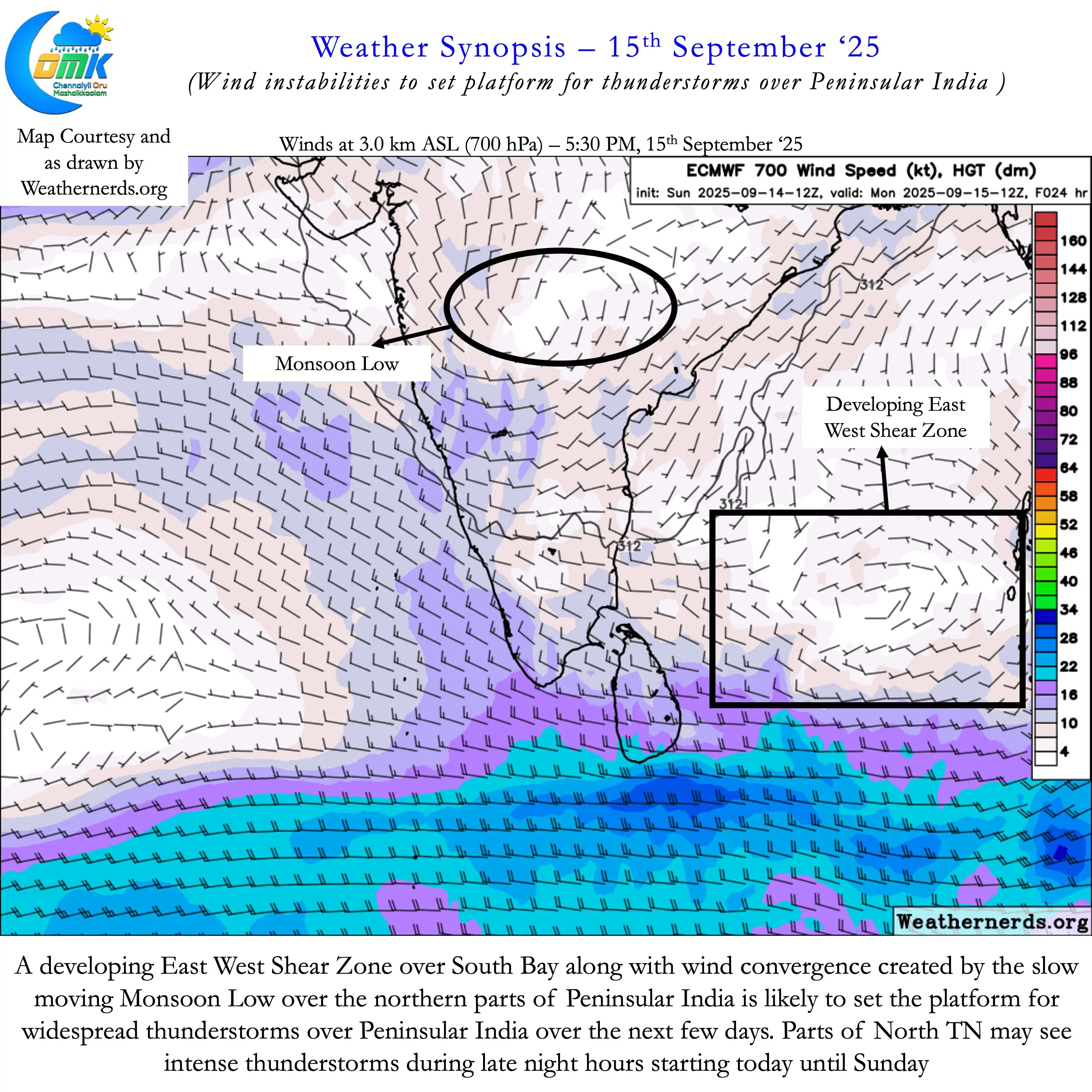
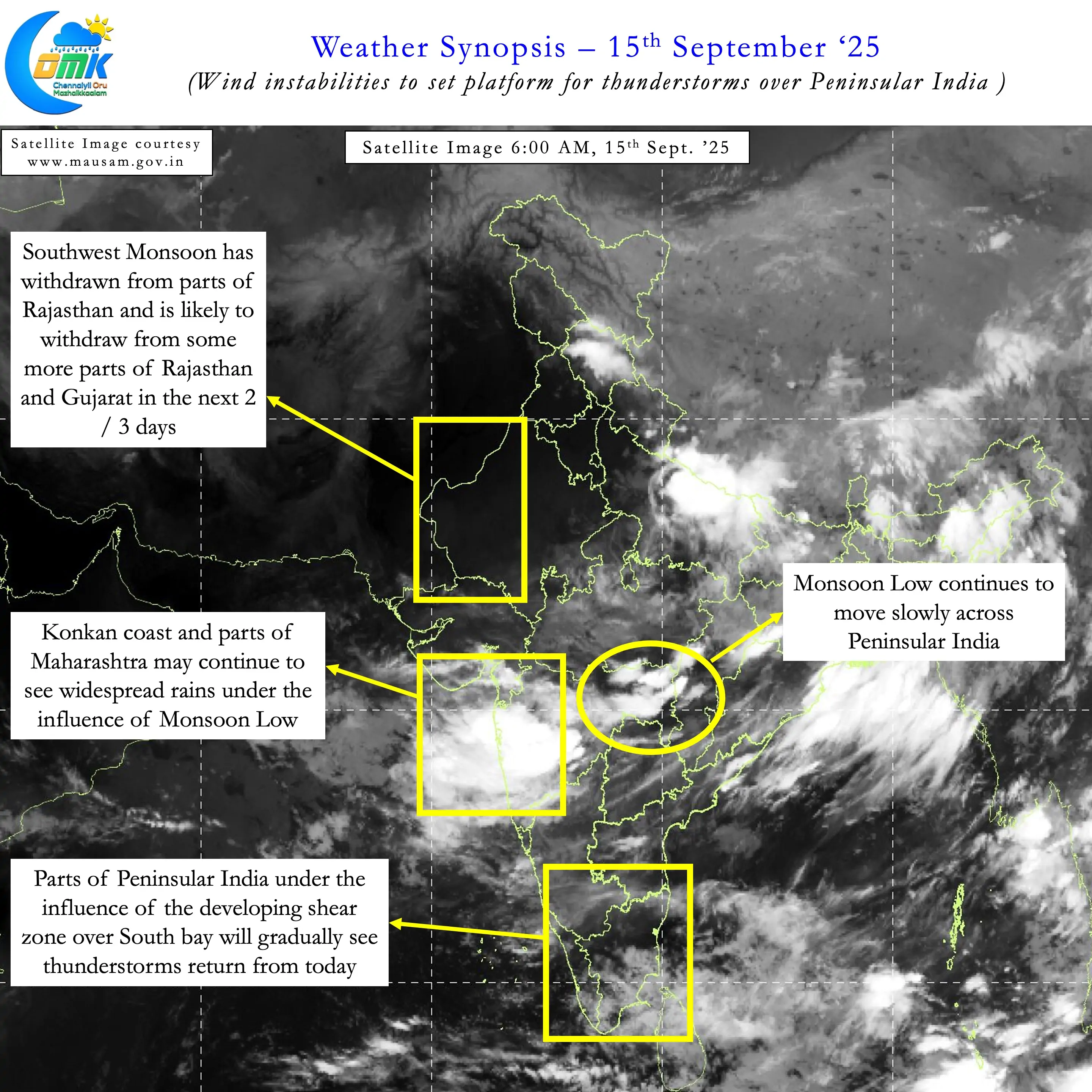
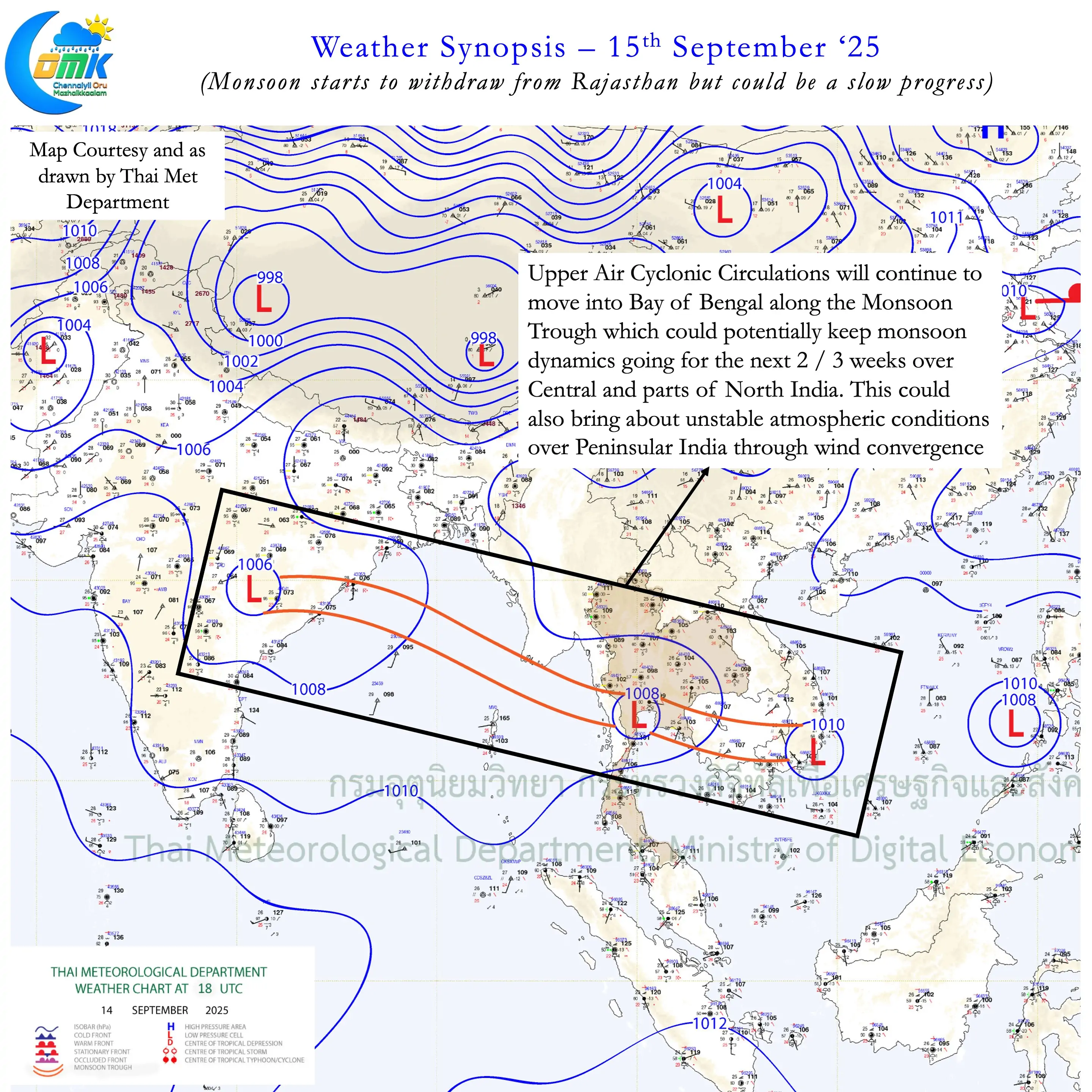
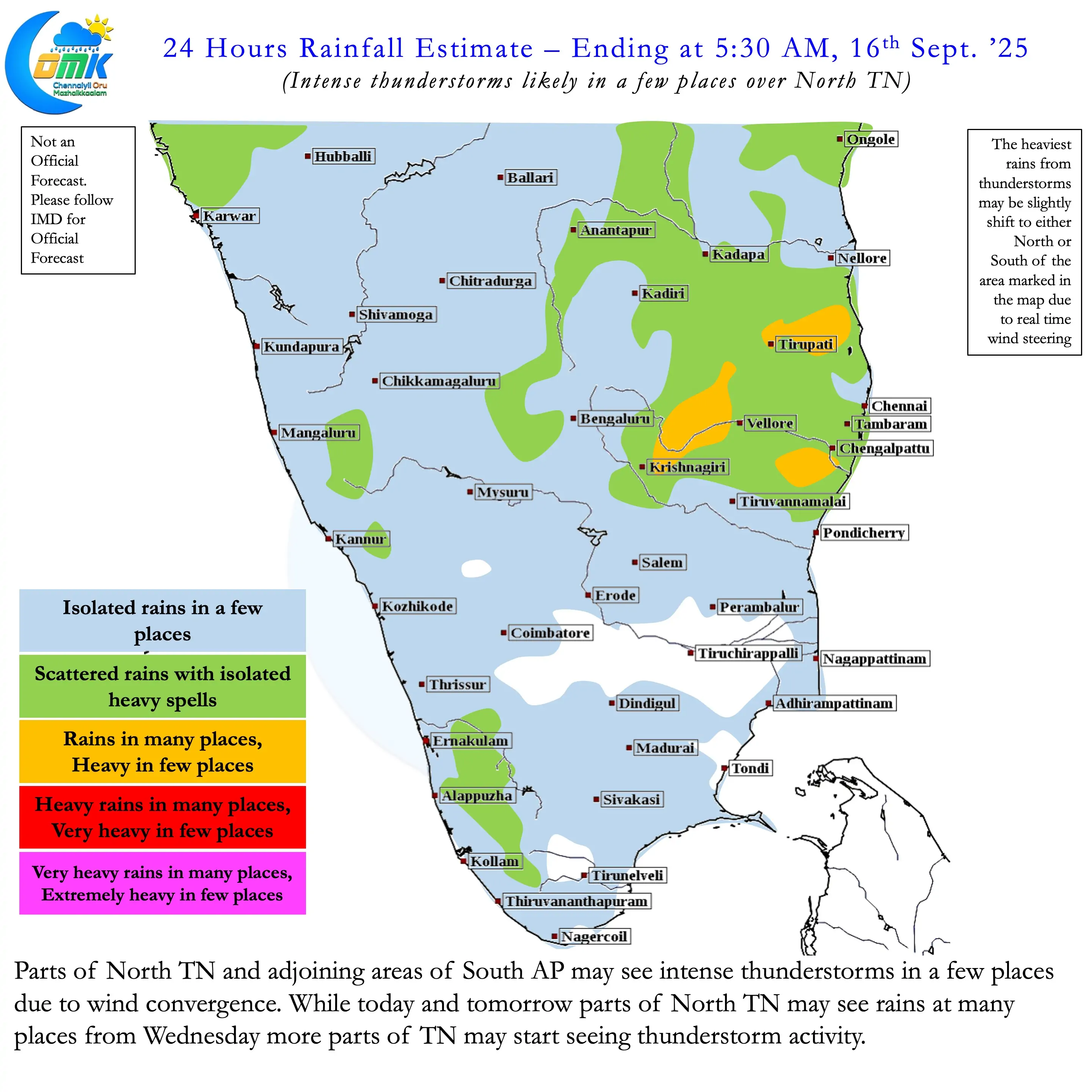
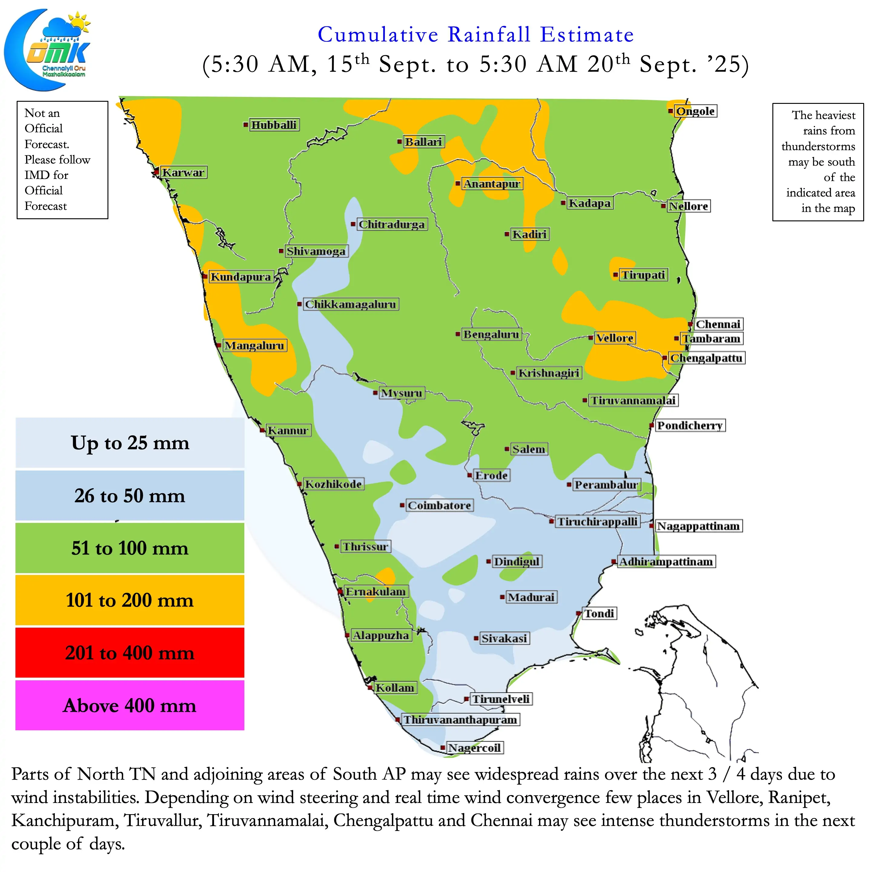
Each time a pulse moves into Bay of Bengal a zone of wind instability gets created though convergence. Depending on the location of the circulation this zone of instability moves up and down bringing thunderstorms to the areas under favourable convergence. With monsoon winds much slower compared to July and August convective thunderstorms find right setup over the interior areas of Peninsular India. Places along the AP / KA / TN borders also benefit from the presence of Eastern Ghats that aid in convective lift.
Over the next few days parts of North TN and South AP may benefit from the East West Shear Zone over South Bay. This could bring in intense thunderstorms over a few places in these areas during the late evening / night hours. Unlike early SWM season when we see thunderstorms during afternoon / evening hours as we get to later part of the season thunderstorms develop closer to the night. This could also mean places along the coast may see thunderstorms well past midnight hour.
Ranipet, Vellore, Tiruvallur, Tiruvannamalai, Kanchipuram and Chengalpattu may be the biggest beneficiaries from this spell of thunderstorms until Friday. Depending on steering coastal areas like Chennai may also see moderate to intense spell of rains during the night hours.