
With 25 days left for the statistical end to SWM thoughts of weather bloggers tend to shift to Northeast Monsoon. In a way 5th September has almost become a date to look out for every year. The seasonal forecasts of ECMWF with September initial conditions comes out on 5th September. September is possibly the closest to current conditions giving a fair idea on what to expect from Northeast Monsoon. But in all this one tends to forget there is at least 6 weeks still left for Monsoon dynamics. At times like this when Monsoon is weak over Peninsular India it is easy to get ahead in our thoughts.
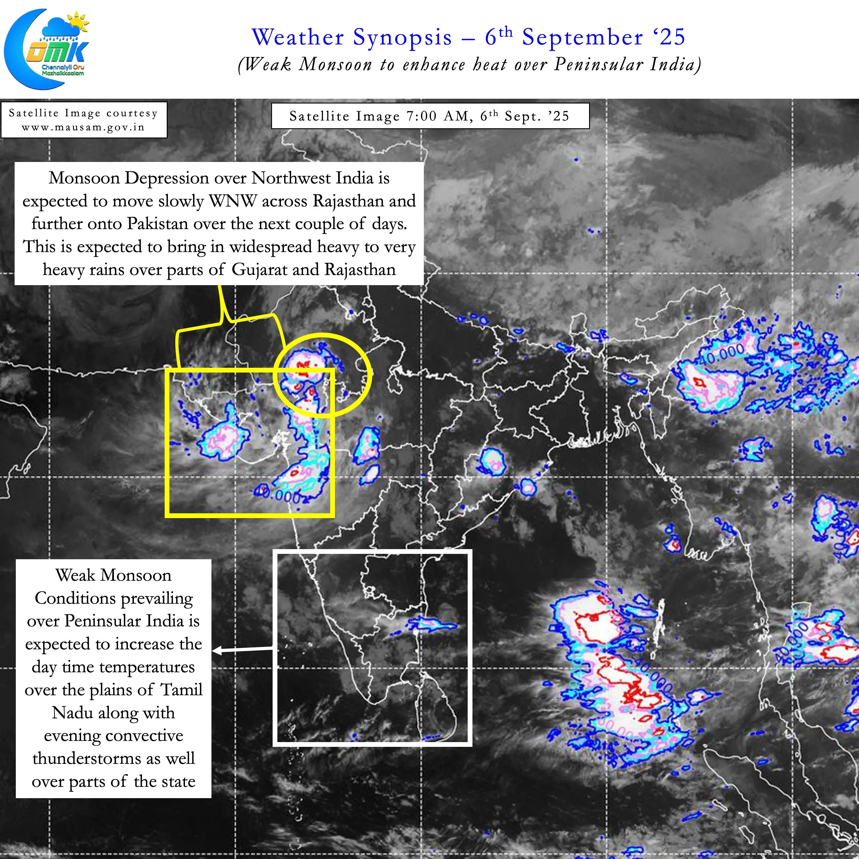
It may be ironic when parts of NW India may potentially see floods from yet another late season monsoon depression. Recently 2021, 2020, 2017, 2014 and 2013 all saw floods over parts of Gujarat during the month of September. Monsoon may remain weak over Peninsular India but it is certainly alive and kicking over Central India and adjoining areas. Favourable MISO which has been more than benevolent to Central India this year once again is influencing the track and intensity fo Monsoon depression currently over parts of MP and Rajasthan. Over the next 2 / 3 days the depression is likely to move across Rajasthan and then onto Pakistan. Consequently NW India may continue to see widespread heavy rains during this period.
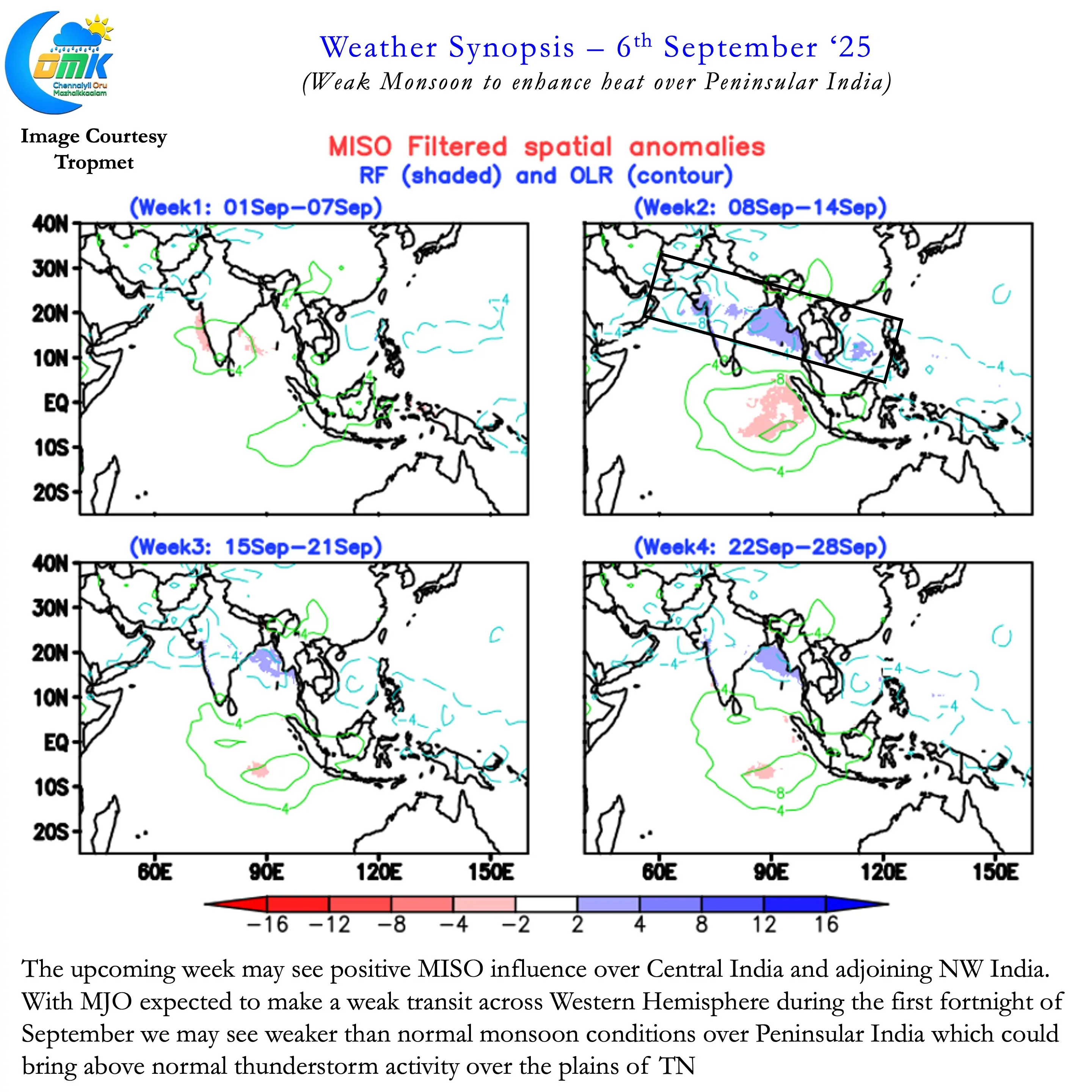
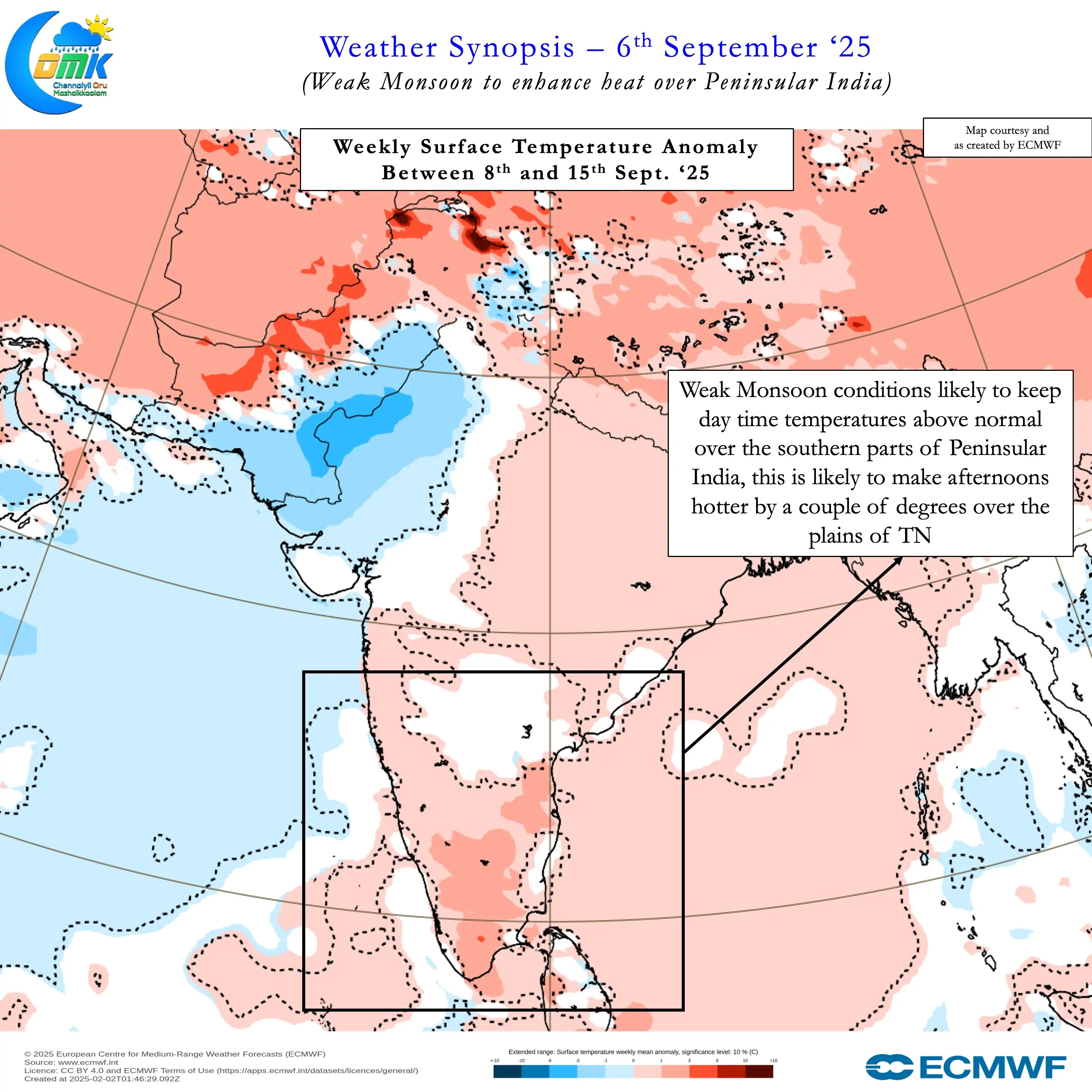
MJO is likely to make a gradual transit over Western Hemisphere during the 1st fortnight of September. This could mean over the next week to 10 days Monsoon may continue to remain weak over Peninsular India. Weaker monsoon could mean not only rains will be lesser along the West coat but also hotter afternoons over the plains of TN. The reduction in moisture from west straight away increases the afternoon heat over the plains of TN.
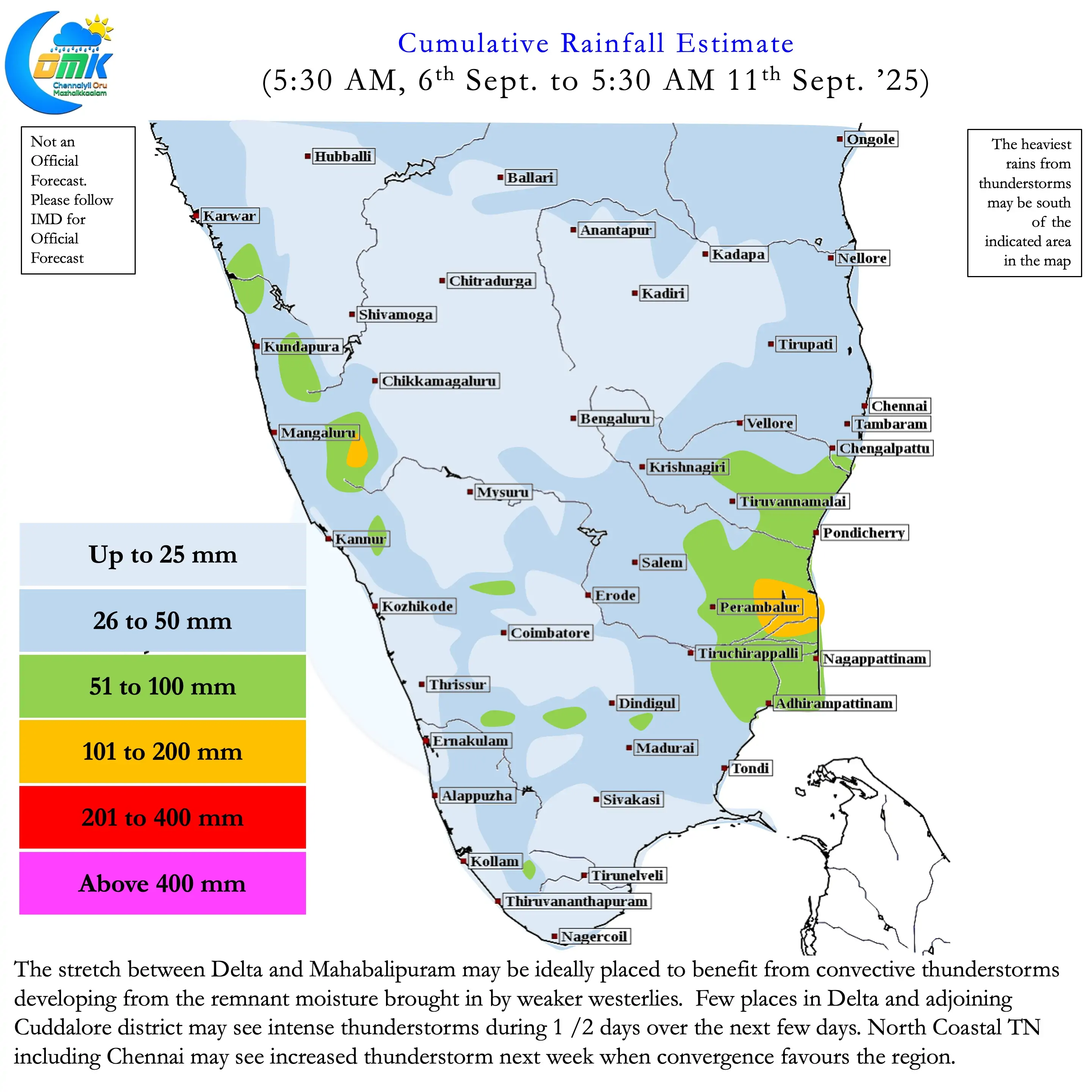
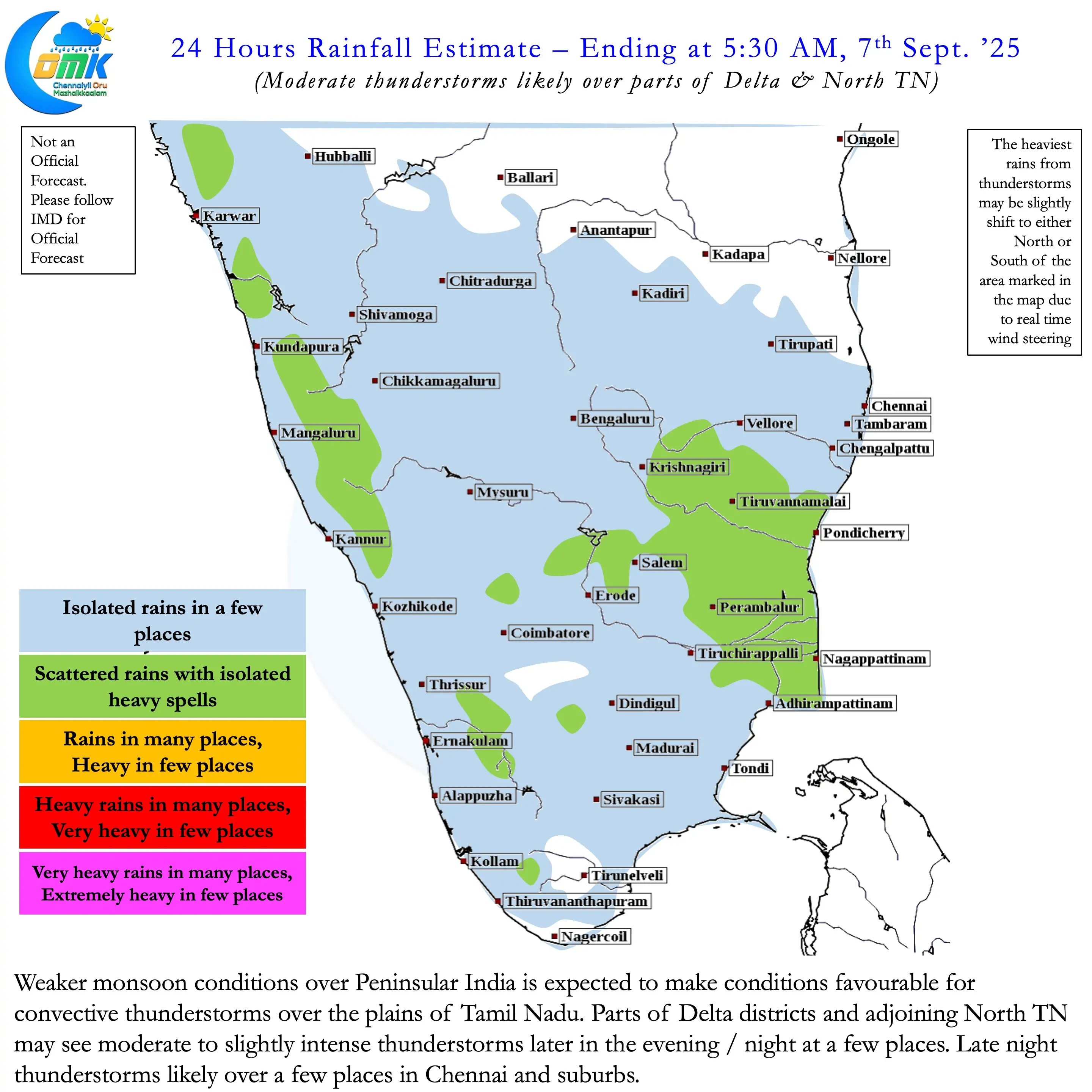
But there is a positive impact as well. Weak westerlies could provide better conditions for convective thunderstorms. Weak moisture from left convectively lifted by day time heat sets the thunderstorm process rolling. With support from wind convergence / sea breeze interaction they enhance over some pockets. Over the next 3 / 4 days parts of Delta and adjoining ares of South and North TN may see moderate thunderstorm activity.
Though Chennai and suburbs may also receive some rains things get better later next week. A fresh low that may form over Central Bay may provide favourable wind convergence over North Coastal TN triggering widespread thunderstorm activity. Until then we may have to live with warm / hot afternoons. Before we wind up the rainiest season of the year for the plains of Tamil Nadu is just starting.