
“When it Rains it Pours” is a very famous metaphor. People from Telangana may relate to this very well this year. Not only has Monsoon brought about episode after episode of flood associated distress to some parts of the state when ever it rains it just pours. In the 13 weeks since 1st June Telangana has seen Large Deficient or Deficient Rains during 7 weeks. Similarly 5 weeks have seen Excess or Large Excess rains. Only the week ending 25th June has seen normal rains. The state is 62% excess for the month of August and at 21% excess cumulatively for the season.
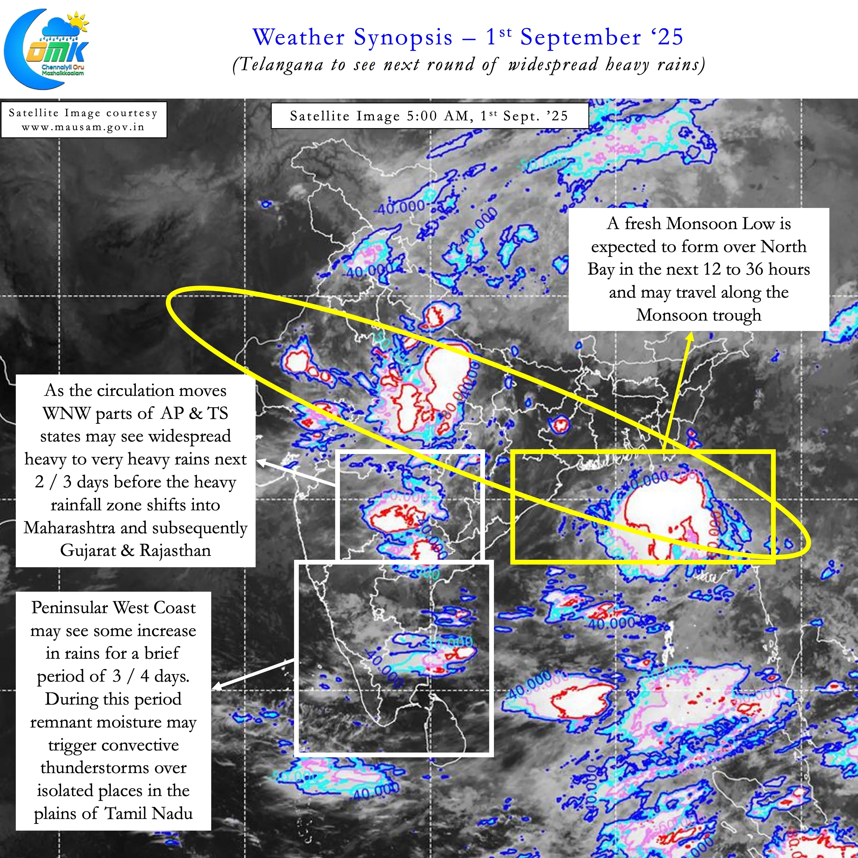
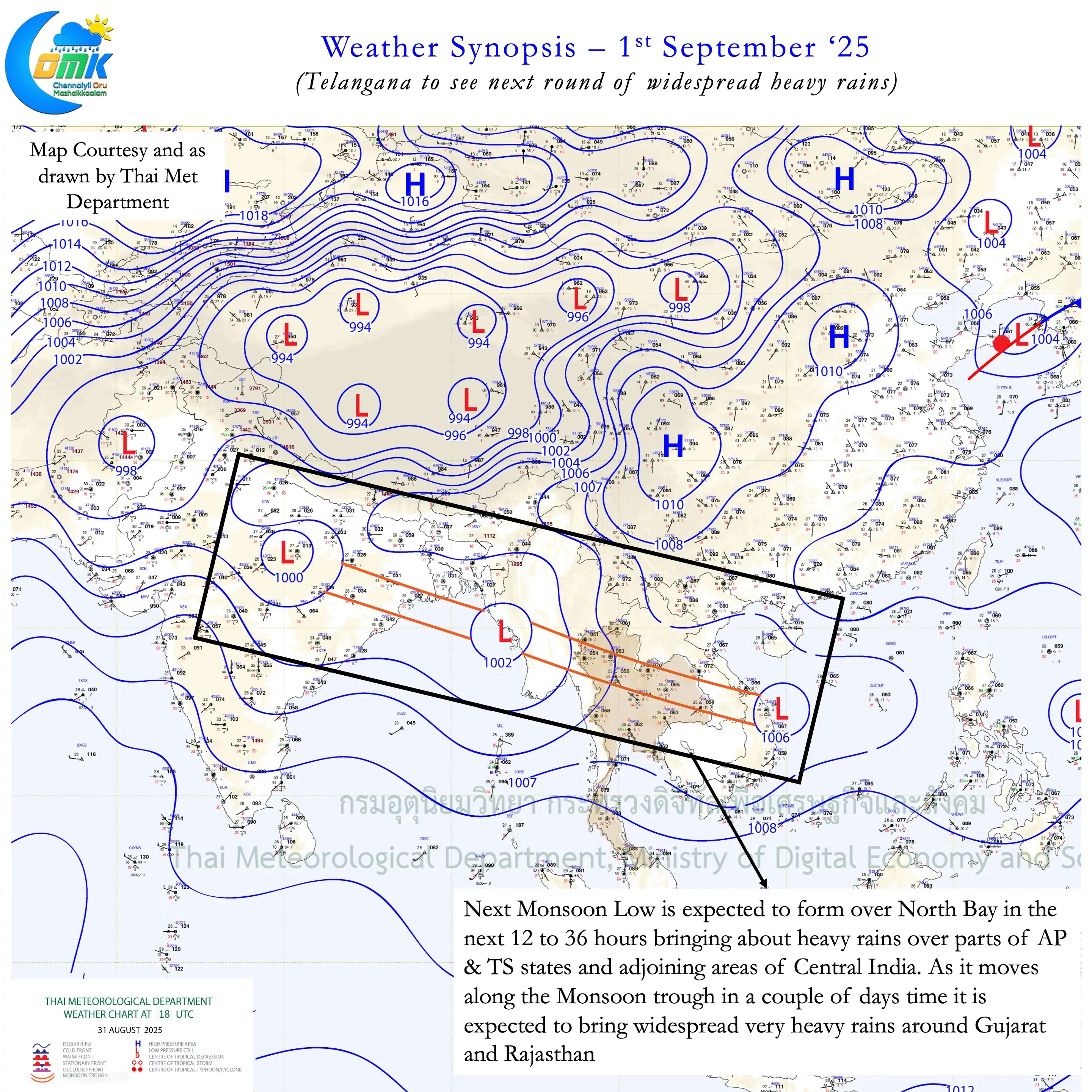
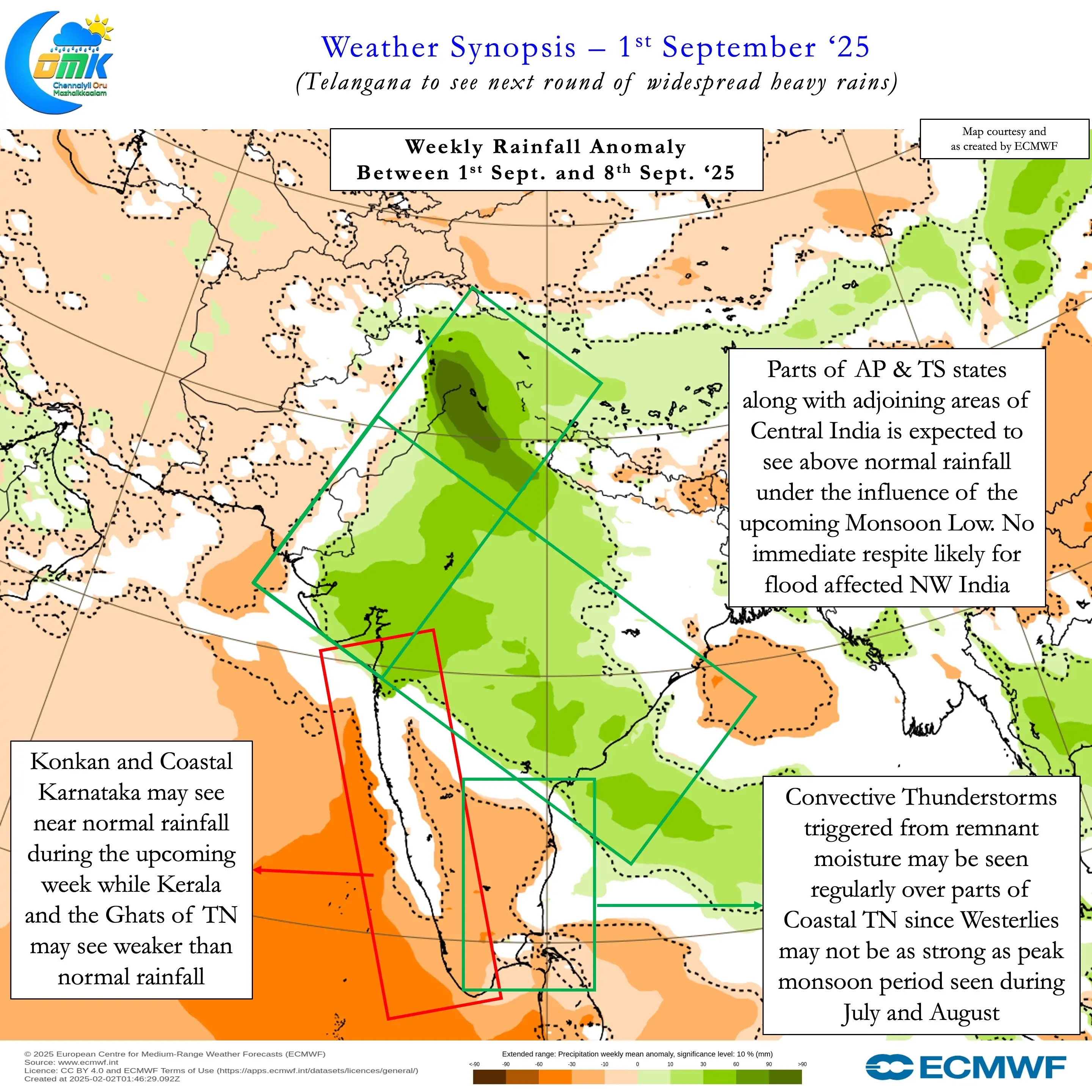
The conveyor belt from South China Sea into Bay of Bengal is ready with the next Monsoon Low. Northwest Bay is likely see a fresh Monsoon Low in the next 12 to 36 hours. Under its influence parts of AP & TS states is likely to see widespread heavy / very heavy rains. In particular Northern parts of Telangana adjoining Central India may be more vulnerable to flooding from Godavari and its tributaries. Dowleswaram is likely to see a peak discharge of 12 lakhs in the next day or two. We need to see whether this peak inflow pushes up with the fresh spell of rains.
As the Monsoon Low moves WNW across the monsoon trough North Konkan and adjoining Ghats may come under heavy rains. Weather models indicate parts of Gujarat and Rajasthan may see a fresh round of heavy rains later this week. All this means respite from floods for NW India is not yet on the cards. This may not be good news for the farmers fo Punjab who have been suffering widespread flooding for the past few days. It could mean Monsoon Withdrawal which normally starts by 17th September from Rajasthan may be delayed
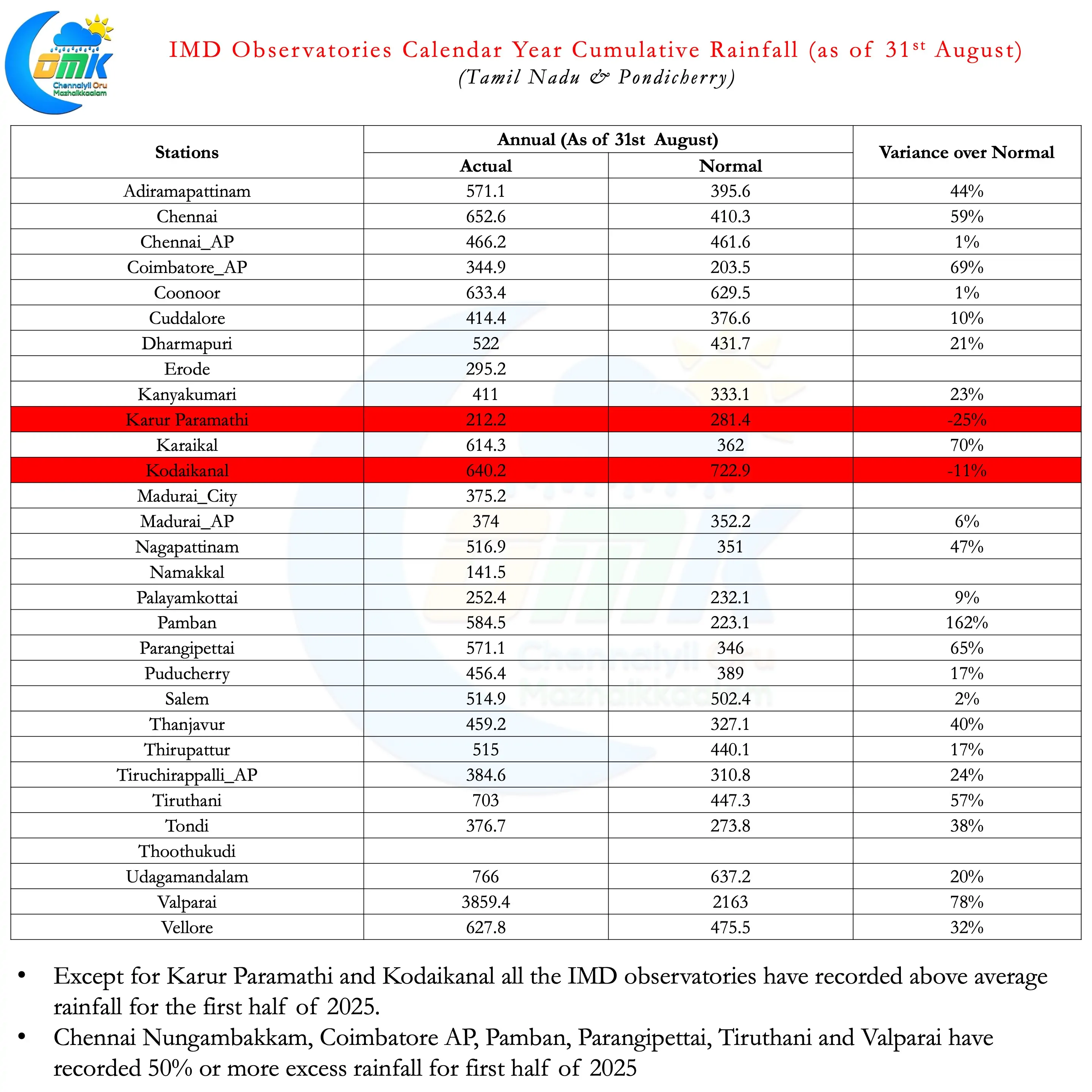
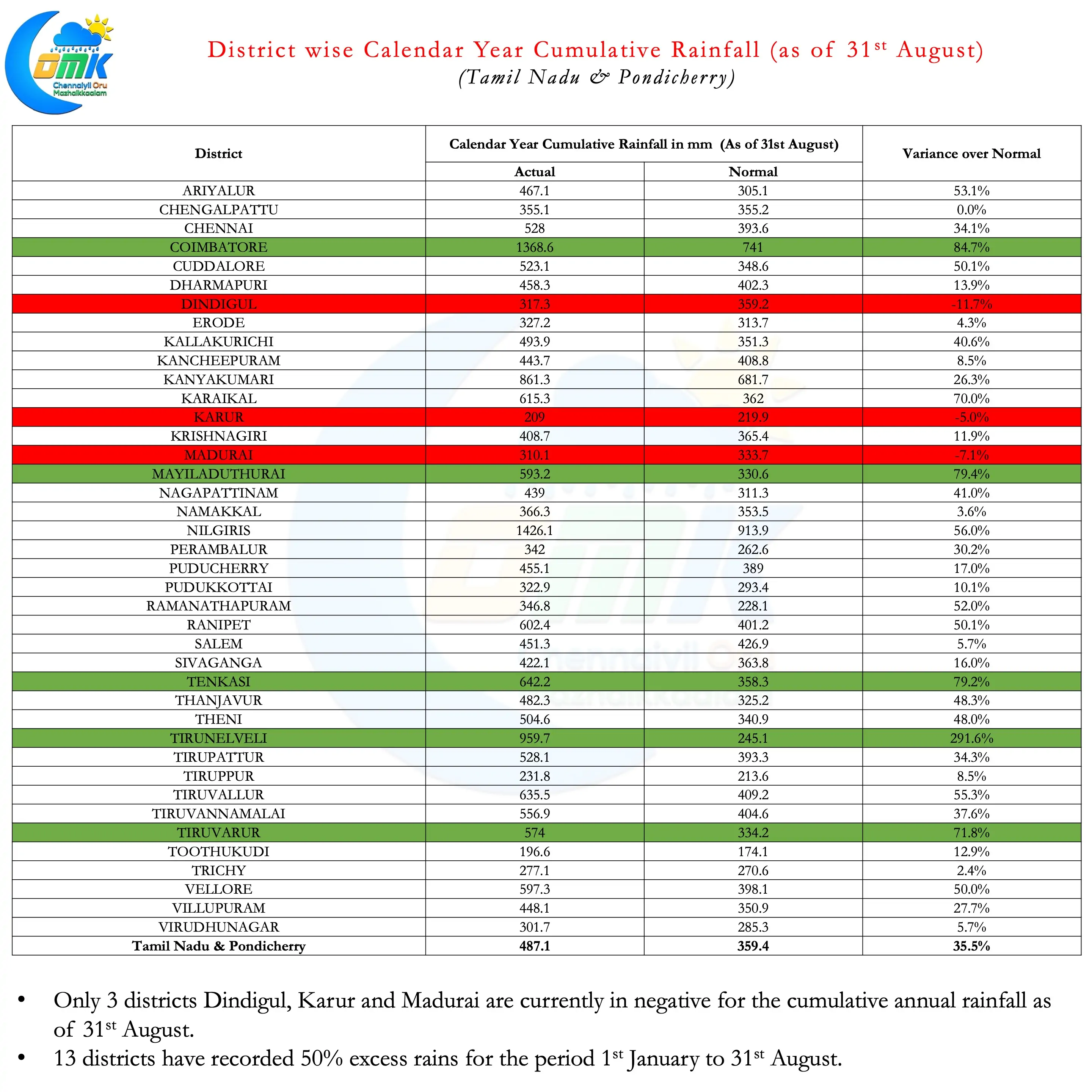
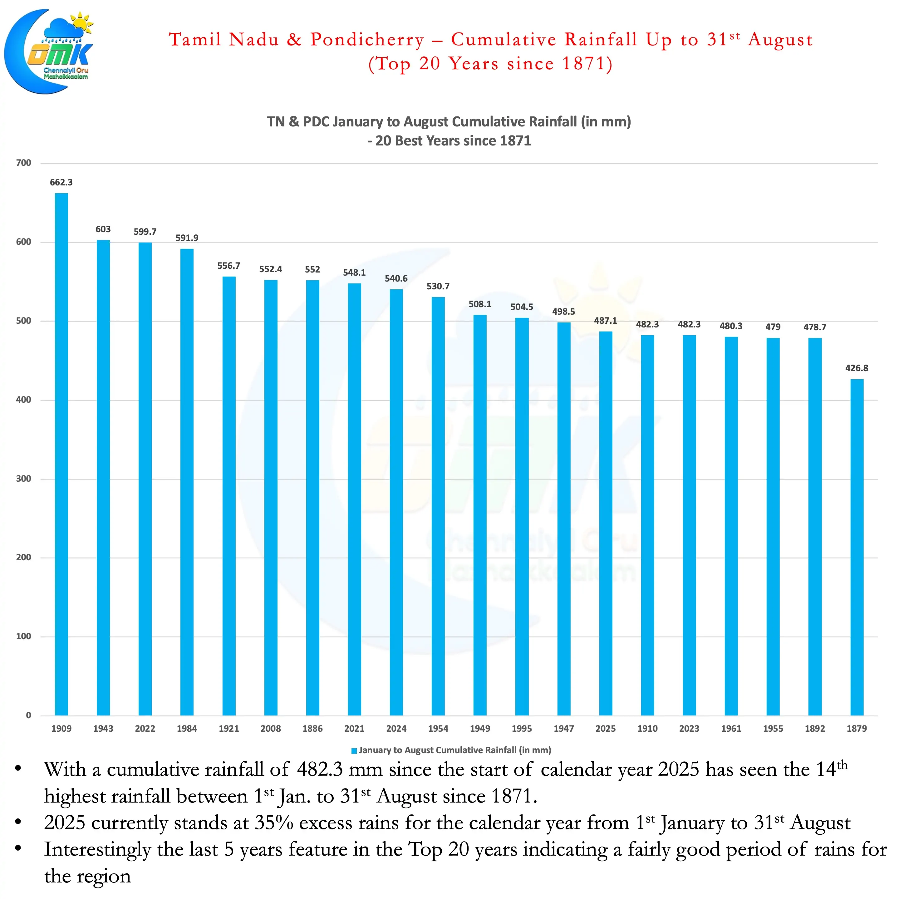
Interestingly in all this it is easy to miss out the rains over Tamil Nadu this year. Cumulatively between 1st January to 31st August except for Karur Paramathi and Kodaikanal all the other IMD observatories in the state have received above normal rains. Similarly only Dindigul, Karur and Madurai are the districts with negative anomaly for the calendar year as of 31st August. As a matter of fact cumulatively for the 1st 8th months TN & PDC has received 35% excess rains. This makes 2025 the 14th best year since 1871 for the period. Interestingly the last 5 years feature in the Top 20 years. This is due to not only a robust thunderstorm season for the state but also extended NEM.
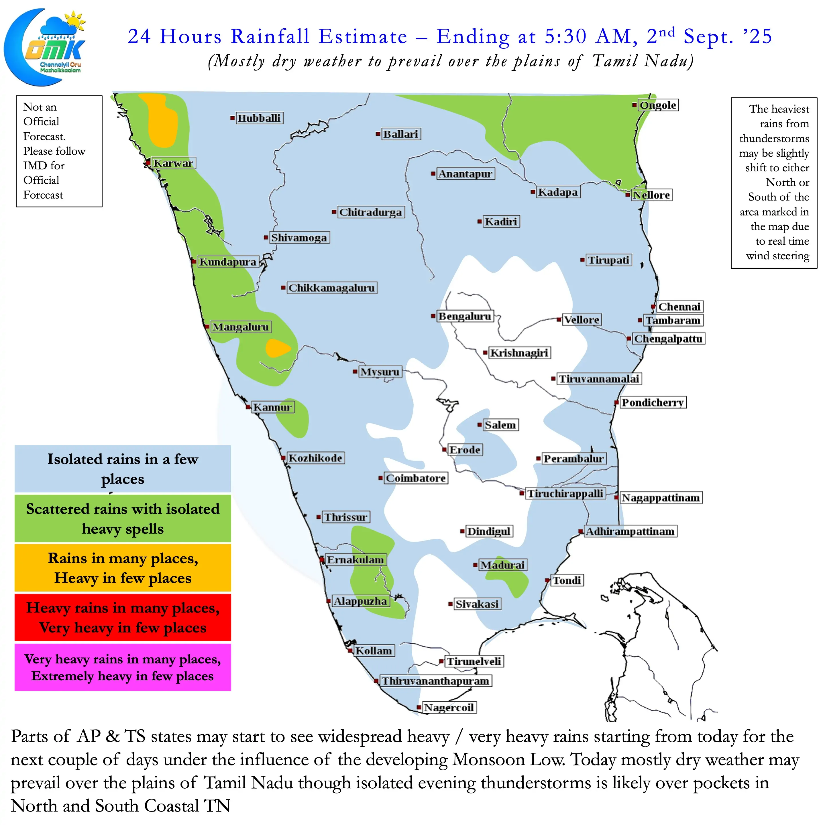
Over the next couple of days thunderstorms over the plains of Tamil Nadu may be slightly reduced. North Coastal TN and South Coastal TN though may continue to see isolated thunderstorms. Unlike July and August when monsoon surge is at peak, September sees a slight reduction in wind speeds. This becomes a positive factor for these areas pushing remnant moisture triggering evening thunderstorms. As we get to the later part of this week more parts of the state may start seeing regular thunderstorms. Sub seasonal weather outlooks indicate September may see regular thunderstorm activity over the leeward plains of TN.