
As we often mention monsoon dynamics is an oscillating pendulum. Very rarely one can see it an equilibrium state. Depending on atmospheric support the movement of pendulum may be fast or slow. When monsoon winds weaken from the west along with break in monsoon thunderstorms improve over leeward plains of TN. When strengthening westerly winds return thunderstorms over leeward plains reduce drastically. Over the past few days Break in Monsoon has brought about the best rainfall spell for Tamil Nadu. The last 3 days has brought a cumulative rainfall of 16.8 mm for TN & PDC against normal rainfall of 7.4 mm.
It is ironic during the same period Chennai and suburbs has practically remained dry with no rains. What was a boon for the interior areas of TN became a bane for Chennai and suburbs. Weak westerlies meant slow moving thunderstorms dumping a lot of rains over interior Peninsular India. Except for coastal stretch between Marakkanam and Chidambaram which received one spell coastal areas of TN mostly missed out.
Now with westerlies strengthening once again we can see a reduction in thunderstorms over leeward plains of Tamil Nadu. The East West Shear zone which helped thunderstorms intensify over the past few days has started to climb up. This instability is expected to become a monsoon low by middle of next week. Consequently we may see a return of monsoon dynamics with strengthening westerlies. Starting from today we may see a gradual reduction in thunderstorms over the leeward plains of TN.

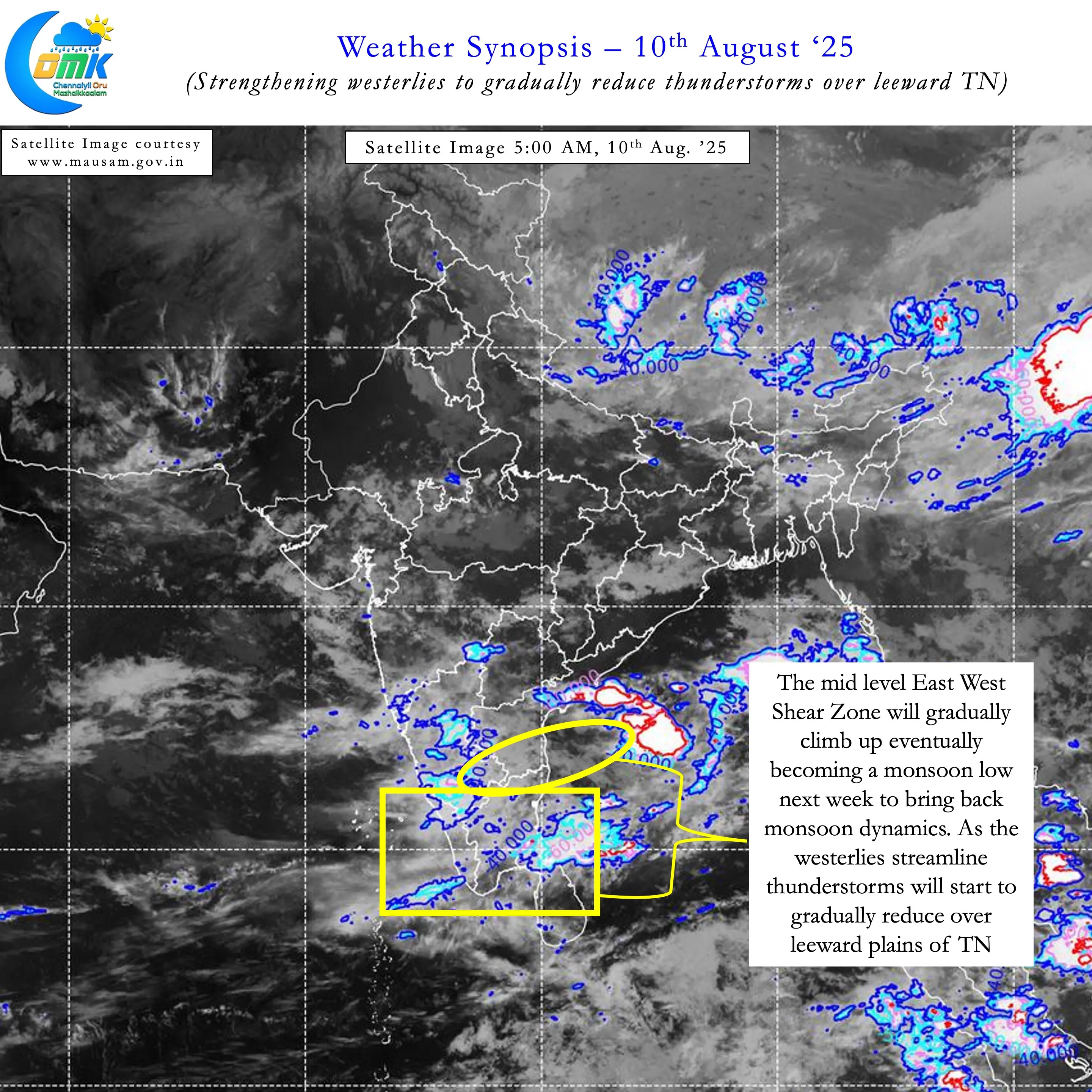
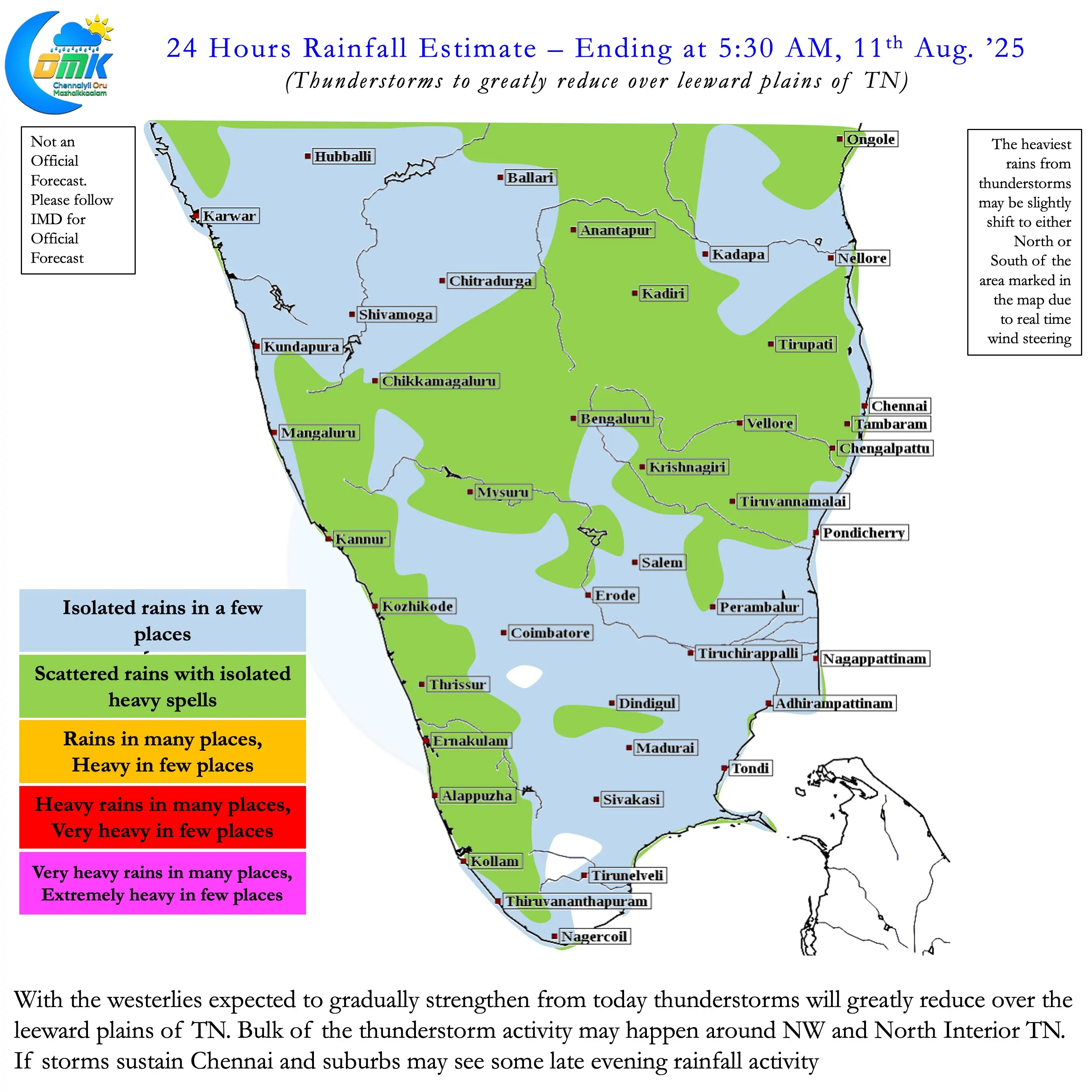
Going by weather models South and Central TN may see reduction first. Places East of Palakkad gap which only see howling winds when monsoon remains strong got much needed rains over the last couple of days. With westerlies strengthening increased wind shear will prevent thunderstorm formation over these areas. North Tamil Nadu along with adjoining areas of South Karnataka and South AP may see some thunderstorms for the next 48 to 72 hours.
Weather also models indicate not much rainfall activity for Chennai and suburbs for the next few days. Weather models indicate convergence zone to fall East of Chennai over the sea from now on as the Shear Zone starts to climb up. Depending on real time wind pattern this convergence zone may fall East or West of model indicated area. Any chance for Chennai to get rains is over the next couple of days with westerly steering winds strengthening. We have seen in the past some of the best spells for Chennai has happened during the period just before the formation of the LPA in Central Bay.
There is a lot of ifs and buts in this depending a lot on real time wind pattern. Overall though thunderstorms are expected to gradually reduce for the leeward plains of TN. Hopefully Chennai gets one much needed spell before pendulum shifts to monsoon dynamics.