
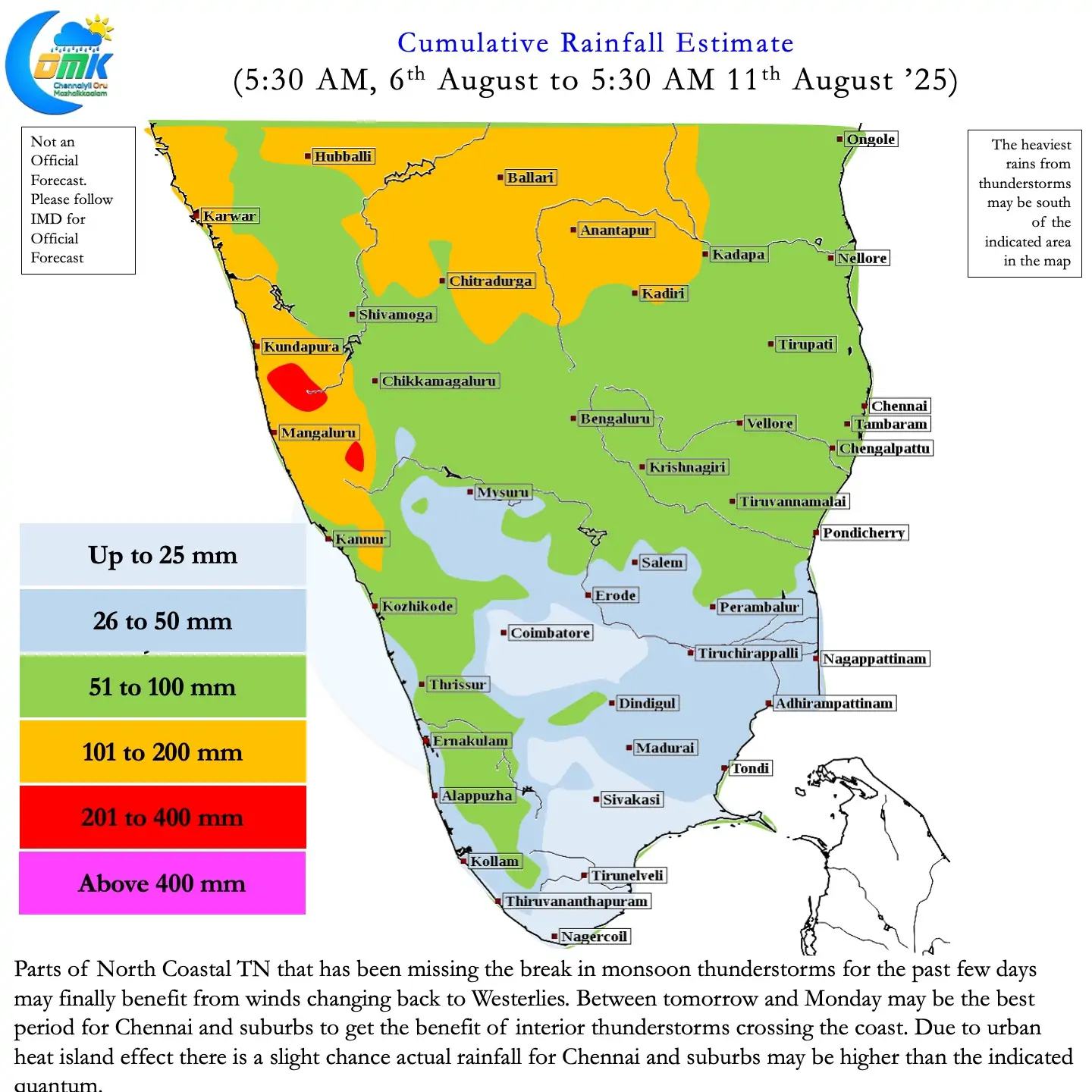
Over the past few days as Southwest Monsoon slowed a window of thunderstorms opened for the leeward plains of TN. Widespread thunderstorms pushed the seasonal rainfall performance for TN & PDC from -11% to 3%. The last 5 days have contributed nearly 30 mm to the seasonal rainfall tally over TN & PDC. But in all this one must not forget North Coastal TN remained mostly a spectator. Chennai AP and Chennai Nungambakkam observatories added less than 5 mm during the same period.
The convergence under the influence of the Cyclonic Circulation benefitted the interior areas of TN more than the coastal areas. Places like Pondicherry which got about 10 cm on Monday night remained an exception than a rule. With the cyclonic circulation moving further west things will get better for North Coastal TN. Over the last 24 to 36 hours winds have returned back to Westerlies over most parts of the state. Over the next 24 hours or so remaining areas of North TN may also get back to Westerlies.
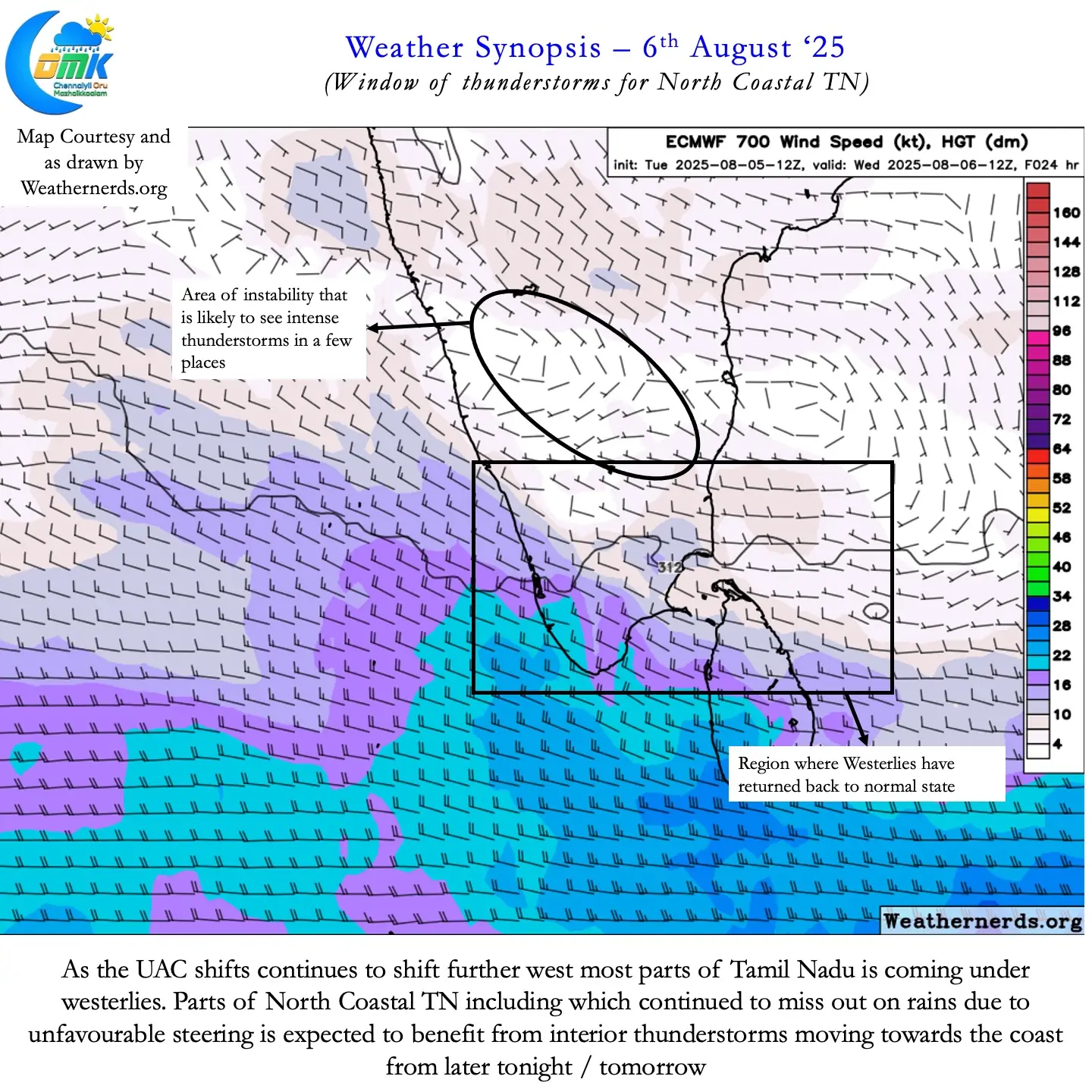
This will open a window of thunderstorms for North Coastal TN as interior thunderstorms may start to move towards the coast once again. Between today and later part of next week things look good for North Coastal TN. Over the next 5 – 7 days there is a fair chance Chennai and suburbs may see at the least 2 days of widespread thunderstorm activity. North Coastal TN will continue to remain under favourable steering till the next Monsoon Low forms over Central Bay.
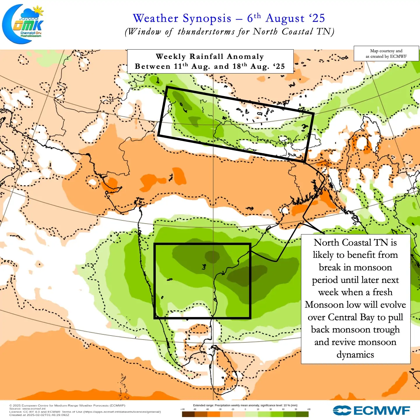
Weather models indicate towards the end of next week a LPA may form over Central Bay. When this LPA forms it will gradually pull back the monsoon trough from the foothills of the Himalayas. This would eventually bring back momentum to monsoon dynamics. Partially the development of a fresh pulse of MJO over the Indian Ocean will drive the return of monsoon dynamics. Until then states like Uttarakhand which is reeling under flash floods may continue to see widespread heavy rains.
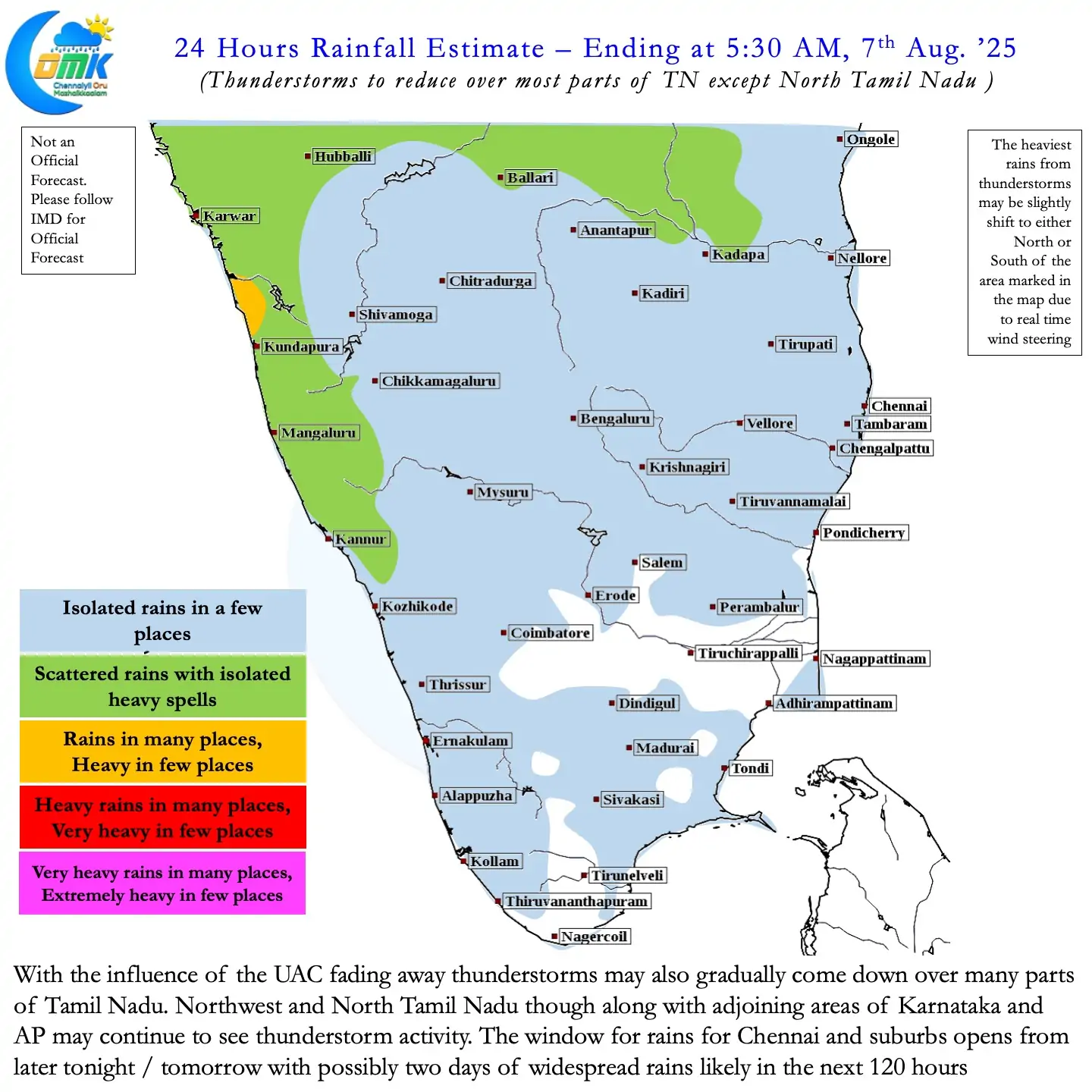
Overall between today and next Thursday things look good for North Coastal TN to see some rains. Chennai and suburbs may benefit from slow moving thunderstorms that start moving towards the coast from later tonight / tomorrow. As always during break in monsoon period thunderstorm peak is expected to be later in the night.