
Like pretty much every atmospheric phenomenon Monsoon is also an oscillating event. Intra seasonal oscillation is an essential component of Southwest Monsoon. Even as early as 1950s and 1960s researchers started to look at Break in Monsoon phenomenon. People like Dr. C Ramaswamy, P Koteeswaram, both of whom went onto become Director General IMD, studied about break in monsoon. Subsequently Dr Rajeevan made a more structured measure of identifying active and break spells of monsoon.
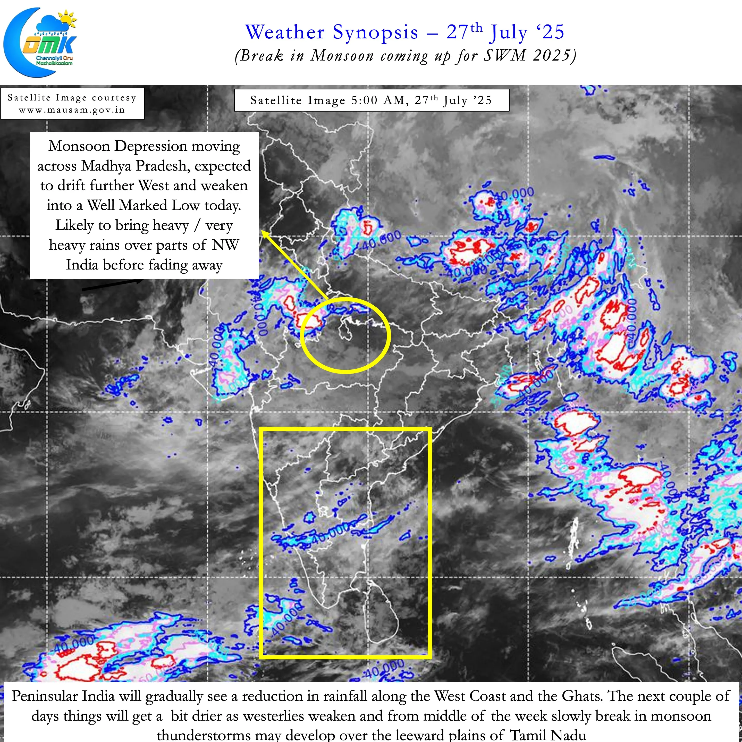
Over the past few days SWM2025 has been relatively active. The Monsoon depression from remnant Wipha typhoon played a crucial role in this. During this period the seasonal performance for Kerala improved to -7% deficit from -15%. Similarly we also saw the daily rainfall chart for SPI show 10 consecutive positive days. This was the longest streak of positive days for Peninsular India since the start of SWM 2025 season. The cumulative seasonal performance that -11% on 16th July flipped to 2.2% on 26th July consequently.
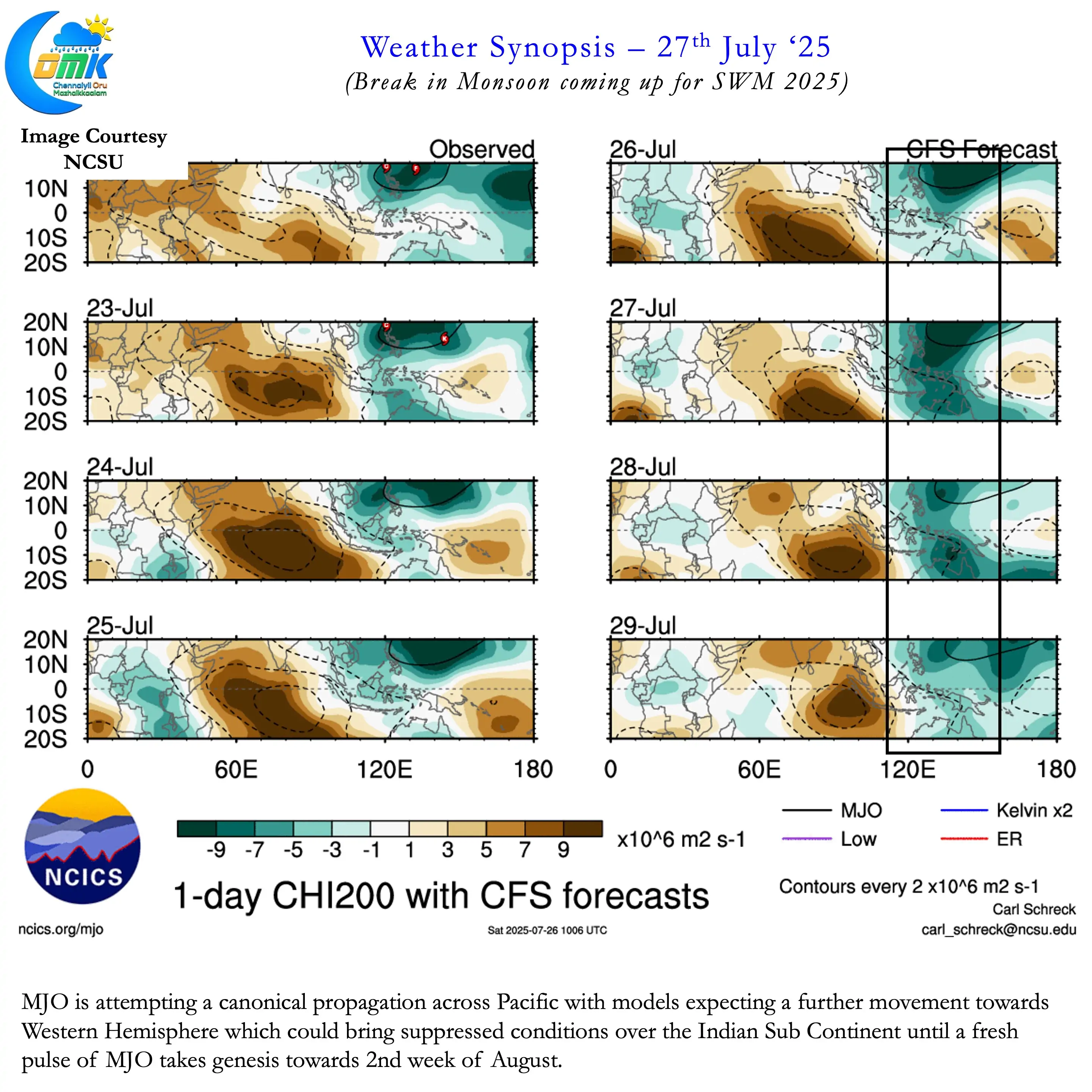
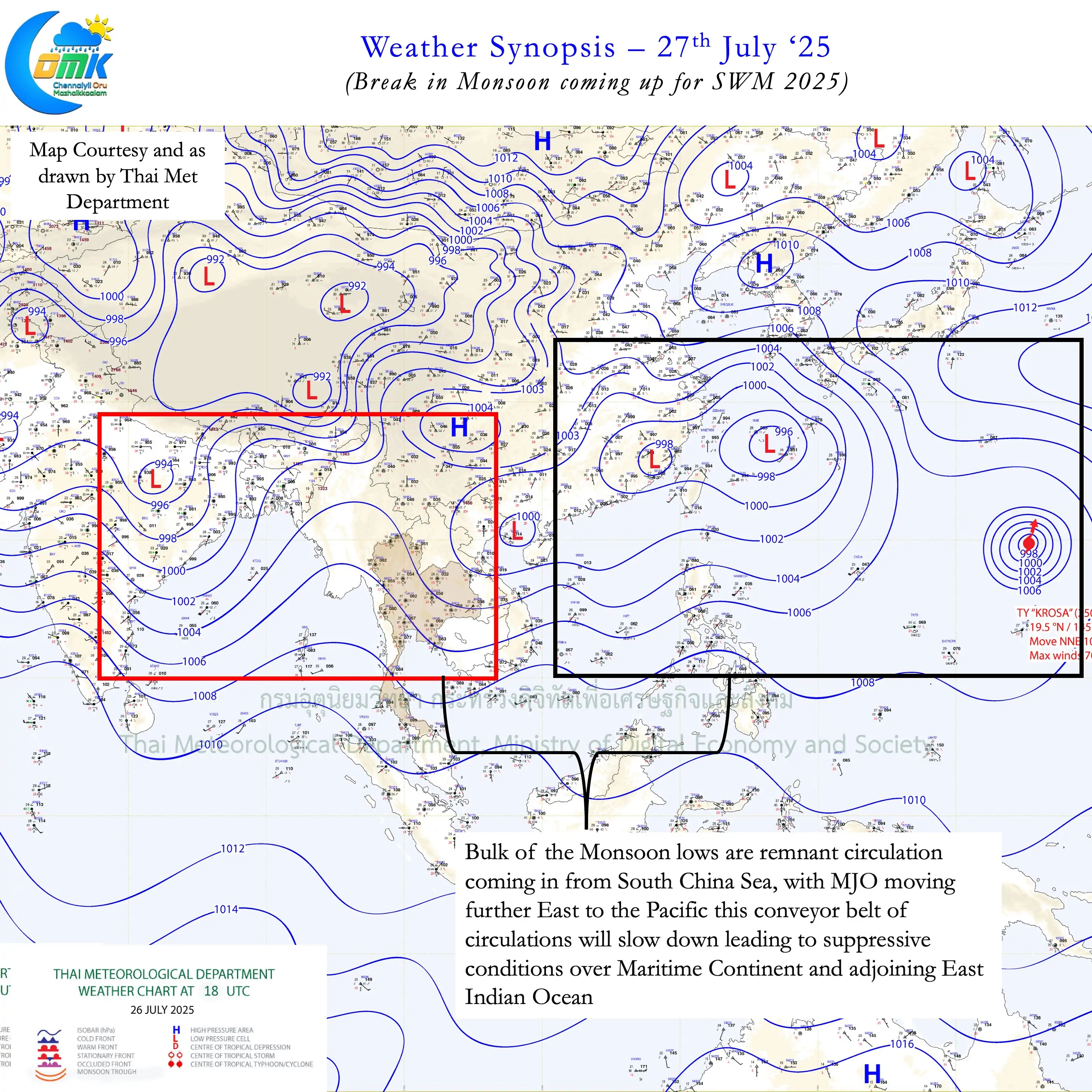
Looking at large scale atmospheric dynamics we can sense the upcoming Break in Monsoon period. This year monsoon has been majorly driven by pulses coming into Bay. Remnant circulation from South China Sea develop into monsoon low when reaching Bay. Even the current depression as explained above was an incoming pulse. But with MJO trying to put together its first canonical propagation movement into the Western Hemisphere is likely. This could potentially bring the first classic break for SWM2025.
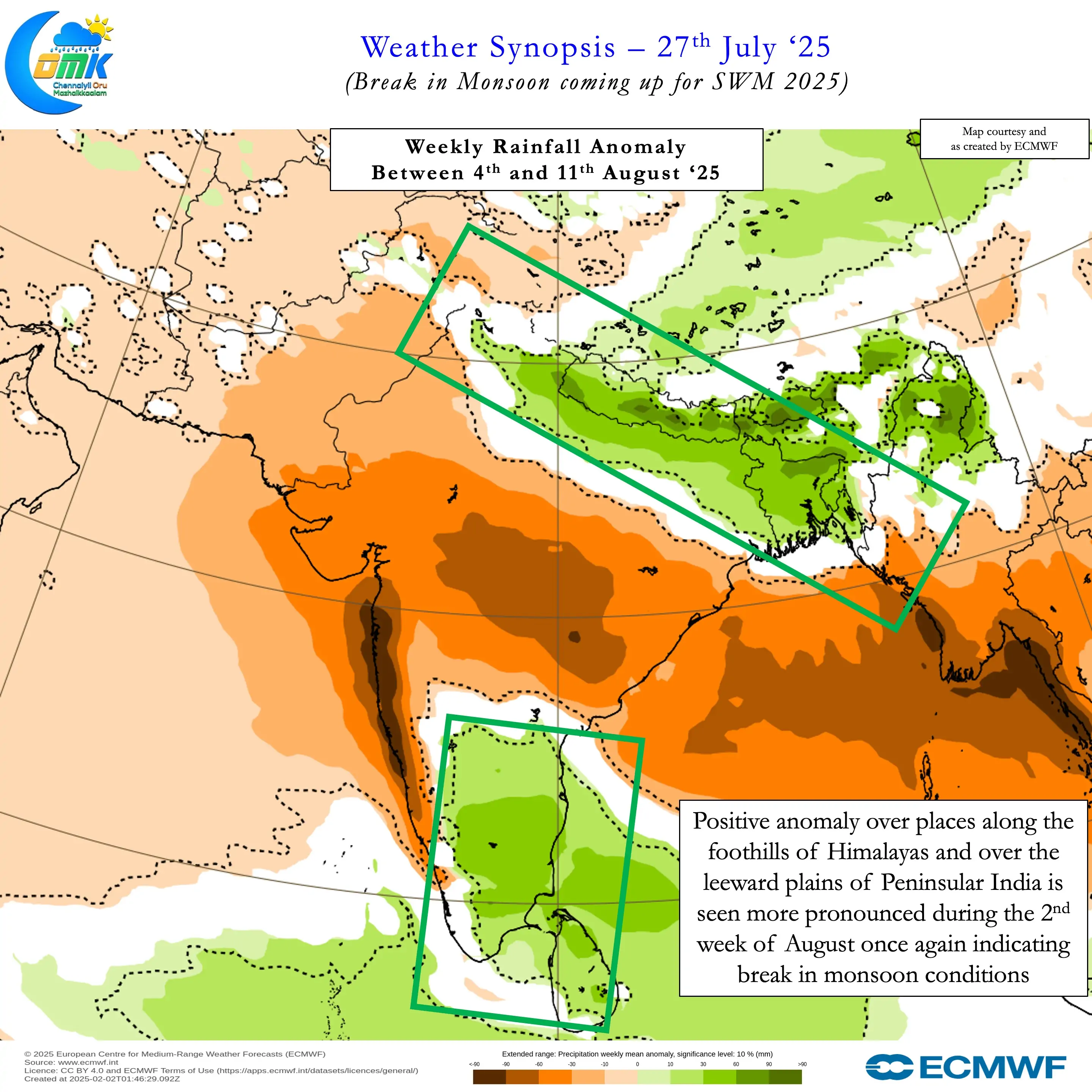
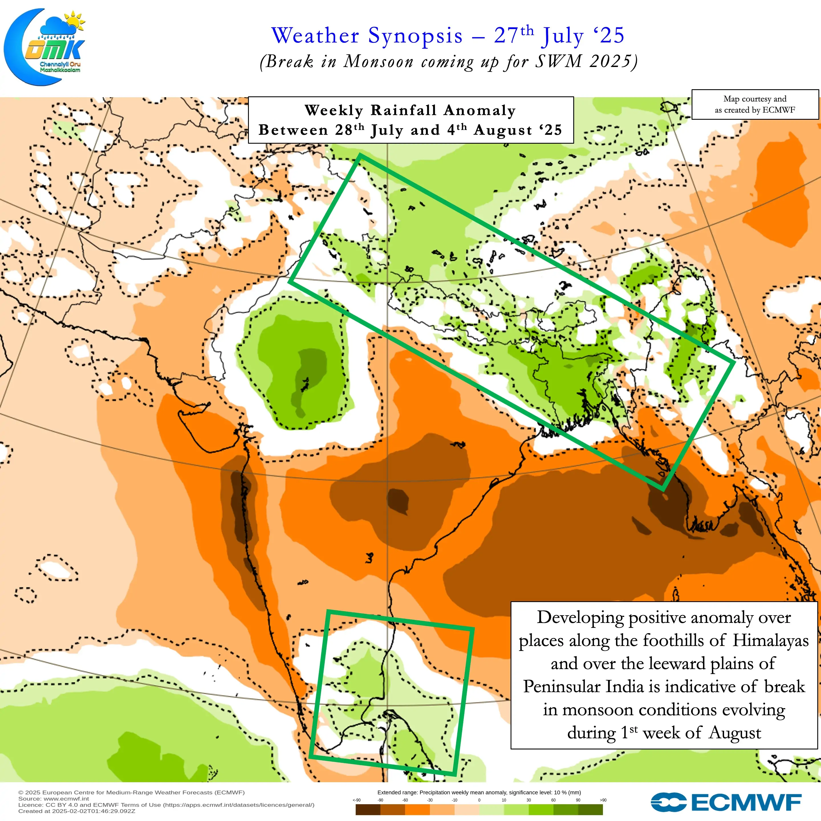
Sub seasonal models also are in sync with their estimates. Weekly rainfall anomaly pattern shows developing positive anomaly for leeward plains of Peninsular India. Similarly during this period above normal rains are also show for the foothills of Himalayas. During the 2nd week of August this pattern is seen developing in a more pronounced manner. All this indicate a possible break period during the 1st half of August.
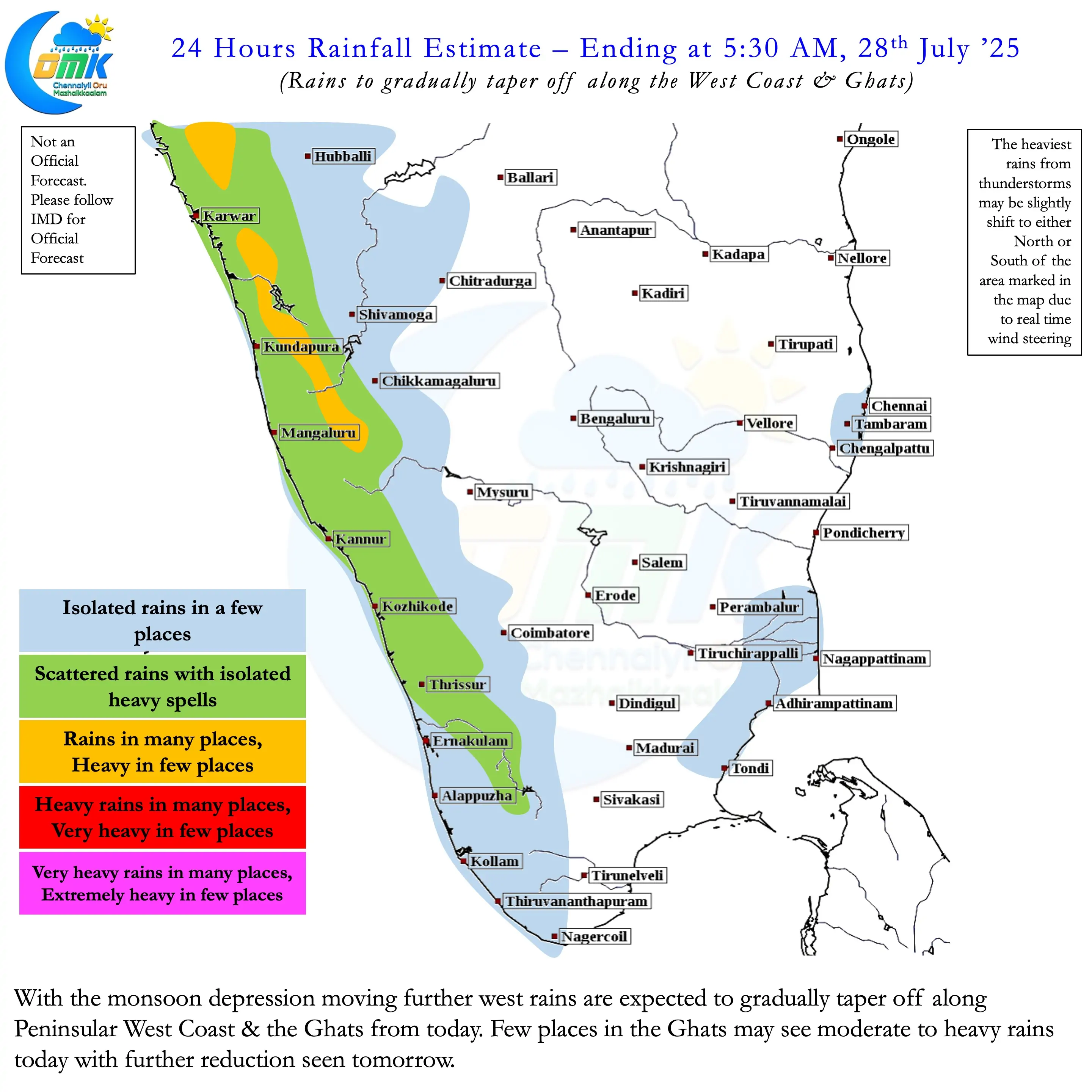
When a fresh pulse of MJO develops over the Indian Ocean possibly around mid of August we may see monsoon get back on track. Until then monsoon may remain weak over Peninsular India. This could bring about a reduction in strength of westerlies. When westerlies weaken it opens up an opportunity for thunderstorms over leeward plains of TN. The biggest change is the return of sea breeze when westerlies weaken. Places like Chennai gets its best rains when monsoon gets weak and brings convective instability to our West. How much rain we get will depend on real time moisture and wind pattern.