
Yesterday contrary to the expectations of weather bloggers and what most models estimated parts of Chennai recorded sharp spells of rains with the core city areas enjoying the bulk of the rains while most of the suburbs possibly getting Saaral Mazhai especially in the southern suburbs. 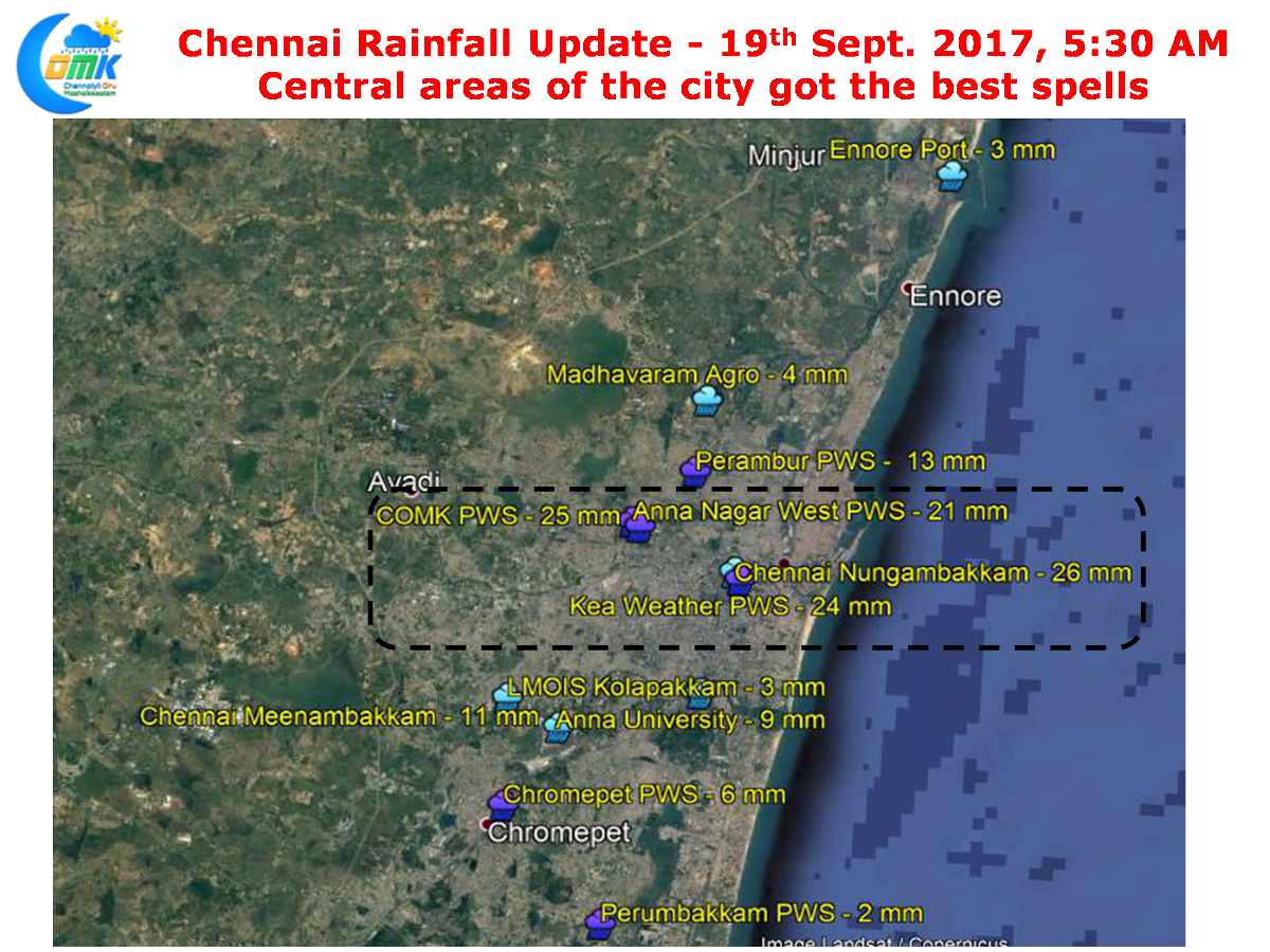
As one can see from the map the bulk of the rainfall happened in the Central Areas with the private weather stations in Anna Nagar & the weather stations in Nungambakkam, both IMD & Private recording above 20 mm while rest of the stations elsewhere in the city recorded much lesser.
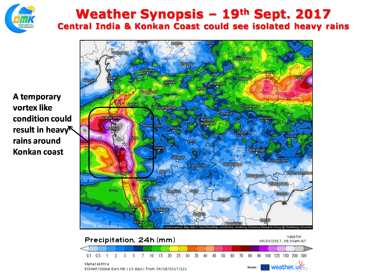
Southwest Monsoon is expected to up the ante in the coming days as parts of Central India & the Konkan coast could see heavy to very heavy rains in a few places. Models indicate a temporary vortex like feature to be present off the Konkan coast which could trigger heavy rains in a few places of Shahyadri Range along with the places in the coast as well.
The off shore trough continues to persist from Maharashtra to Kerala giving some impetus to the monsoon dynamics along the west coast with Kerala now reaching -9% deficit after two very good days of rainfall. Things could slightly ease though in the next day or two as possibly Konkan coast enjoys the limelight.
Powered by WPeMatico