
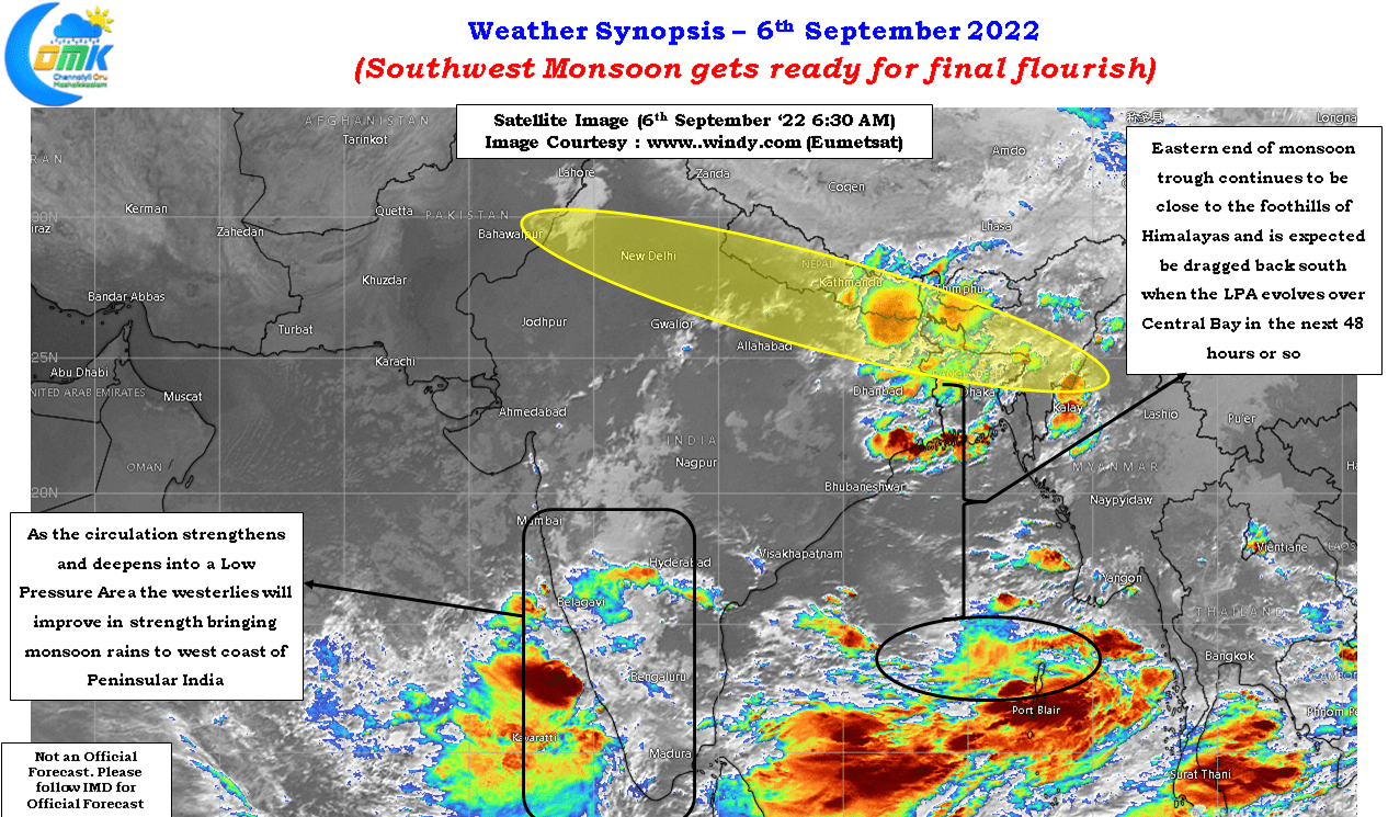
In a fascinating journey of changing dyanmics and contrasting impact the Southwest Monsoon season of 2022 has decided to trigger a final flourish in the form of strengthening monsoon dynamics on the back of a developing circulation in Central Bay that is expected to become a LPA in the next 48 hours or so. For the regular weather observers it is no surprise to see Monsoon try to score the last over out of the park. Under almost similar La Nina conditions 2013 monsoon saw extreme flooding over parts of Gujarat during the last week of September under the influence of a stalled Monsoon depression that was stationary over the Kutch region for a couple of days.
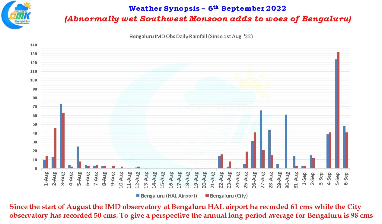
One man’s meat is another man’s poison goes an old Roman saying. This holds good for weather as well with the swining monsoon dynamics bringing contrasting impacts to different parts of Peninsular India. The active thunderstorms over Peninsular India over the past few days has meant places like Bengaluru record moderate to heavy rains on many days. While one can never ignore other factors like terrain, infrastructure issues, hydrology etc the last couple of days of localized flooding needs to be seen in the context of nearly 60 cms of rains which has fallen over the city since the start of August. That is nearly 2/3rd of the average annual rainfall for Bengaluru.
The good news though is with monsoon getting ready for one final flourish on the back of a developing LPA in Central Bay things could become better for not only Bengaluru but also neighbouring places like Hosur in Northwest interior Tamil Nadu which has seen the region’s famous floriculture suffer damage due to the heavy spell of rains for the past couple of weeks. With Onam being one of the highlights of the festive season demand for flowers it is indeed a lost opportunity for the floriculturists.
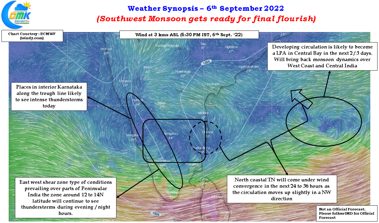
Chennai though has remained fairly passive for the past few days with the last spell of rains happening on 1st of September. The bulk of rains have happened in the interior areas though places in the same latitude as Chennai has enjoyed intense thundertorms. With the circulation deepeneing and expected to move NW as it becomes a low pressure area the wind convergence is expected to happen over North coastal Tamil Nadu and adjoining parts of South coastal AP in the next 24 to 36 hours which could bring one fairly widespread spell of rains over Chennai adjoining KTCC region before West coast and Central India gets increased monsoon rains from the LPA.