
We keep mentioning often about instabilities, especially when we look at thunderstorm opportunities. The very popular Dr. Ramanan used to mention often about uncertainty being the biggest challenge in tropical weather when media used to often question him on the difference in weather forecasts between us & places like Europe. Tropical Weather thrives on this uncertainty and possibly why it makes that much more interesting following weather here. With the arrival of Monsoon dynamics there normally exists a more stable Westerly regime reducing or to an extent removing the instability element in weather. With strong winds from the Low Level Jet (0.9 to 1.5 kms Above Sea Level) the thunderstorm possibilities reduce drastically under active monsoon conditions. When the monsoon dynamics are weak the winds slow down allowing remnant moisture to traverse along Peninsular India & interplay with the Day time convective heating to create thunderstorm opportunities.
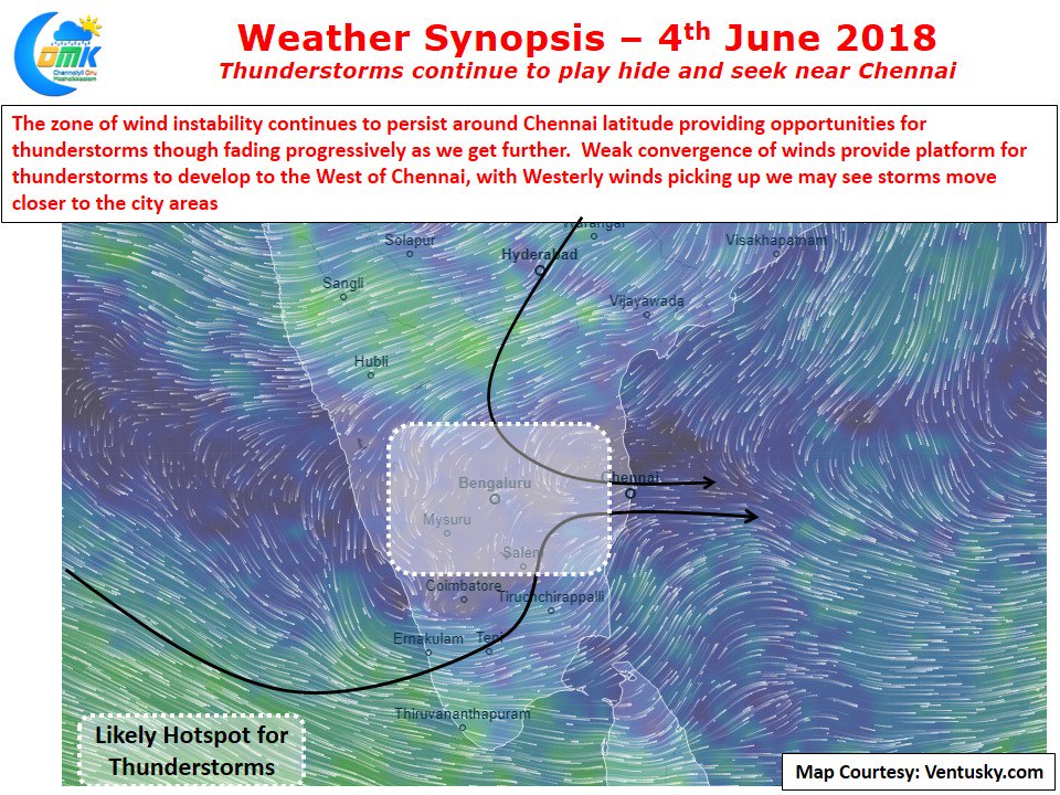
In the current context a state of flux is prevailing over Peninsular India with monsoon progress slowing down creating a large unstable area (zone of poor winds) around the latitude of Chennai. North of this zone the winds continue to be Northerlies / Easterlies while south of it has seen monsoon onset. Add to this mixture though still weak monsoon is certainly picking up along the West Coast since yesterday bringing more moisture into the interior places. This influx of moisture through the Lower Level Jet also acts as an insulation from Heat for most of the interior places and at times even places along the East coast.
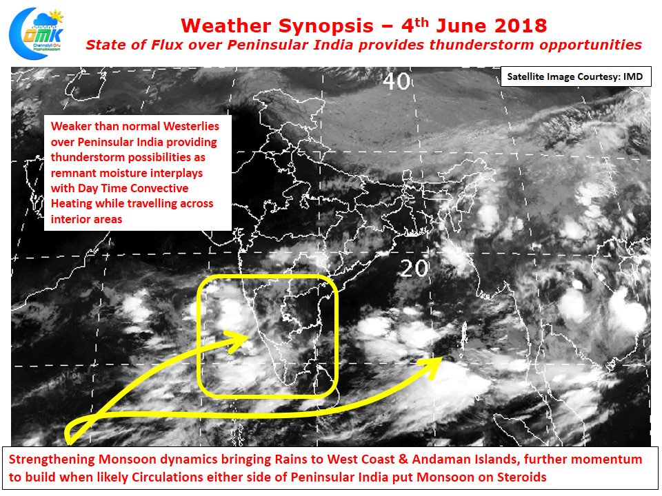
Today also we are likely to see thunderstorms develop in the area to the West of Chennai with places between Bengaluru & Chennai possibly seeing a spell or two of heavy thunderstorms which could slowly drift towards the coastal areas. Yesterday saw some of the remnant thunderstorms reach the sea for the first time this season. This will augur well for the city areas of Chennai if thunderstorms form at right locations to catch some of the rains missing for the last couple of days even if it is not going to be heavy. Rains will continue in West coast picking up gradually as we progress into this week with a crescendo likely around weekend when a fully loaded double barrel gun could put monsoon on steroids in the form of dual circulation on either side of Peninsular India