
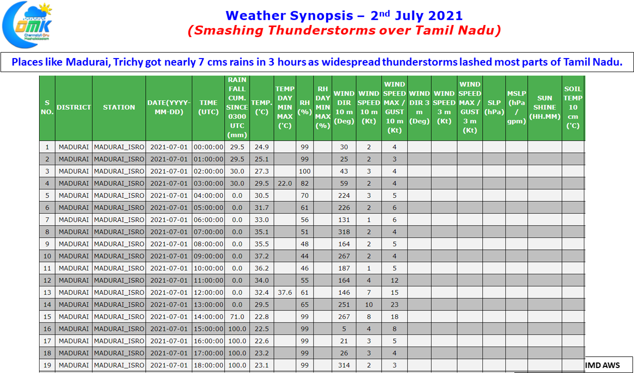
Tamil Nadu saw an extremely stormy evening yesterday as widespread thunderstorms lashed the interior areas of the state with many places seeing rainfall accumulations around 7 to 10 cms. Places in Dharmapuri, Krishnagiri dt which survives primarily on thunderstorms enjoyed a very good day of rains with Palacode recording 94 mm for 24 hours ending today morning. Meanwhile Madurai & surroundings got blinder of rains as nearly 7 cms of rains fell in an hour over many places. Even Trichy AP recorded 7 cms over three hours with bulk of them falling in an hour like Madurai.
Chennai though remained a spectator with very poor steering winds being the culprit. Similar scenario unfolded during the wee hours of Wednesday as well with thunderstorms that travelled for nearly 8 hours slowly from interior Peninsular India dying out just as it reached Tiruvallur, similarly yesterday the NW Interior TN storms never made the journey towards Chennai. In an interesting development thunderstorms started very early yesterday and by around evening 8 PM most of the storms started to fade away disappointing those who were waiting to see if the interior thunderstorms make the journey to coast.
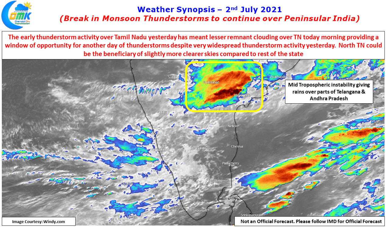
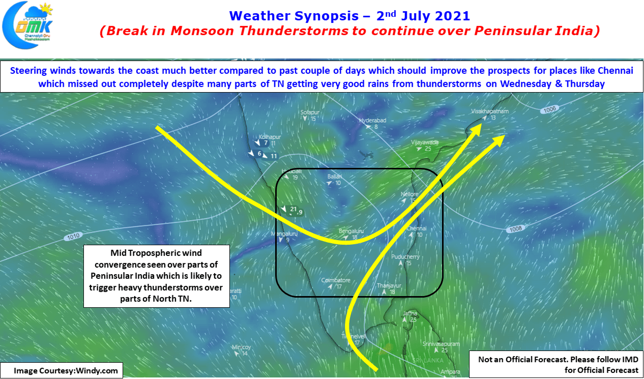
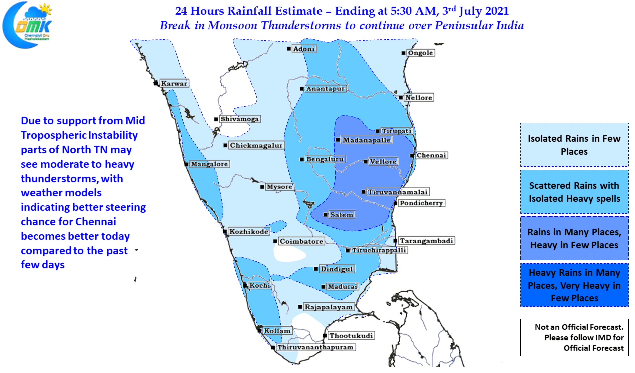
While its always tricky to expect rains the day after such a widespread rainfall activity like yesterday the mid tropospheric instability gives some hopes for Break in Monsoon thunderstorms to continue today as well. Interestingly weather models indicate better steering winds today for Chennai which gives some hope the city may get its due compensation for missing out the last two days.