
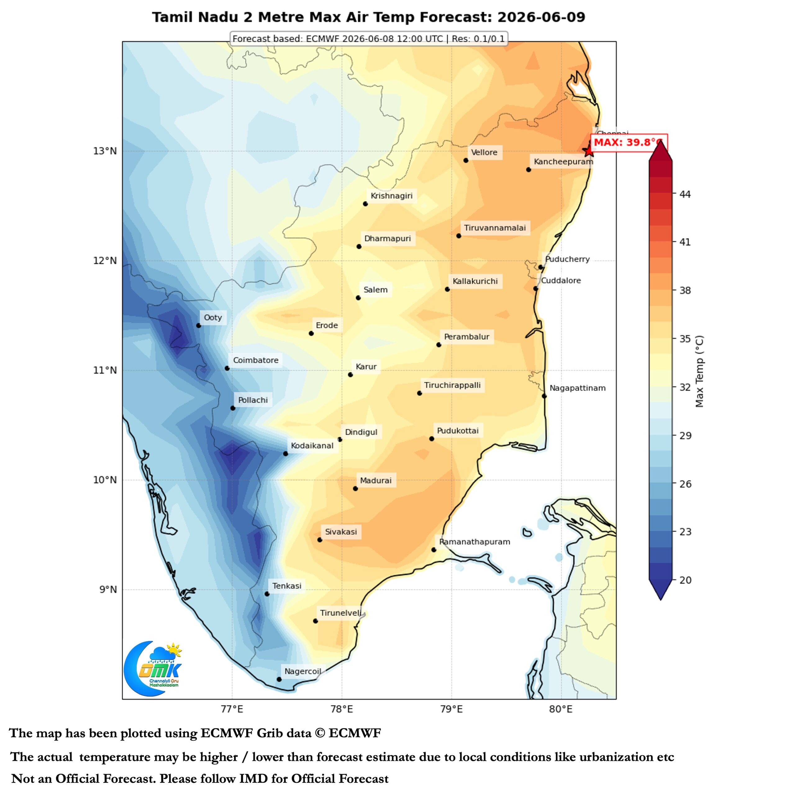
The Southwest Monsoon juggernaut has been slowly ambling along ever since it made onset over Kerala on 4th June. As the monsoon moves along the leeward plains of North TN is also bearing the brunt. The brunt of stiff westerlies that keep temperatures high till evening. With sea breeze either not coming in or very weak hot afternoons turn into uncomfortable evenings and nights. The minimum temperature in the COMK PWS at Padi has recorded above 31°C every day for the past 3 days.
Often people assume once Kathiri / Agni Natchathiram period finishes summer ends. But for places like Chennai in the leeward plains of TN the worst time of the year is always 1st fortnight of June. Day time temperatures peak late into the afternoon. Sea breeze struggles in its fight against stiff westerlies. A period when respite from uncomfortable conditions can come only through the arrival of thunderstorms. Nights are always uncomfortable until regular arrival of thunderstorms cool down the hinterland to the west of Chennai.
The one single question from pretty much everyone in Chennai is when will we get respite? Finally we have something to look forward to. As the proverb goes there is light at the end of the tunnel.
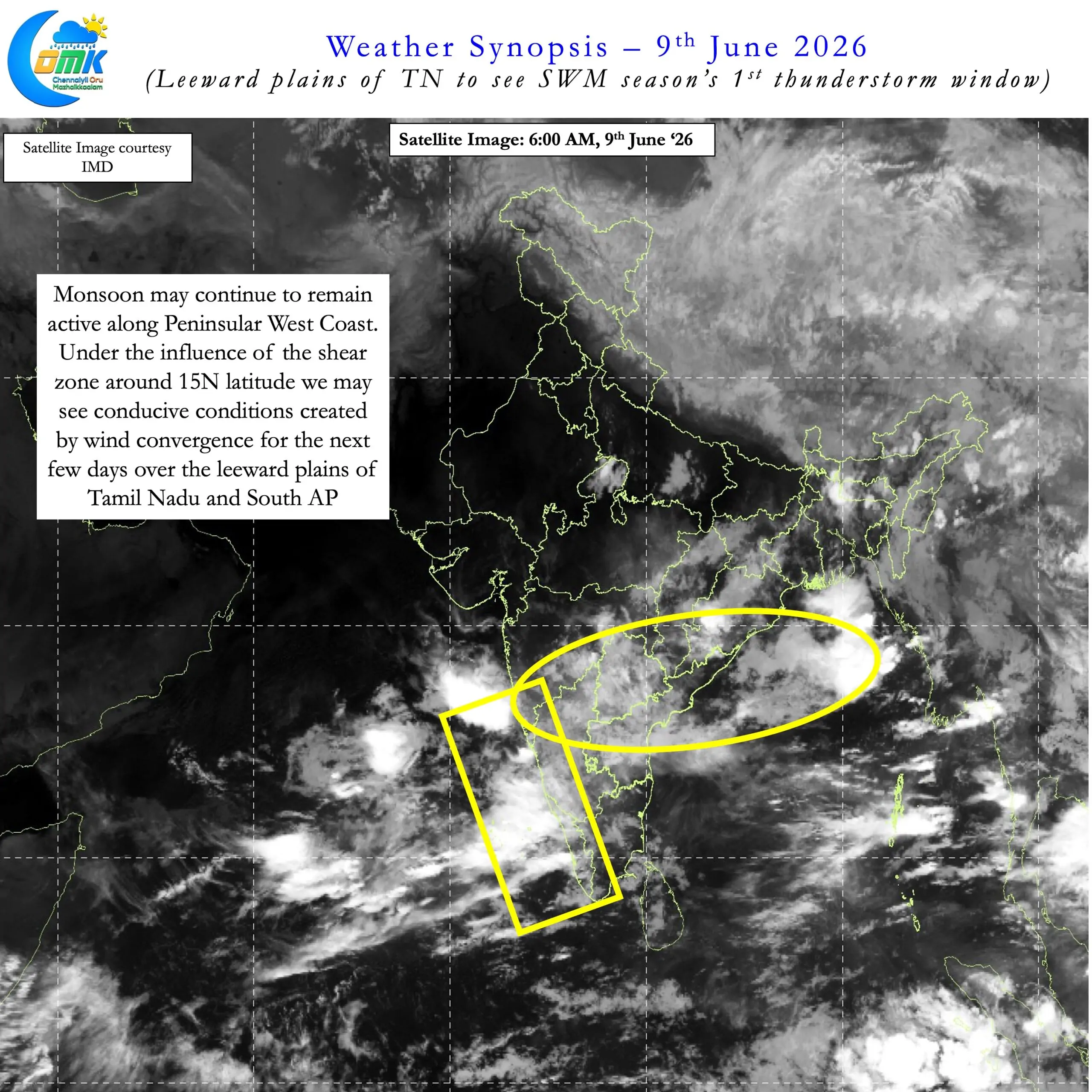
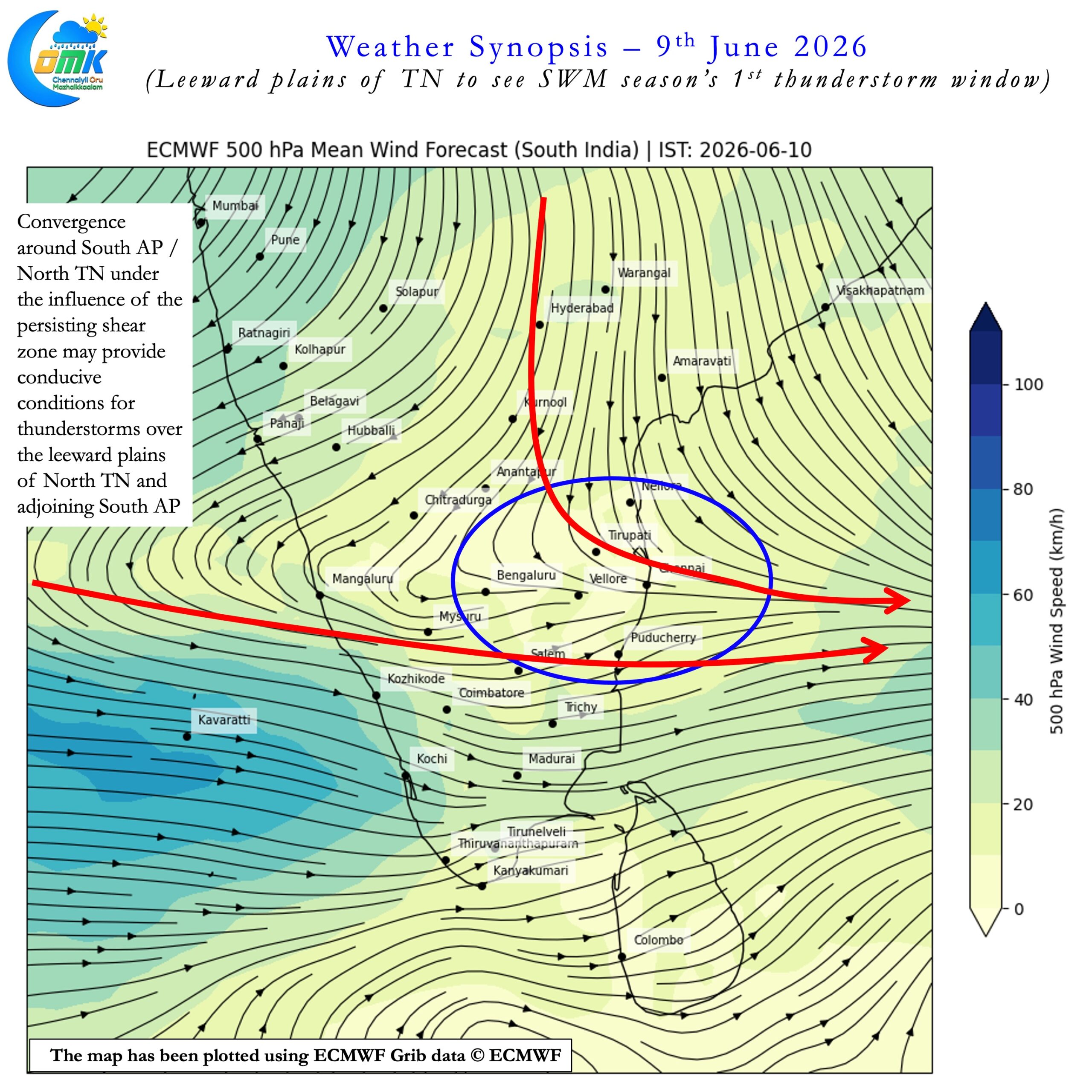
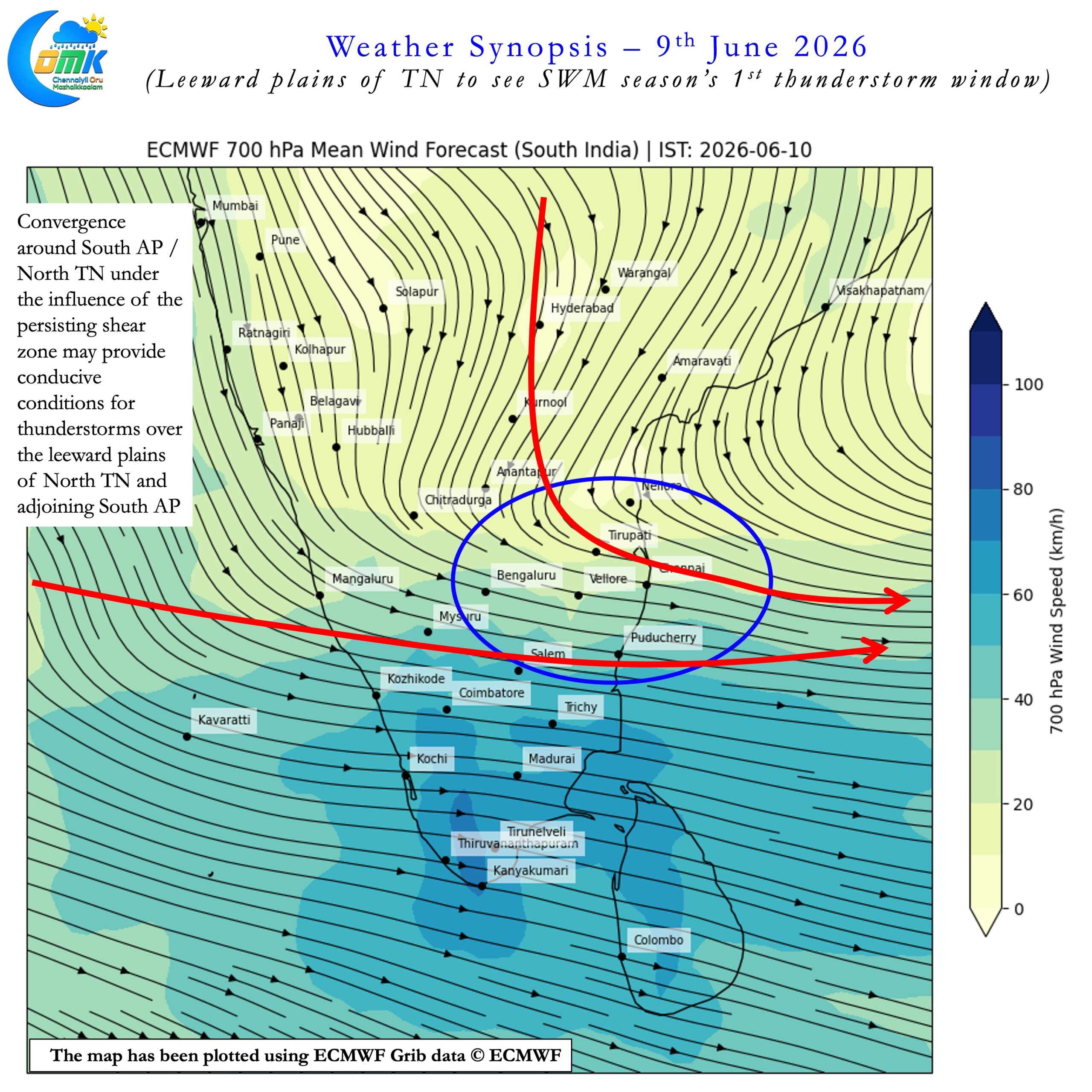
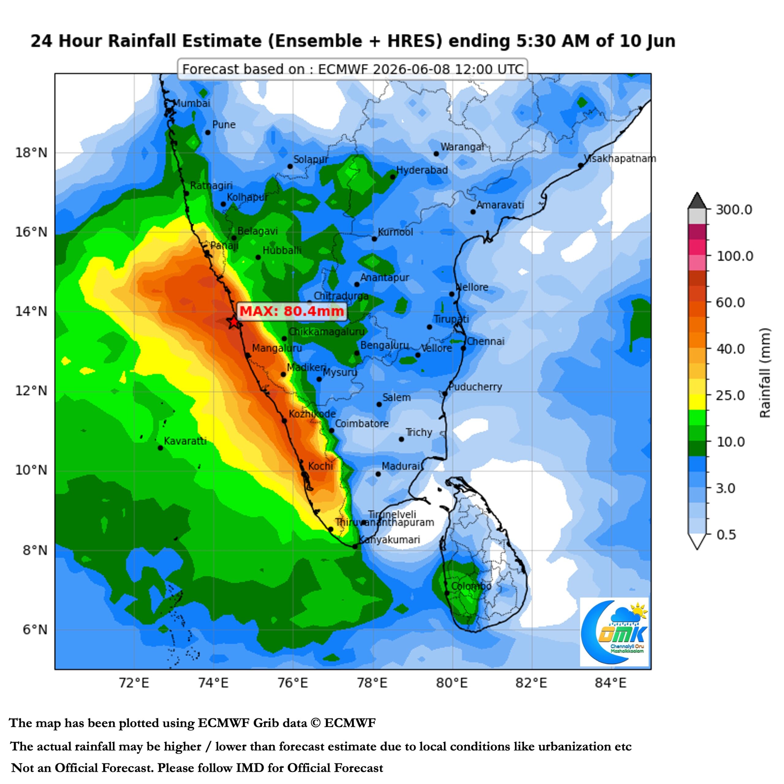
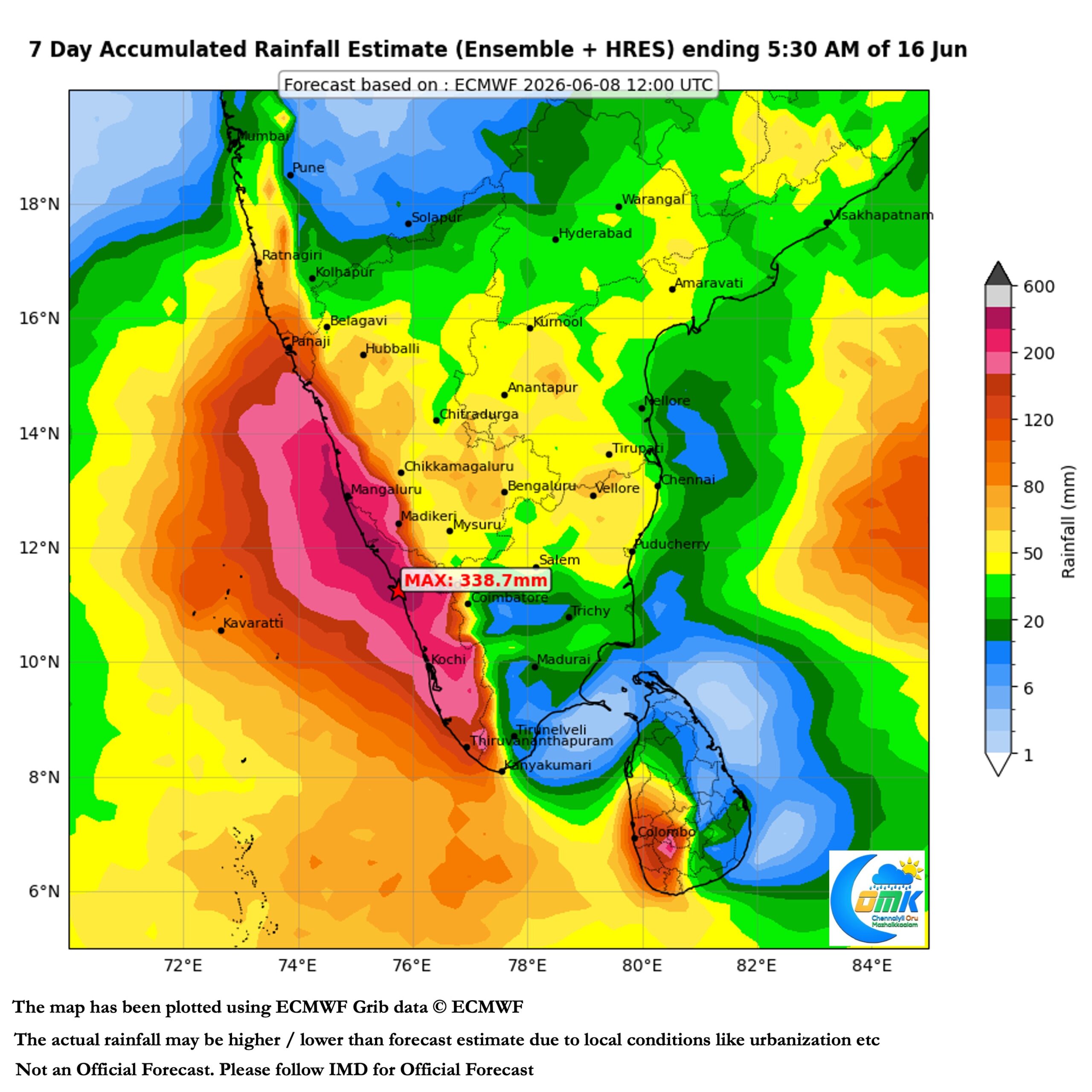
Monsoon continues to be active along Peninsular West Coast bringing widespread rains. The presence of shear zone in the region though opens up a window of thunderstorms for the leeward plains. The arrival of drier winds from North provides wind convergence that makes it conducive for Veppasalanam rains to happen over parts of TN and adjoining South Coastal AP.
Normally the period just before formation of a Monsoon Low in Bay opens this thunderstorm window. While models indicate a slight chance for a possible Monsoon low in head bay. The convergence created by this developing cyclonic circulation may provide the platform for thunderstorms over the leeward plains of TN. As always picking up the right spots for thunderstorms is tough. But the broad region between Perambalur / Ariyalur and Kavali along Peninsular East coast may benefit from this spell of thunderstorms over the next few days.
Between today and Friday there is a very high chance for Chennai and suburbs to see its first thunderstorm of SWM 2026 season. More often than not the first set of thunderstorms are underestimated by weather models. So it would not be a surprise if we end up seeing widespread rains during this period for the city and suburbs. Fingers Crossed for respite and rains soon. But before that we may have to bear the heat today. Chennai and suburbs may be the hottest part of the state once again today.